Residential Area Planning: Principles, District Structure & Public Services Levels
 libre
libre
Residential area planning organizes housing through a stepwise service system, where facilities are grouped into levels according to how often residents need them and how far they will walk to reach them.

What are the levels of public service in residential planning?
Public services in a residential area are organized into three levels based on frequency of use and walking distance. The first level covers everyday necessities placed immediately around homes, the second covers daily and periodic needs at neighborhood scale, and the third covers periodic and occasional facilities serving a whole residential district. This stepwise arrangement keeps the most-used facilities within the shortest reach while concentrating larger, less-frequently-used institutions at central points.
The first level of public services comprises institutions, enterprises, and facilities of everyday necessity located closest to the dwelling. These include grocery stores, utility yards, children's and sports grounds, adult recreation areas, parking lots near residential buildings, kindergartens, and schools. This level also includes the green space around a group of residential buildings — the garden of a residential group — together with the various structures and grounds set within it.
The second level of public services covers institutions and enterprises of daily and periodic necessity. Examples include shops, canteens, household workshops, clinics, pharmacies, and cultural and consumer service points, along with green spaces of neighborhood significance such as a neighborhood garden intended for the recreation of the entire population, sport included.
The third level of service covers enterprises and institutions, structures, and devices of periodic and occasional use. This level includes large stores such as department stores and grocery stores, cafes, clubs, restaurants, hotels, cinemas and theaters, district clinics and hospitals, museums, sports complexes, and the garden or park of a residential area.
What is a residential district?
A residential district is the largest structural unit of the urban area in small and medium-sized cities. In the structure of large cities, the equivalent unit is the settlement (planning) district, which is itself formed by several residential districts grouped together.
A residential district is built around pedestrian accessibility to the institutions and enterprises of cultural and consumer services, within a radius of 1000–1500 meters from the dwelling. Its population usually amounts to 25–60 thousand people, a figure that depends heavily on the number of storeys in the buildings.
The most rational population size for a residential district depends on the size of the city, the number of storeys, the natural conditions, and the landscape features of the area. The boundaries of residential districts are formed by main streets of city and district significance, as well as by large green areas such as gardens and parks.
Depending on the general planning features of the city, residential districts take one of several forms:
- groups of adjacent districts separated by highways and streets or by green belts;
- groups separated from one another by natural reservoirs, forests, and groves, as well as by highways and major roads;
- areas separated from one another by natural barriers such as hills and mountains.
A residential district is usually subdivided into microdistricts, which are the main structural units of the city's residential area.
What is a microdistrict?
A microdistrict is the organization of a residential complex that meets the most basic needs of the population — education of the younger generation, cultural recreation, economic activity, and cultural and household services for residents. It is the building block from which residential districts are assembled.
A microdistrict consists of groups of residential buildings together with kindergartens, schools, dairies, bakeries, pharmacies, and household and play grounds near the residential buildings. Microdistricts are organized on the principle of pedestrian accessibility within a radius of no more than 500 meters, with the exact service radius determined by the population size.
Microdistrict population varies with the height of the buildings. For five-storey buildings it is 6–12 thousand people; for mixed development it is 18–20 thousand people, calculated at a living space of 9 m2 per person. Several microdistricts are combined into one residential district, which forms its own system of second-level public service enterprises and institutions.
The number of microdistricts within a residential district depends on local conditions and general urban planning objectives. A residential district in a small or medium-sized city whose territory is not crossed by a main street may not be subdivided into microdistricts at all.
Red lines are the boundaries that separate residential districts and microdistricts from city streets. Buildings are placed along a line set back at least 6 meters from the red line, and this setback boundary is called the building line.
Tasks of landscape organization of residential areas and neighborhoods
Rational organization of residential areas is addressed at every stage of design, construction, and operation. The pre-design period begins with an analysis of the urban planning situation and of the local natural and landscape features, since these conditions shape every later decision about layout and greening.
Social and demographic factors strongly influence how the greening system for residential areas and neighborhoods is formed.

The greening system for residential areas and neighborhoods should be developed with environmental factors in mind, improving the sanitary, hygienic, and aesthetic indicators of the environment. A well-designed system should provide for:
- biological sustainability and aesthetic value of existing and projected plantings and soil cover under high anthropogenic loads;
- normal conditions for aeration of the space, reduction of noise, gas pollution, and dustiness, and compliance with the optimal insolation regime of the territory;
- selection of a sustainable range of vegetation and a rational planting structure that eliminates adverse effects on the human body.
The efficiency of landscape organization carries great weight across the project. When developing design solutions at every stage, planners should observe the following provisions:
- maximum preservation of existing landscape elements such as plantings, water bodies, landforms, and soil cover;
- development of a landscaping system and its planning elements with multi-purpose use in mind;
- use of techniques that allow comprehensive mechanization of project implementation;
- widespread use of typical, standardized elements of landscaping and gardening.
Landscape organization of residential complexes cannot be separated from the development itself. In practice it is a single process that weighs architectural, planning, urban planning, engineering, agrotechnical, and environmental factors together.
Developing a landscape organization project for neighborhoods, groups of residential buildings, and individual buildings is one of the central tasks of urban development. Such a project must respect the natural features of the area — the surrounding landscape, relief, water bodies, and vegetation — to the fullest extent possible.
During design and research work, landscape design engineers carefully analyze the territories and development areas to be landscaped. This stage gathers data on the residential area, the system of streets and highways, parking lots, crosswalks and pedestrian routes, and the population — its social composition and age structure.
At the detailed planning stage, the residential area's greening system is resolved: the principal placement of plantings of all categories according to the specifics and character of the residential development, the system of squares, streets, highways, and public and shopping centers. This same stage also sets the general nature-protection solution — maximum preservation of relief, plantings, and water bodies, and the organic incorporation of natural elements into the overall architectural and planning concept. Such an outcome is possible only with a thorough study of the area's natural conditions and the direct participation of specialists.
How are green areas in residential developments categorized?
Green areas in a residential development are divided into three categories according to who uses them and what function they serve. The landscaping system of a residential area is made up of different objects with different roles, and it includes all the main categories of city plantings except those of citywide importance. The three categories are:
- I — general use: parks, gardens of residential areas, squares, boulevards, green areas near public and administrative buildings, neighborhood gardens or gardens at groups of residential buildings, and courtyards or green areas at residential buildings;
- II — limited use: green areas of schools, kindergartens, clubs, cinemas, clinics, and libraries, together with adjoining strips and front gardens;
- III — protective plantings: plantings along highways within neighborhoods that shield against unfavorable winds, and ground-anchoring plantings on slopes.
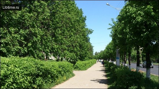
Gardens, boulevards, and squares play a key role in creating a favorable environment for recreation. Gardens are best placed in residential areas close to public and shopping centers, while boulevards and pedestrian alleys are designed along the direction of mass pedestrian traffic so they connect the arrays of gardens and provide convenient access to them, to places of work, to public transport stops, and to commercial public buildings.
Public gardens intended for short-term recreation are usually provided along the routes of mass traffic, where they catch the largest number of passing residents during the day.