Wind Orientation: Reading Wind Direction for Navigation
 libre
libre
Wind direction works as a natural compass: many winds blow from a consistent, predictable direction, so knowing the prevailing wind lets you find north, south, east, and west without instruments.

- trade winds;
- monsoons;
- breezes;
- fen (foehn) winds;
- bora winds.
This guide explains how to orient yourself by the wind in the field, the physics that makes wind direction predictable, how wind direction is reported on the compass and the wind rose, and how meteorologists measure wind speed and use it to forecast weather. Wind orientation will never match the precision of a magnetic compass, but in the right conditions it is a genuinely useful backup skill.
Wind Orientation: Using Winds as Natural Landmarks
Winds become natural landmarks when they blow from a stable, known direction over a region. Because the prevailing wind in a given place and season usually comes from the same quarter of the horizon, a traveler who knows that direction can reconstruct the cardinal directions from the feel of the wind on the face, the lean of vegetation, or the shape of wind-sculpted snow. This principle has guided navigators since antiquity, long before the magnetic compass reached Europe.
The reliability of wind orientation depends entirely on the wind being constant. A gusty, shifting local wind tells you nothing, but a trade wind, a seasonal monsoon, or a persistent mountain-valley wind holds its bearing for days or months at a time. The skill lies in knowing which winds in your region are dependable and what direction they normally take.
When Wind Orientation Makes Sense
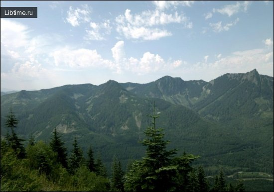
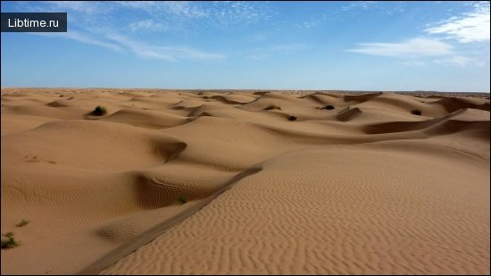
Navigation by wind makes sense when the terrain is unfamiliar or when you need to locate the nearest natural objects without a map or working compass. It is most valuable in featureless landscapes — open steppe, tundra, desert, or polar ice — where there are few visual landmarks and where, in some cases, the magnetic compass itself is unreliable.
Wind orientation is also a practical fallback in conditions that hide other natural references. During a blizzard or at a dark night when the Polar Star is not visible, the direction of a known constant wind, or the grass and snow it has shaped, may be the only clue to north and south. It complements rather than replaces other methods: use it alongside the Sun, stars, and compass whenever those are available.
How Winds Form: The Physics Behind Wind Direction
Wind is the horizontal movement of air from areas of higher atmospheric pressure toward areas of lower pressure. Understanding why wind blows where it does helps explain why certain winds are constant enough to navigate by. Four physical factors shape wind direction at the surface: the pressure gradient force, the Coriolis force, friction, and the convergence and divergence of air masses. These mechanics are described in standard meteorology texts such as the work of Frederick K. Lutgens and Edward J. Tarbuck, published by Prentice Hall.
Coriolis Force and Earth's Rotation Effects
The Coriolis force deflects moving air to the right in the Northern Hemisphere and to the left in the Southern Hemisphere, a consequence of the Earth's rotation. Named after the French scientist Gustav-Gaspard Coriolis, this apparent force explains why trade winds in the Northern Hemisphere blow from the northeast rather than straight from the north. The Coriolis force is zero at the equator and strongest near the poles, which is one reason global wind patterns differ so markedly by latitude.
Convergence and Divergence of Air Masses
Convergence occurs where surface winds flow together and air is forced to rise; divergence occurs where air spreads apart and sinks. Convergence around low-pressure areas lifts air, cools it, and tends to form clouds and precipitation, while divergence around high-pressure areas brings sinking, drying air and fair weather. These vertical motions are tied to horizontal wind by the principle of mass continuity — air that converges at the surface must rise, and air that rises must eventually descend elsewhere.
Friction Effects on Wind Flow
Friction with the Earth's surface slows the wind and changes its direction near the ground. Without friction, wind would flow parallel to the isobars; friction drags the flow so that surface wind crosses isobars at an angle, spiraling inward toward low pressure and outward from high pressure. This is why surface winds around a low-pressure system blow counterclockwise and inward in the Northern Hemisphere, a structure captured by the Norwegian Cyclone Model developed by meteorologists in Bergen, Norway.
Air Pressure and Wind Patterns
The pressure gradient force is the primary driver of wind, pushing air from high to low pressure. On a weather map, isobars — lines of equal pressure — show this gradient: closely spaced isobars mean a steep pressure gradient and strong wind, while widely spaced isobars mean light wind. The relationship is direct, so meteorologists predict wind speed in part by reading the spacing of isobars. High-pressure systems are generally associated with calm, fair weather, while low-pressure systems bring the convergence and rising air that produce storms.
Types of Winds Useful for Orientation
Several categories of wind blow consistently enough to serve as natural landmarks. The most useful are large-scale planetary winds like the trade winds and monsoons, along with persistent regional and local winds shaped by geography.
Trade Winds
Trade winds are the winds of the equatorial zone, blowing constantly in one direction and formed under the influence of the Earth's rotation. In the Northern Hemisphere the trade winds are northeasterly, and in the Southern Hemisphere they are southeasterly. The zone of action of the trade winds reaches 2,000 to 2,500 kilometers wide, making them among the most dependable wind references on the planet.
Monsoons
Monsoons are stable seasonal winds that arise from the unequal atmospheric pressure over land and sea at different times of year. In winter, monsoons blow from the continents toward the seas and oceans; in summer they blow in the opposite direction, from sea to land. Monsoons are widespread around the Pacific Ocean and penetrate a thousand kilometers or more into the interior of continents.
Breezes
Breezes are local but reliable winds blowing in the coastal areas of seas and large lakes. A breeze blows from the sea during the day and from the land at night, driven by the same uneven heating that causes monsoons but on a much smaller scale. Their reach is limited — at sea, 20 to 25 kilometers from the shore, the breeze can no longer be felt.
Fen (Foehn) Winds
The fen, or foehn, is a strong gusty wind blowing down from the mountains that warms and dries the air it passes over. A foehn can raise local air temperature by 10 to 20 degrees or more and causes extreme dryness, and it occurs most often in the cold season. Historically these winds have been documented in the Caucasus, Crimea, the mountains of Central Asia near Tashkent, in Altai, and in Western and Eastern Transbaikalia. A foehn often lasts about a day, sometimes three or four.
Bora Winds
The bora is a cold wind that rushes down a mountain slope with great force. Its air movement resembles that of the foehn, but the bora brings cold rather than warmth. Bora winds occur along much of the Adriatic coast and the Mediterranean Sea, on the Black Sea coast near Novorossiysk, on the shores of Baikal, on Novaya Zemlya, and elsewhere; their strength sometimes reaches 40 m/s. Near Novorossiysk, cold air masses trapped behind the wall of the Caucasus Mountains spill over the Markhot Pass from a height of 435 meters down to the sea.
Local and Regional Constant Winds
Beyond the great planetary and mountain winds, many places have their own constant local winds whose formation depends on the surrounding terrain and atmospheric conditions. On the Dzhezkazgan plateau in Central Kazakhstan, for example, northeastern winds blow constantly, especially in the daytime, sometimes reaching 12 m/s, and subside only at night. Italy offers further examples around Como Lake in Lombardy, where regular daily winds near Dervio, Olginate, and the towns toward Bergamo and the Dolomites have long been known to sailors. Northerly winds also blow steadily during July and August across the Balkan Peninsula and its adjacent islands.
Mountain-Valley Winds: The Ursatievsky Wind Example
The Ursatievsky wind is a constant mountain-valley wind born where the Syr Darya River carries its waters from the Fergana Valley through the rapids of Bekabad, a narrow throat about 80 kilometers long. Cold air flows down from the mountains surrounding Fergana, overflows the valley, and finds its only exit through the narrow Bekabad passage, gaining intensity until it falls on the Golodnaya (Hungry) steppe near the Zaporozhskaya and Ursatievskaya railway stations. Locals give this wind a bad reputation: it sometimes blows for five or six days without pause, raising loess dust and even pebbles from the Syr Darya spits in clouds that veil the Sun. The Ursatievsky wind blows most often in winter; in summer the dry, hot kokandets blows here from the Hungry Steppe instead.
Determining Wind Direction in the Field
To orient by wind in the field, you first need to read the wind's direction accurately, and there are several simple techniques for doing so without instruments. Wind direction is always named for the direction the wind comes from — a "north wind" blows from the north toward the south.
Finger Technique for Wind Detection
The finger technique detects faint wind that you cannot otherwise feel. Wet a finger and hold it up: the side that cools first faces into the wind, because evaporation carries heat away fastest on the windward side. This primitive method is sensitive enough to register a breeze too light to move grass or smoke, making it useful for picking up the gentlest constant wind.
Grass Drop Wind Direction Testing
Dropping a handful of dry grass, sand, or light dust shows wind direction at a glance. Hold the material at arm's length and let it fall; the direction it drifts reveals where the wind is heading, and by extension the quarter it blows from. This grass-drop test is a staple of golfers reading the breeze — players like Chi Chi Rodriguez were known for tossing grass before a shot — and it works equally well for a traveler checking a constant regional wind.
Reading Bent Grass and Vegetation
Persistent winds permanently bend grass, shrubs, and trees, leaving a lasting record of the prevailing direction. Where a constant wind blows, vegetation leans away from it and branches grow longer on the sheltered side, so the lean of the grass points downwind and lets you reconstruct north and south. On the coastal tundra, where constant winds blow toward the sea in the fall, feeling which way the grass was bent reveals the cardinal directions even in the dark.
Orientation by Wind in Tundra and Polar Regions
In tundra and polar regions, constant winds are often the most reliable orientation cue, because the magnetic compass becomes unreliable near the magnetic pole and the Polar Star may be hidden. Constant winds blow in the fall on the coastal tundras of Chukotka, and travelers use them to orient in the dark night and in blizzards: when the Polar Star — the "stuck stake," as it is called locally — is not visible, they shovel snow, feel the grass, and read which way the autumn winds bent it toward the sea. The wind-sharpened snow drifts, the lines and traces, and the stone heads of the hills all tell direction to anyone who can read them. In Antarctica, on Adelie Land, the southeast wind blows so constantly that members of the Mawson expedition of 1911–1914 oriented themselves unmistakably by it alone during blizzards and total darkness, ignoring a compass whose accuracy was distorted by the nearby magnetic pole.
Wind Direction and the Compass
Wind direction is formally reported using the points of the compass or degrees, which lets a felt wind be translated into a precise bearing. The compass divides the horizon into named directions, and modern meteorology reports wind direction in degrees from 0 to 360. Tying your sense of the wind to the compass is exactly what makes wind orientation usable as navigation.
Cardinal Directions and Coordinate Systems
The cardinal directions form the coordinate system from which all wind directions are derived. They subdivide progressively from four points to thirty-two, and finally to a continuous scale of degrees, giving finer and finer resolution.
4-Point Compass System (N, S, E, W)
The four-point compass uses the cardinal directions north, south, east, and west, set 90 degrees apart. This is the simplest system and the foundation of all the others — when you orient by wind, you are usually trying to recover at least these four points.
8-Point Compass with Intermediate Directions
The eight-point compass adds the intercardinal directions — northeast, southeast, southwest, and northwest — between the four cardinals, splitting the horizon into 45-degree segments. These eight points are enough to describe most prevailing winds, such as the northeasterly trade winds.
16-Point Compass with Secondary Intercardinal Directions
The sixteen-point compass inserts secondary intercardinal directions such as north-northeast and east-southeast, dividing the horizon into 22.5-degree segments. This resolution is common in weather reports and marine forecasts, where a wind described as "south-southwest" carries useful precision for sailing and coastal navigation.
32-Point Compass and Degree Measurements (0–360°)
The thirty-two-point compass divides the horizon into 11.25-degree segments, and beyond it meteorologists use degrees from 0 to 360, where 0° (and 360°) is north, 90° is east, 180° is south, and 270° is west. Reporting wind direction in degrees gives the finest resolution and is the standard for instruments and data feeds. The points themselves trace back to the classical compass winds of Ancient Greece, whose four chief winds — Boreas (north), Notos (south), Eurus (east), and Zephyrus (west) — gave their names to the directions long before degrees existed.
The Compass Rose and Wind Direction Points
The compass rose is the figure that displays all the wind direction points arranged around a central circle. Its ancestor, the wind rose, originated as a meteorological diagram showing the directions and frequencies of winds at a location, and in modern climatology a wind rose still summarizes how often the wind blows from each direction and at what speed. On weather maps, wind direction is drawn with wind arrows or wind barbs: an arrow flies with the wind, pointing the way it blows, while a wind barb's feathers indicate both direction and speed. Reading these symbols — the orientation of the arrow, the count of barb feathers — lets you extract direction and strength from a map at a glance.
Measuring Wind Speed and Strength
Wind speed is measured with instruments called anemometers and reported in units such as miles per hour, knots, or meters per second. While wind direction tells you orientation, wind speed tells you the strength of the flow, and the two are always reported together. The historical Beaufort scale estimates wind force from observable effects — from calm to hurricane — and is still a handy reference when no instrument is available.
Anemometer Types and Applications
An anemometer is the standard instrument for measuring wind speed, and several types exist for different applications. Common designs include:
- cup anemometers, whose rotating cups spin faster in stronger wind;
- vane anemometers, which combine a propeller with a wind vane to read speed and direction together;
- ultrasonic anemometers, which measure how wind alters the travel time of sound pulses between sensors, with no moving parts;
- pressure-tube anemometers based on the Pitot tube, which derive wind speed from the pressure differential between still and moving air.
The earliest direction indicator, the anemoscope, simply showed which way the wind blew, while the wind vane refined this into a pointed, freely rotating arrow that aligns itself with the wind. Together with the windsock — a fabric cone that fills and points downwind, long used at airfields to show both direction and rough speed — these instruments turn invisible airflow into a readable measurement.
Heated Wire Anemometer Methodology
The hot-wire (heated wire) anemometer measures wind speed by how quickly moving air cools an electrically heated wire. The instrument keeps a fine wire at a constant temperature and measures the electrical power needed to maintain that heat as air flows past; faster wind carries away more heat and demands more power, giving a precise reading. Because hot-wire anemometers respond to very rapid fluctuations, they are widely used in research where high-frequency wind measurement matters, as detailed in engineering references such as those edited by Myer Kutz and published by John Wiley & Sons.
Standard 10-Meter (33 Feet) Measurement Reference
Surface wind is measured at a standard height of 10 meters (about 33 feet) above open ground so that readings from different stations are comparable. Wind near the surface is slowed by friction with the ground and obstacles, so without a fixed reference height, measurements would vary with how high the instrument sat. The 10-meter standard, used by the National Weather Service and meteorological agencies worldwide, defines what "surface wind" means in forecasts and observations.
Wind and Weather Forecasting
Wind direction and speed are core variables in weather forecasting, because they reveal the movement of pressure systems and air masses that bring changing conditions. A shift in wind direction often signals an approaching front, while steady wind from a known quarter suggests stable weather. Agencies such as NOAA, the National Weather Service, and private services like AccuWeather combine surface wind data with satellite imagery, radar observations, and pressure analysis to produce forecasts. Modern tools — interactive weather maps, real-time wind monitoring, and live wind-mapping products such as the Wind Map, Global Surface Winds visualizations, and Windy.app forecasts — make wind patterns visible to anyone, supporting marine and coastal forecasting, aviation weather products, river and flood forecasting, drought and snowfall outlooks, hurricane tracking, and even space weather. Public programs like SKYWARN and the Weather-Ready Nation initiative, along with NOAA Weather Radio and citizen networks such as CoCoRaHS, extend this data into emergency preparedness and public outreach. This same forecasting matters far beyond navigation — for kitesurfing, windsurfing, sailing, and fishing, accurate wind speed and direction forecasts decide whether conditions are safe and favorable, whether you are tracking state-wide wind patterns in Oklahoma, California, or Maine.
Fair Weather and High Pressure Associations
Fair weather is associated with high-pressure systems, where sinking, diverging air suppresses cloud formation. Because air descends in a high, it warms and dries, clouds tend to dissipate, and winds are typically light and circulate outward — clockwise in the Northern Hemisphere. When a region sits under a high-pressure system, the steady, gentle wind and clear skies usually signal a continued spell of calm weather.
Cloud Formation and Precipitation Processes
Clouds and precipitation form where converging winds force air to rise around low-pressure areas. As air rises it expands and cools, water vapor condenses into cloud droplets, and if the droplets grow large enough they fall as rain or snow. This is why weather forms near low-pressure systems: the inward-spiraling surface winds drive the convergence and lift that build storms, which is why a backing or strengthening wind around a low often heralds worsening weather.
Wind Orientation vs. Compass Orientation: Limitations
Orienteering by wind does not give the precision of orienteering by compass, but it can still be genuinely useful. A magnetic compass gives a fixed, repeatable bearing in almost any conditions, whereas wind orientation depends on the wind actually being constant — a shifting or gusty wind, or one that simply dies down, leaves you with no reference at all. Local winds can also reverse on a daily cycle, like breezes and some mountain-valley winds, so you must know the wind's expected behavior for the time of day and season.
The strength of wind orientation appears precisely where the compass fails. Near the magnetic poles, in regions of magnetic anomaly, or when no compass is at hand, a known constant wind and the marks it leaves on grass and snow may be the only available guide — as the polar examples of Chukotka and Adelie Land show. The best practice is to treat wind as one cue among several, cross-checking it against the Sun, the stars, terrain, and a compass whenever those are available, and relying on it alone only when nothing else will serve.