Underground Lakes and Rivers: Exploring Earth's Hidden Waters
 libre
libre
Underground rivers and lakes form a hidden hydrographic network beneath the Earth's surface, mirroring the rivers and lakes we see above ground. Underground rivers flow along the floors of many caves, sometimes carving distinctive valleys with terraces along their slopes, while underground lakes collect in chambers and depressions at varying depths.
Most underground watercourses are small streams, and only occasionally do they reach significant size. The largest underground rivers are found in the caves of Krasnaya (Crimea), Abrskila (Caucasus) and Shemakhinskaya (Urals). This page explains how these subterranean waters form, the types of underground lakes, their chemistry and temperature, and where the most notable examples can be found.
How do underground rivers form?

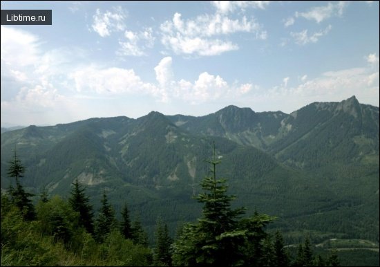
Karst massifs that look arid and waterless on the surface often hold significant reserves of high-quality water at depth, and these reserves sometimes feed large surface rivers. The waterless Ai-Petri plateau, for example, is the recharge area for the two largest rivers of the Crimean Peninsula — the Belbek and the Chernaya.
The Krasnopeshchennaya River, which flows along the floor of the Red Cave (Krasnaya) in Crimea, is one of the most thoroughly studied underground karst rivers. Its flow rate is just 0.01 m³/sec in summer and winter, but during spring snowmelt it surges to about 6 m³/sec — a six-hundredfold seasonal increase that illustrates how strongly underground rivers depend on surface conditions.
Underground rivers frequently include waterfalls, some reaching heights of 3–6 metres and more where passages drop sharply. These cascades form where the cave floor steps down or where a resistant rock layer creates a sudden break in the channel's gradient.
The Achkhitizgo River, which flows out of the Abrskila Cave in the Caucasus, has an average flow rate of 0.25 m³/sec — about 2.5 times greater than the Red Cave river. Its higher discharge reflects a larger recharge area and more consistent feeding from the surrounding massif.
What is the chemical composition of underground rivers?
The water of underground rivers is predominantly calcium-hydrocarbonate or calcium-sulfate in composition, reflecting the rock through which it flows. Rivers passing through limestone dissolve calcium carbonate and carry a hydrocarbonate signature, while those moving through gypsum pick up sulfate. This dissolving action is the same process that slowly enlarges the caves the rivers occupy.
What types of underground lakes exist?

In the early stages of cave formation, three kinds of lake appear:
- Erosion lakes — hollowed out by the mechanical action of flowing water.
- Corrosion lakes — dissolved into the rock by chemically aggressive water.
- Dam-flow lakes — created where roof collapses, sandy-clay sediment, or accumulations of calcium carbonate form natural dams that pond the water.
At later stages of cave development, basin-accumulative lakes appear, which may be either flowing (connected to a moving stream) or non-flowing (isolated). These represent a more mature phase, after the main passages have stabilised and water gathers in established depressions.
Basin-accumulative lakes form when infiltration water collects in depressions lined with clay material. They are not connected to groundwater flow or to one another, and they can sit at different hypsometric levels within the same cave system.
How large are underground lakes?
The overwhelming majority of underground lakes are small, with only a handful reaching notable size. Lake Bolshoye in the Kungur Cave is among the largest at an area of 1,300 m², while Lake Anatolia in the Abkhazia Grotto of the Anakopia Cave exceeded 1,000 m² in 1961. Even these "large" examples are modest compared with surface lakes, underscoring how confined the underground environment is.
Why does the water level change?
The water level in underground lakes is subject to seasonal fluctuations and is often linked, especially on plains, to the level of a nearby surface river. In some cases the amplitude of fluctuation is dramatic — reaching 17–35 metres in the Anakopia cave.
Changing water levels alter not only the area of a lake but also the number of lakes present. In the Lake Grotto of the Kungur Ice Cave, depending on the water level, the chamber may hold a single lake or as many as 12 separate ones — a striking demonstration of how dynamic these underground basins are.
What temperature is the water in underground lakes?
Water temperature in underground lakes is governed by the local climate and the morphological structure of the cave. In many lakes the temperature stays almost constant year-round, varying only within tenths of a degree, because the surrounding rock insulates the water from seasonal swings at the surface.
What is the chemistry of underground lake water?
Underground lakes across the territory of the former Soviet Union divide by water chemistry into two main groups:
- Hydrocarbonate-calcium lakes — with mineralization up to 550 mg/l, confined to limestone caves.
- Sulfate-calcium lakes — with mineralization up to 1,250 mg/l and more, developed in gypsum cavities.
The mineralization difference reflects the host rock: gypsum is far more soluble than limestone, so lakes in gypsum cavities carry a heavier dissolved-mineral load.
What are underground mineral lakes?
Underground mineral lakes form a special group fed by waters rising from below rather than seeping in from above. Lake Kou in the Baharden cave in Central Asia is a well-known example, measuring 72 metres long, 30 metres wide and 12 metres deep.
The water of Lake Kou is of sulfate-sodium-chloride-calcium composition and carries the odour of hydrogen sulfide. That hydrogen sulfide is produced by biochemical sulfate reduction under anaerobic conditions, driven by sulfate-reducing microorganisms living in the lake.
Lake Kou has a water mineralization of 2,858 mg/l — markedly higher than ordinary limestone or gypsum cave lakes. Its level falls in winter and rises in summer, though the annual amplitude of fluctuation stays within 10–15 cm. The water is notably warm, at 34 °C in winter and 37 °C in summer, reflecting its deep, mineral-rich source.
Is there soil inside caves?
Caves generally have no soil cover, because the processes that build soil — vegetation, weathering and organic accumulation — cannot operate in permanent darkness. Only in the entrance zones of some limestone and dolomite caves do small patches of humus-carbonate soil develop, where light and surface debris still reach.
Underground rivers and lakes are among the most striking features of the subterranean world, combining geological history, distinctive chemistry and quiet beauty. If you ever have the chance, this is a beauty worth seeing at least once in your life.