Forest Navigation by Moss and Lichen: Find North Without a Compass
 libre
libre
Moss tends to grow on the shadier, more sheltered side of a surface, which in the Northern Hemisphere is usually the north-facing side — so a thick cushion of moss on one side of a boulder or tree can hint at direction. Look carefully at this unusual compass that nature created on a forest stone, but treat it as one clue among many rather than a definitive arrow to north. We have already written about different signs of orienteering, orienteering in the forest and with the help of a compass. We advise you to read these interesting articles.

How to navigate by moss: nature's compass
To navigate by moss, find a free-standing tree or large stone in open forest, compare how much moss grows on each side, and note that the most lush, consistent growth usually marks the shadiest, dampest aspect — north in the Northern Hemisphere and south in the Southern Hemisphere. Moss is a moisture-loving bryophyte, so it colonises the side of a surface that stays cool and wet longest, which is the side the sun strikes least directly.
This method is a probability indicator, not a precision instrument. Tristan Gooley, the natural navigator behind books such as The Natural Navigator: The Rediscovered Art of Letting Nature Be Your Guide, stresses that moss reflects local moisture and shade rather than a magnetic bearing, so a single mossy rock proves little on its own. The reliable approach is to read many surfaces, build a consensus, and cross-check moss against the sun, wind, slope and other natural signs.
The science behind moss growth and direction
Moss grows where moisture lingers and direct sun is scarce, and in the Northern Hemisphere those conditions are most common on north-facing surfaces. Because the sun tracks across the southern sky in northern latitudes, the south side of a trunk or boulder dries fastest, while the north side holds the cool, damp microclimate that bryophytes need. That environmental bias — not any magnetic sense — is what makes moss loosely directional.
Why moss grows on the shady side
Mosses and lichens do not like heat and direct light, so they grow on the shadier side of a surface. Where the mosses and lichens are thickest, that side is generally the cooler, north-facing one in the Northern Hemisphere; on the sun-baked south side there is usually less moss or none at all. The relationship reverses in the Southern Hemisphere — in Australia, the shaded, moss-friendly aspect faces south — which is why moss navigation always depends on knowing which hemisphere you stand in.

Moisture requirements for moss growth
Moss depends on standing surface moisture and high air saturation rather than soil-borne water, because bryophytes lack true roots and absorb water directly through their leaves. To judge direction, check the moisture of the moss itself, not the soil beneath it — the damper, more thriving cushions mark the aspect that stays wettest longest.

You can also read the ground around a stone as a supporting clue. On one side the soil is comparatively dry, which tends to be the sunnier south side, and on the opposite, shaded side it is wetter. Overhanging branches complicate this: they cast extra shade and drip water onto whatever lies beneath, so moss can flourish under a canopy regardless of compass direction. An old, rotting stump usually carries moss on all sides because the decaying wood holds water everywhere, which makes stumps poor direction indicators.
Bark texture and moss cultivation
Rough, deeply furrowed bark cultivates moss far more readily than smooth bark, because the ridges trap moisture, dust and spores that smooth surfaces shed. When you hunt for directional clues, favour trees with coarse bark and inspect vertical, smooth-barked surfaces with suspicion — a smooth trunk may show no moss on any side simply because it offers nowhere for spores to anchor, not because one direction is sunnier. Surface gradient matters too: gently sloping or pitted faces retain water and host moss, while steep, fast-draining faces stay bare even on the shady side. These same moss-growth principles inform architectural and green-wall design, where builders deliberately roughen and shade surfaces to encourage living moss.
Step-by-step: reading moss to find north
Work through several surfaces in turn, record which aspect each one favours, then take the majority verdict as your best estimate of north. A disciplined observation-to-conclusion process beats a single glance, and the steps below move from the simplest reading to a cross-checked conclusion.
- Pick a free-standing boulder or tree away from dense canopy and slopes.
- Compare the quantity and vigour of moss on each side.
- Note the wetter, shadier aspect — your candidate for north.
- Repeat on at least three or four separate surfaces nearby.
- Accept the direction only if most readings agree, then confirm it with the sun or a compass.
Checking moss on boulders and stones
Boulders make better moss compasses than trees because a large stone sits still, exposes broad faces to the sky, and is less shaded by its own foliage. Examine where the moss is thickest and where the rock stays bare; the lush side points toward the shaded, generally northern aspect. Sun-warmed stone faces dry quickly and stay clear, reinforcing the contrast.
Reading moss on trees and rotting stumps
Standing trees can indicate direction through their mossiest side, but rotting stumps cannot. Most of a stump's surface stays damp as the wood decays, so moss colonises it on every side and gives no usable bearing. On a living trunk, look for the side carrying the heaviest, most continuous moss and compare it with neighbouring trees rather than trusting one specimen.
Using soil moisture around stones
The soil ringing a stone offers a secondary moisture clue: the drier arc usually faces the sun (south in the Northern Hemisphere) and the damper arc faces the shade. Use this only to support what the moss already suggests, because drainage, recent rain and ground cover can skew soil moisture independently of direction.
Climate and location requirements for moss navigation
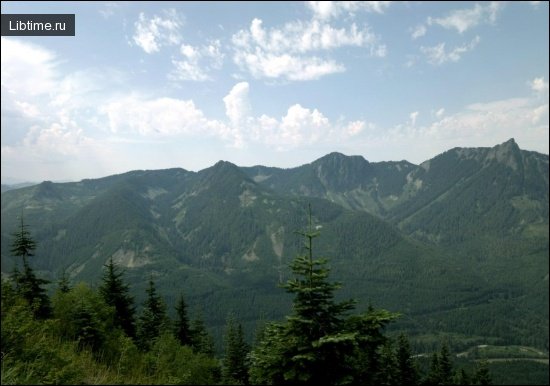
Moss navigation works best in cool, humid, temperate forest ecosystems where moisture is plentiful enough to create a real difference between sunny and shaded aspects. The damp coastal forests of the Pacific Northwest, Cascadia and British Columbia — think of the rain-soaked country around the Chilliwack River — grow moss so generously that the directional signal is easy to read, while the temperate woodlands of the United Kingdom offer similar conditions.
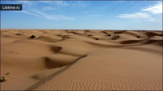
In hot, dry or heavily exposed environments the method collapses, because moss either fails to grow or grows only in the few sheltered pockets that have nothing to do with north. Hemisphere also dictates the rule: across Northern Hemisphere forests the shaded, mossy aspect trends north, whereas in the Southern Hemisphere it trends south. Latitude refines this further, since at high northern latitudes the sun stays low in the south and sharpens the shade contrast that moss responds to.
Common misconceptions about moss and direction finding
The biggest misconception is that moss reliably grows on the north side of every tree — it does not. Moss responds to moisture and shade, and plenty of factors override direction: dense canopy, a north-flowing breeze, a leaning trunk, ground that drains one way, or simply a wetter microclimate on the "wrong" side. Treat the "moss equals north" idea as a rough tendency that needs confirming, not a law.
Common mistakes in natural navigation analysis
The most frequent natural-navigation errors come from reading too few clues and ignoring the things that distort them. Watch for these traps:
- Judging direction from a single mossy rock or tree instead of a sample.
- Reading moss on rotting stumps, which grow it on all sides.
- Forgetting which hemisphere you are in and reversing the rule.
- Overlooking overhanging branches that shade and drip onto one side.
- Mistaking a damp, sheltered gully or stream bank for a directional signal.
Critical thinking is the antidote: each observation is a hypothesis to test, not a conclusion to trust. Use the process of elimination, discard clues you can explain by local terrain, and keep only the pattern that repeats across many surfaces.
Why you should cross-check multiple indicators
Cross-checking several independent indicators turns a guess into a defensible bearing through a multiple-location consensus method. No single sign — moss, ant hill, sun or slope — is trustworthy alone, but when three or four of them agree, the odds of error drop sharply. Read the moss, glance at the sun's position, note the prevailing wind and check the lie of the land, then commit only when the clues converge.
Other natural navigation methods
Moss is just one entry in a wider toolkit of natural navigation, and the strongest navigators combine several. Ant hills, lichens, algae, the sun and the stars each carry directional information, and learning to read them gives you redundancy when any one clue is ambiguous.
Orienteering by ant hills
Ant hills point the way because ants are heat-loving insects that build to catch the sun. Most anthills sit on the south side of a tree, stump or shrub, and the mound itself is usually gently sloping on its warm southern face and noticeably steeper on the cooler northern side.

Lichen and reindeer moss as direction indicators
Lichens add another natural compass, and one type is especially telling in the far north. In the tundra, in white-moss pine forests (more: What types of forests) and taiga bogs across northern Eurasia, lichens of the genus Cladonia — known as jagel or reindeer moss, and an irreplaceable winter fodder for reindeer — also work as direction finders. Besides being sources of valuable antibiotics and enzymes, the darker tips of their branching bushes tend to face north. Moving north you see a darker lichen surface; moving south the dark colouring hides and the bushes look paler.
Algae as a surface-dwelling navigation indicator
Algae behaves much like moss, favouring the damp, shaded side of trees, rocks and walls, so a green algal film often marks the same cool aspect — generally north in the Northern Hemisphere. Caitlin Fong, a biologist at California State University, Northridge, has noted that surface-dwelling algae respond to the same moisture and light gradients that govern bryophytes, which is why algae and moss usually agree. Read algae exactly as you read moss: sample many surfaces and confirm the pattern before trusting it.
Celestial navigation using the sun and stars
Celestial navigation gives a far more accurate bearing than any plant, using the predictable motion of the sun and stars. By day, the Shadow Stick Method finds an approximate east–west line: plant a stick upright, mark the tip of its shadow, wait fifteen minutes, mark the new tip, and the line between the marks runs roughly west to east. Its accuracy is limited near midday and around the spring and fall equinoxes, when the sun's path and Earth's axial tilt change the shadow's behaviour, so treat the result as approximate.
By night, the North Star — Polaris — marks true north in the Northern Hemisphere because it sits almost directly above the celestial pole, with only a small offset. Find it by following the pointer stars of the Big Dipper, or cross-check using the line of Orion's Belt. Because Polaris barely moves while other constellations wheel around it through the seasons, it gives a steadier fix than any moss-covered stone.
Navigating by compass: usage and limitations
A magnetic compass — a quality instrument such as those from Brunton Compasses — is the most dependable handheld direction finder, but it has limits worth understanding. A compass points to magnetic north, not true north, so you must allow for local declination when working from a map. Iron-bearing rock, power lines, vehicles and even some gear can deflect the needle, and a compass tells you direction but nothing about terrain, which is why pairing it with map reading and terrain association matters. Where no compass is at hand, the natural alternatives above — sun, stars, moss and ant hills — fill the gap.
Choosing forest landmarks and beacons
Picking distinctive landmarks in advance is the surest way to avoid getting lost, because clear reference points let you fix your position, hold a direction and gauge distance along a route. This is the heart of terrain association: matching what you see on the ground to the shape of the land and to a topographic map. Writer A. Avdeenko, in the book "Above the Tisza," describes his hero Kablukov navigating exactly this way:
"The thick fog did not prevent Kablukov from orienting himself. By the signs, there and here scattered along the sentinel path, he easily determined where he was. Here was the stony bed of a groove washed by spring rains, which meant that he had already traveled more than a third of the way. In fifty paces there should be a stump of an old oak tree. Yes, there it is, there it is. In seven minutes the bare trunk of an oak tree, broken by lightning, will blacken through the fog, then, on the other, on the right flank, there will be a big boulder deeply embedded in the ground.
Choose landmarks that stay visible and unmistakable — a lightning-split trunk, a stony streambed, a deeply embedded boulder — and string them into a remembered sequence so you can retrace the route even in poor visibility.
Natural "lights" and glowing stumps as guides
Glowing stumps and fungal threads can serve as night-time beacons in forests rich with honey fungus. Walk the silent forest after dark and bright points of phosphoric light may flash in the blackness: the growing ends of the fungus's rhizomorphs glow.

The fungus, sheathed in a dense shell, branches strongly under the bark of weakened trees, drives into the living wood, draws out its juices and kills the tree. The protruding ends of the fungus, the rhizomorphs, glow like miniature electric bulbs.

Rotted stumps glowing with phosphoric fire are the brightest of these forest "beacons," with shimmering luminous streams seeming to flow down them from top to bottom where myriads of bacteria nest. Bioluminescent microbes contain complex chemicals called luciferin and luciferase, and different bacteria glow with their own strength and colour. These cold night lights, source of many superstitions, are simply bioluminescence — a living glow, especially active in windy, oxygen-rich, damp weather, running around the clock. Memorising the location of rotting trees and half-ruined stumps before nightfall turns them into light pointers on the way back, and reading moss or ant hills alongside them helps you hold the right direction.
Accuracy and critical thinking in natural navigation
Natural navigation is a skill of probabilities, and its accuracy rises sharply with practice and disciplined observation. Treat every sign — moss, lichen, ant hill, sun shadow — as evidence to weigh rather than proof to obey, and you will avoid the confident mistakes that strand careless hikers. Practitioners and educators such as Craig Caudill of the Nature Reliance School and survival instructor Creek Stewart teach the same habit: build a conclusion from multiple converging clues, and keep testing it as you move. Communities like Georgia Bushcraft and homesteads such as Wild Bluebell Homestead pass these natural-navigation methods on through hands-on teaching, because the technique is learned in the field, not memorised from a page.
Combining traditional and modern navigation methods
The strongest navigation strategy layers traditional natural signs beneath modern tools, with a clear hierarchy of trust. Plan before you set out — pre-event planning beats improvisation every time — and carry a map and compass as your primary instruments, with a GPS unit or mapping service such as Caltopo.com as backup. Use natural indicators like moss, sun and stars to sanity-check the technology and to keep going if a device fails:
- Map and compass — primary tools for bearing and terrain association.
- GPS and digital maps — fast confirmation and backup, battery permitting.
- Celestial navigation — reliable direction by sun and Polaris when tools are gone.
- Moss, lichen and ant hills — supporting clues, cross-checked and never trusted alone.
Emergency navigation skills if you get lost
If you become lost, stop moving, stay calm and use every available clue before committing to a direction. Panic-walking burns energy and scatters your mental map, so the first emergency skill is patience. Build a direction the same way you would on a calm hike — read the sun or stars for a bearing, sample moss and other signs for agreement, and relate what you see to the terrain and any map you carry.
- Stop, sit, and steady your breathing before deciding anything.
- Establish direction from the sun, Polaris, or a compass if you have one.
- Cross-check with moss, algae, ant hills and slope for consensus.
- Identify a distant landmark and use terrain association to fix your position.
- Move deliberately toward a known feature — a river, ridge or trail — rather than wandering.
Regular practice is what makes these skills work under stress. Wilderness navigation, like any forest survival or bushcraft discipline, is built through repetition on easy days so the habits hold on hard ones — read clues on every walk, test your guesses against a compass, and the emergency version becomes second nature.