How to Navigate in the Desert: Find Direction and Landmarks Without a Compass
 libre
libre
Desert navigation is the practice of finding direction and maintaining a route across vast sandy or stony terrain that offers few fixed landmarks. The most reliable methods combine celestial observation — using the Sun, Moon, and stars — with reading natural indicators like dune shapes and wind-carved rock, supported by a compass, topographic maps, and GPS. In an environment where shifting sands can erase a road overnight, no single technique is enough; experienced desert travelers cross-check several at once.
How to Navigate in the Desert: Core Principles
To navigate the desert, fix a known direction using the Sun or stars, identify a distant landmark that lies on your intended line of travel, walk toward it, and repeat the process as each landmark is reached. This chained-landmark method is the backbone of desert wayfinding because it lets you hold a straight bearing even where the ground gives almost nothing to steer by. The desert surface is a huge sandy or stony expanse with no continuous vegetation cover, only individual plants.

Why Desert Navigation Is So Difficult
Desert navigation is difficult because the landscape is both featureless and unstable, so the cues people rely on elsewhere either do not exist or move. Many areas contain shifting sands that, driven by the wind, fill roads and paths and completely change the terrain in a short time. This combination of monotony and constant change is what writer Tristan Gooley and other natural-navigation researchers describe as the central problem of arid terrain: high unpredictability (perplexity) punctuated by sudden hazards and changes (burstiness). Cloudy days in the desert are rare, however, which means you can almost always orient by the Sun, Moon, and stars.
Understanding the Desert Terrain and Shifting Sands
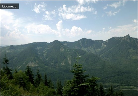
Desert terrain is not one surface but several, and each one navigates differently. The major desert ground types include soft sand dunes, gravel plains, granite outcrops, and lava fields, alongside dry riverbeds and escarpments. R. A. Bagnold, the British explorer who pioneered motorized travel in the Sahara and the Arabian Desert, documented how dune fields move as coherent systems shaped by prevailing wind — knowledge that still underpins modern desert route planning. Optical illusions such as mirages and the loss of scale on flat plains add a further layer of difficulty, making distant objects appear closer or features appear where none exist.
Route Planning Before You Enter the Desert
Plan a desert route before departure by studying topographic maps, marking water sources and fuel points, calculating distances, and recording escape routes back to known infrastructure. Pre-journey planning is the single most effective safeguard in remote desert travel because it converts an open, featureless expanse into a sequence of known waypoints. Note the position of any settlement, well, or graded track relative to your line, since these become handrails and backstops if you drift off course.
Build redundancy into the plan: carry more water and fuel than the direct distance suggests, log expected bearings between waypoints, and agree on emergency-preparedness steps before leaving signal coverage. Field researchers working in regions like the Southern Nejd Quadrangle of Saudi Arabia note that communication barriers and the absence of reliable contact make self-sufficiency essential, so every plan should assume no outside help will arrive quickly.
Identifying and Avoiding Desert Obstacles
Identify desert obstacles in advance by reading the map for escarpments, soft-sand belts, lava fields, and steep wadi crossings, then plan detours around them rather than through them.

Celestial Navigation in the Desert
Celestial navigation in the desert uses the predictable movement of the Sun by day and the stars by night to establish true direction without any instruments. Because clear skies are the desert norm, the sky becomes the most dependable compass available. The Sun gives a north–south line through shadow geometry, while at night Polaris marks true north in the Northern Hemisphere.
How to Determine North Using the Sun
Determine north from the Sun using the shadow-tip method: place a stick upright, mark the tip of its shadow, wait fifteen minutes, mark the new tip, and the line between the two marks runs roughly west-to-east, with north at right angles to it. This sun compass works anywhere the Sun casts a shadow and needs no equipment beyond a stick and two stones. Bedouins and the Tuareg refined comparable sun-based techniques over centuries of crossing the Sahara and Arabian Desert.
Using a Gnomon to Find the North-South Line
A gnomon finds the north–south line by tracking how the Sun's shadow crosses a set of marked circles. On a sunny day, take a sheet of drawing paper, attach it to a piece of plywood, and draw several concentric circles of arbitrary radius. In the center, fix a long needle in a plumb position. Mark where the shadow of the needle's tip crosses the circles before and after noon, connect the points on each circle with straight lines, and divide them in half. The straight line (NS in the figure) drawn through the division points is the north–south direction. With a gnomon you can also check how far a magnetic needle deviates from the geographical meridian.
Gnomons and Obelisks in Armenia
Obelisks acting as gnomons are widespread across Armenia, where well-cut basalt or tuff columns several meters high stand at crossroads, near temples and springs, and on the squares of ancient villages. All of them are typical gnomons — primitive instruments for measuring time and determining latitude. One was discovered recently at the base of the Echmiadzin Cathedral on the site of a former pagan temple and is now installed on a pedestal near the same cathedral.
Orienteering in Flat Desert Terrain
In flat desert and semi-desert, fix the north–south line from the two points where the Sun rises and sets. Mark a stake at point A; ten meters away, in the direction of the rising Sun's center, mark point C; at sunset, at the same distance toward its center, mark point B. Point O marks the middle of line BC, and the direction AO, passing through O, is the north–south line. Having established the sides of the horizon this way, you can verify them against the readings of a bussol.
Night Navigation by Polaris and the Stars
At night, the fastest way to find north in the desert is by Polaris, the North Star. The direction to Polaris coincides with the north–south direction when the line connecting Polaris with the fourth star of Cassiopeia and with the second-from-the-end star in the "tail" of the Big Dipper stands roughly perpendicular to the horizon.

Navigating by the Moon
Navigate by the Moon by reading which side is illuminated: before midnight a waxing Moon's lit side faces roughly west, while after midnight a waning Moon's lit side faces roughly east, giving an approximate east–west reference. A quick field rule is to draw an imaginary line through the tips of a crescent Moon's horns down to the horizon — that point lies roughly south in the Northern Hemisphere. The Moon is less precise than Polaris but invaluable on nights when it dominates the sky.
Compass and Bearing Navigation
A magnetic compass gives a continuous directional reference in the desert by aligning with Earth's magnetic field, letting you hold a bearing between celestial fixes. The compass remains essential gear precisely because it works when the Sun is overhead and shadows vanish, or when blowing sand hides the stars. A quality field instrument such as a Brunton lensatic compass lets you sight a distant bearing and walk it accurately.
Compass Calibration and Bearing Techniques
Calibrate compass use by correcting for magnetic declination — the angle between magnetic north and true north — before trusting any bearing. To take a bearing, hold the compass level, point the direction-of-travel arrow at your target, rotate the bezel until the orienting lines align with the needle, and read the figure at the index. Subtract or add the local declination to convert between magnetic and true north so that a bearing read off a topographic map matches the one you walk on the ground.
Checking Direction with a Bussol
A bussol checks direction by measuring the angle between the magnetic meridian and the line to any chosen object — its azimuth. After establishing the sides of the horizon by Sun or stars, take a bussol reading along the same line to confirm the two agree, which also reveals the local magnetic deviation. Cross-checking an instrument reading against a celestial fix is the core discipline of dead reckoning: each method catches the other's error before it compounds over distance.
Using Natural Landmarks and Wind Indicators
Natural landmarks in the desert — wind-carved rock, dune slopes, and animal tracks — encode the direction of the prevailing wind and therefore a reliable bearing. Reading these features is the heart of natural navigation, the skill set Bedouins and the Tuareg mastered long before instruments existed. Each indicator below points back to a known wind direction, which the traveler converts into a heading.
Reading Wind Direction from Traces on Rocks
Wind direction can be read directly from the way it sculpts soft rock. Limestones, sandstones, and similar stone develop parallel furrows separated by sharp ridges aligned with the constant wind; on the limestone plateau of the Libyan Desert near Fezzan, furrows up to a meter deep run in the direction of the steady north wind.

Interpreting Dune Shapes and Sand Ridges
Dune shape reveals wind direction because every barchan has a flat windward slope and a steep, almost sheer leeward face. The gentle side faces the wind; the steep side, sometimes with a small overhanging canopy, faces away — so reading the asymmetry of a dune tells you which way the wind blows and fixes your bearing.

Navigating by Footprints and Tracks in Daytime
By day, footprints and animal tracks act as wayfinders pointing toward water, settlements, and established routes. Caravan trails, the remains of pack-animal equipment, and the traces of old fires all indicate where people and animals have travelled, and following them often leads to an oasis or well. Bedouin trackers read the freshness, depth, and spacing of prints to judge how recently a group passed and in which direction, turning the ground itself into a record of movement.
Traditional Desert Navigation Methods
Traditional desert navigation relied on memorized routes, celestial cues, and inherited knowledge of wind and terrain rather than instruments. The Arabs, Bedouins, and Tuareg developed sophisticated wayfinding systems that crossed the Sahara and Arabian Desert reliably for centuries, and many of their methods remain valid today. A widely quoted Arab proverb captures the mindset — that the one who does not know the road will not reach the destination however fast he travels — underlining the value placed on route knowledge over speed.
Ancient Arab Navigation Techniques
Ancient Arab navigators combined star bearings, wind-direction reading, and detailed mental maps of wells and landmarks along routes such as the Mecca Road. They distinguished route finding — recalling a specific known path — from open navigation across untracked ground, much as Pacific Islanders did at sea, and historians have drawn direct comparisons between the two traditions. Travelers like Lawrence and the explorer R. A. Bagnold recorded how desert guides held direction across the Fezzan and the deep Sahara using little more than the Sun, the stars, and an intimate reading of the sand.
Bedouin Track Systems and Cross-Track Hazards
Bedouin track systems are networks of established routes linking wells and grazing grounds, and their main hazard is the cross-track — a path crossing your own that can pull you onto the wrong line. Following the wrong track at a fork is the classic desert error, which is why traditional travelers memorized the sequence of junctions and the landmarks marking each.

Map-Based Navigation in the Desert
Map-based desert navigation translates the flat reality of the ground into a planned route by reading elevation, scale, and grid coordinates from a topographic map. Maps remain vital where the terrain itself offers no cues, and combined with GPS they let a traveler fix an exact position anywhere. Understanding map orientation and scale is the foundation: align the map to north, match its scale to real distances, and the desert becomes a navigable grid.
Reading Contour Lines and Elevation Profiles
Contour lines show elevation by connecting points of equal height, and reading them turns a flat map into a three-dimensional picture of dunes, escarpments, and wadis. Lines packed close together mean steep ground — an escarpment or a sheer dune face — while widely spaced lines mean gentle gradients.

Using Coordinate Systems and GPS Tools
GPS pinpoints desert position using satellite coordinates and lets you record waypoints, log a track, and share locations in standard formats. A handheld GPS device or smartphone app records waypoints for wells and camps and exports them as GPX, KML, or KMZ files for import into mapping tools built on OpenStreetMap data, such as OsmAnd Maps.

Desert Driving and Vehicle Navigation
Desert driving demands a capable four-wheel-drive vehicle, careful fuel planning, and techniques for crossing soft sand without becoming trapped. Vehicles such as the Land Rover Defender and Nissan Patrol are favored for desert exploration because of their clearance, low-range gearing, and durability. Travel in pairs where possible, lower tire pressure on soft sand to spread the load, and carry recovery gear so a bogged vehicle can be freed.
Fuel calculation drives the whole trip: estimate consumption across soft sand — far higher than on road — add a wide safety margin, and never plan a leg longer than your range to the next known fuel point. Park on slopes nose-out for an easy downhill start, recover sand traps by digging out and laying tracks under the wheels, and use two-person teams so one driver can spot while the other negotiates dunes. In open, unrestricted desert, stay alert to protected-area boundaries and posted limits, and treat off-road safety as a planning task rather than an improvisation.
Surviving Extreme Heat While Navigating
Surviving desert heat while navigating means timing travel to avoid the hottest hours, conserving water and energy, and protecting yourself from temperature extremes that can shift dramatically between day and night. Move at dawn, dusk, or night when the air is cool and stars guide you, and rest in shade through the searing midday. Heat management is itself a navigation decision, because exhaustion and dehydration degrade judgment faster than any map error.
Desert Survival Navigation Essentials
Essential desert survival gear pairs navigation tools with the means to stay alive long enough to use them: ample water, sun protection, a reliable compass, a topographic map, and a charged GPS device with spare power.