How to Orient in the Forest Without a Compass: Natural Signs Using Mushrooms and Moss
 libre
libre
You can orient yourself in the forest without a compass by reading natural signs — the way mushrooms and moss favor the north side of trees, how berries ripen faster on sunny southern slopes, where the sun and stars sit in the sky, and how terrain features drain and tilt. None of these methods alone is perfect, but combined they reliably point you toward the cardinal directions when no compass or GPS is available.
Every element of nature around us has its own significance and is closely related to other seemingly useless objects. Whether it is a small insect or a fixed stone, it is collectively our home, which we must cherish.

How to Orient in the Forest Without a Compass
Orienting in the forest without a compass starts with combining several independent clues rather than trusting any single one. A reliable natural-navigation routine works like this:
- Establish a rough cardinal direction from the sun's position or a shadow.
- Confirm it against vegetation signs — moss, grass density, berry ripeness, tree growth.
- Pick a distant landmark in your intended direction and walk toward it.
- Re-check at intervals, because a single clue can mislead you.
Natural navigation without technology rewards patience and observation. The sun gives you direction by day, the stars by night, and the landscape itself — slopes, water drainage, treelines — gives a constant frame of reference. Treat each sign as a vote, not a verdict, and let the majority guide you.
Reading Natural Signs of Orientation on the Terrain
Plants, fungi, and ground cover respond to sunlight and moisture, which makes them readable directional indicators once you know what to look for. The following signs are most useful in temperate forests of the Northern Hemisphere, where the sun tracks across the southern sky and the north side of objects stays cooler, shadier, and damper.
Orienteering by Mushrooms
Mushrooms tend to grow on the north side of trees and stumps, making them a useful orientation sign. They like to grow under trees or on stumps, and you will most often find them clustered on the shaded northern face. On the eastern and western sides of a tree there are usually fewer mushrooms, and on the southern side — especially after prolonged dry weather — they are rare. Redheads grow in a consistent location each year, such as under the same pine tree on the north side or to the northeast and northwest.
Redheads growing south of the tree show a greenish-blue coloring and a rough, dry surface, although the stem and cap remain red and juicy in section. This difference in appearance is itself a clue: the sun-stressed southern specimens look different from their shaded northern counterparts.
Why Mushrooms Favor the North Side
Mushrooms favor the north side because it holds more moisture and stays cooler and shadier, the conditions fungi need to fruit.

Reading Moss Growth on Trees and Stumps
Moss tends to grow thicker on the north side of trees and rocks in the Northern Hemisphere because that face stays shaded and damp, but its reliability is limited. Moss growth as a directional indicator works best as a confirming vote rather than a standalone answer: in dense, humid forest moss can wrap a trunk completely, and local shade from boulders, slopes, or neighboring trees often matters more than compass direction. Lichen growth patterns follow similar logic — many lichens prefer the cooler, moister side — but they too vary with microclimate.
Use moss and lichen the way experienced navigators do: check several trees and rocks, look for a consistent bias toward one side across many of them, and only then treat that side as likely north. A single mossy trunk proves nothing; a whole stand leaning the same way is meaningful.
Orienteering by Berries
Berries ripen faster on the southern side, so the riper, more abundant fruit points south and the opposite direction is north. In an open forest glade, fruits ripen earlier from the south, where they catch more sun. In the forest, berries — blueberries, blackberries, cowberries, cloudberries, cranberries — on the southern side are heated better and ripen faster than on the northern side.

Real Story: How Berries Helped Lost Hikers Find Their Way
A group of high school students once used berry ripeness to navigate out of a forest where they had become lost. In the second half of August they went into the forest to pick cranberries. There were few berries in the nearest glades, so the children went deeper, found a lot of cowberries in the young growth, got carried away running from bush to bush, and got lost.
The sky was covered with gray clouds and rain began to pour down. The clearing, overgrown with young pine trees, occupied dozens of square kilometers. Around the horizon, the upper line of the dark forest, covered with a shroud of fog, was just visible. Even experienced people could not easily orient themselves in such conditions, and the children became despondent, thinking about what signs of orientation the forest might offer.
- Here, look, - one boy said, examining the berry bushes near the nearest stumps, - on one side there are more berries and they are riper - this is the southern side. And in the morning we went northward into the forest, I noticed the Sun in the cloud gap, it was on the right. It means we have to go back home to the south.
Everyone examined the berry patch, were convinced of the correctness of their comrade's reasoning, and went home, where they were eagerly awaited. The boy had combined two methods — berry ripeness and remembered sun position — which is exactly why his conclusion held up.
Orienteering by Grass Cover
Grass density and color reveal direction in open forest glades, with the south side generally fuller and the north side staying green longer.

Look closely, though, and the grass is usually thicker on the southern side than on the northern side. Around the second half of summer the grass begins to turn yellow, and on the north side the green color lasts longer because that face stays cooler and moister. Other orienteering signs are covered in the article on orienteering in the forest.
Using Trees for Direction
Trees record direction in their bark, branch spread, and growth, because the sunnier southern side grows differently from the shaded north. Branches and foliage on freestanding trees are often denser and reach farther on the south side, where they receive more light. Tree tilt can also reflect prevailing winds: in exposed areas trees lean away from the dominant wind direction, so if you know your region's prevailing winds you gain another orientation clue.
Tree Bark, Branches, and Annual Rings as Clues
Bark texture, branch density, and the spacing of annual rings all carry directional information. Birch trees show this well — birch bark is often cleaner, lighter, and more elastic on the south side, while the north side tends to be darker, coarser, and more likely to carry cracks or growths. On a cut stump, the annual rings are frequently wider on the side that faced south, since that side gained more sun and grew faster. As with moss, read several trees before drawing a conclusion, because a single specimen's shape may reflect a neighbor's shade rather than true direction.
Ant Hills as Direction Indicators
Ant hills usually sit on the south side of a tree, stump, or stone and slope more gently toward the south, giving you two clues in one. Ants build on the warmer, sunnier southern side for heat, and the southern slope of the mound is typically longer and less steep than the steeper northern slope. To use anthill orientation, find several mounds, note which side of their supporting object they favor, and check whether the gentle slope consistently faces the same way — that direction is south in the Northern Hemisphere.
Compass Plants and Prickly Lettuce Orientation
Compass plants align their leaves north–south to manage sunlight, so their orientation points you toward the cardinal directions. The classic example is the compass plant, Silphium laciniatum, of the North American Great Plains, whose large leaves twist to face their edges toward the midday sun and their flat surfaces east and west — meaning the leaf blades line up roughly along a north–south axis. Prickly Lettuce behaves the same way: its leaves rotate to a vertical north–south plane in full sun, which is why it earned the nickname pilot weed. Tansy, Tanacetum vulgare, is another plant sometimes noted for sun-following habits. Read a stand of these plants rather than one leaf, since shade and crowding distort individual alignment.
Animal Behavior as Navigation Clues
Animal behavior offers indirect navigation clues through nesting orientation, feeding patterns, and movement toward water. Many birds and mammals shelter on the sunnier, more protected side of slopes and structures, and game trails frequently lead downhill toward water — useful because following drainage usually leads to streams, then rivers, then human settlement. Animal navigational behavior patterns, such as the way migrating birds and mountain animals follow consistent seasonal routes, can hint at the lay of the land. In mountain country, Dall sheep and similar animals trace established paths across slopes; observing where these animal navigational behavior patterns converge can reveal passes, water, and easier terrain.
Game trails are a double-edged tool. They make excellent natural handrails when they run in your intended direction, but you should avoid following game trails when they lead into dense brush, cliff bands, or away from your route — animals travel for food and water, not to reach a trailhead. Treat a game trail as a convenience, never as a guaranteed path out.
Navigating by the Sun
The sun is the most dependable natural compass, rising in the east, setting in the west, and sitting due south at midday in the Northern Hemisphere. Because its path is predictable, sun position and movement give both rough orientation at a glance and precise direction with a little technique. The methods below need only the sun, a stick, or an analog watch.
Finding Direction Using the Sun's Position
You can get a rough fix from the sun in seconds: it rises roughly in the east, sets roughly in the west, and at local apparent noon — its highest point — it lies due south in the Northern Hemisphere and due north in the Southern Hemisphere. For a precise reading, use the shadow stick method:
- Push a straight stick upright into level, sunlit ground.
- Mark the tip of its shadow with a stone — this first mark is west.
- Wait 15 to 20 minutes and mark the new shadow tip — this second mark is east.
- Draw a line between the two marks; it runs roughly east–west, and a line perpendicular to it runs north–south.
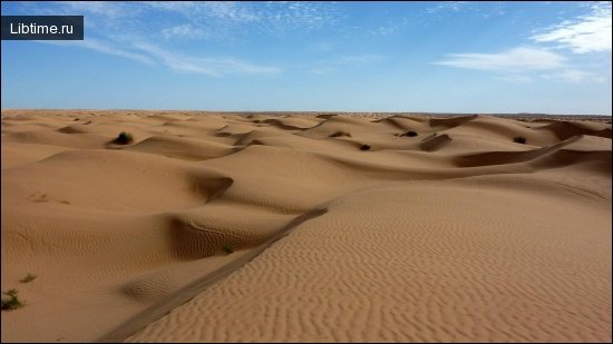
The shadow stick method for daytime orientation works because the shadow tip travels west to east as the sun moves east to west across the sky. Shadow patterns are clearest near midday when shadows are short and the sun moves fastest across your meridian. In the desert, a barrel cactus tends to lean toward the south as it grows toward the sun, offering a slower but useful version of the same sun-driven clue.
Determining Cardinal Directions With a Clock or Watch
An analog watch becomes a compass when you align its hour hand with the sun. In the Northern Hemisphere, point the hour hand at the sun; the point halfway between the hour hand and the 12 o'clock mark indicates south. In the Southern Hemisphere, instead point the 12 o'clock mark at the sun, and the midpoint between 12 and the hour hand indicates north. If you only have a digital watch, draw a clock face on paper with the correct hour hand to use the same analog watch compass technique.
Adjusting for Daylight Saving Time
During daylight saving time the watch compass needs a one-hour correction. Because clocks are set one hour ahead, use the 1 o'clock mark instead of the 12 o'clock mark as your reference point when finding the midpoint with the hour hand. Skipping this adjustment throws your reading off by about 15 degrees, enough to matter over a long walk.
Navigating by the Stars at Night
At night the stars replace the sun, and in the Northern Hemisphere one star — Polaris, the North Star — marks true north almost perfectly. Star navigation works because the night sky appears to rotate around the celestial poles, so certain constellations reliably indicate direction. Learn a handful of star patterns and you can navigate after dark without any device.
Locating the North Star (Polaris)
Find north by locating Polaris, the North Star, using the Big Dipper as a pointer. The two stars at the outer edge of the Big Dipper's bowl — the "pointer stars" — line up directly toward Polaris, which sits at the end of the handle of the Little Dipper (the constellation Ursa Minor). Extend the line between the pointer stars about five times their distance and you reach Polaris; drop straight down from it to the horizon and that point is true north. Polaris is not especially bright, so the Big Dipper pointer trick is the most reliable way to confirm you have the right star. The bright star Vega can help you orient the sky on summer nights but does not mark a cardinal direction.
If the Big Dipper is below the horizon or hidden, you can navigate by star movement instead: pick any star, watch it against a fixed foreground reference, and judge direction from how it moves — stars rising are in the east, setting in the west, looping low across the south, or circling tightly around the north. In the Southern Hemisphere, where Polaris is not visible, use the Southern Cross: extend the long axis of the cross about four and a half times its length to find the south celestial pole, then drop to the horizon for south.
Using the Moon for Orientation
The moon gives rough direction based on its phase and the time it appears. A crescent moon's horns can be used as a pointer: a line drawn through the two tips and extended to the horizon indicates roughly south in the Northern Hemisphere. More simply, if the moon rises before the sun sets, its illuminated side faces west; if it rises after midnight, the lit side faces east, since the moon is always lit by the sun. Moon phase orientation is less precise than star navigation, so treat it as a backup and confirm against other signs.
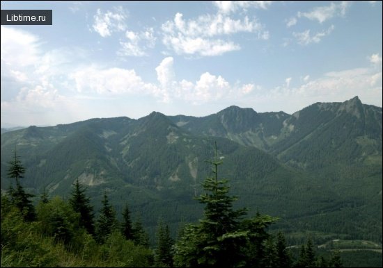
Navigating by Terrain and Landscape Features
The landscape itself is a navigation tool when you read its slopes, water, and elevation as a connected system. Reading the landscape for orientation means using large, stable features — ridges, gullies, rivers, treelines — as handrails and reference points that do not change with weather or time of day. Topographic map reading turns these features into a precise picture: USGS quadrangle maps show contour lines, drainages, and treelines, and apps like Gaia GPS, Avenza Maps, or Gaia GPS overlays let you study the same terrain before you ever leave the trailhead. Trip planning and map study before wilderness travel is the single most effective way to avoid getting lost in the first place.
Following Rivers, Slopes, and Snow Patterns
Water and slope give you direction and a route to safety at the same time. Following water sources works because water always flows downhill and small streams join larger ones that eventually reach valleys and settlements — when truly lost, following drainage downstream is a classic survival strategy. Ridges and gullies act as natural handrails you can follow without losing your line, while the Close-Middle-Far landmarking technique keeps you on course over distance:
- Close range (25–50 feet): a nearby rock or tree to step toward immediately.
- Middle range (100–500 feet): a distinct feature to aim past once you reach the close marker.
- Far range (500+ feet and beyond): a distant peak, treeline, or ridge that fixes your overall direction.
Snow melt patterns add a seasonal clue: in the Northern Hemisphere, south-facing slopes receive more sun and melt out first, so lingering snow tends to sit on the shaded northern side of slopes, trees, and boulders. Treeline elevation works as a three-dimensional location marker — the elevation at which trees stop growing is consistent within a region, so spotting the treeline tells you roughly how high you are. Regional variations matter: treeline sits far lower in the Alaska Range near Denali, Alaska than in the Sierra Nevada Mountains along the Sierra Crest near Lake Tahoe and the Desolation Wilderness, and lower again at high latitudes than in warmer Arizona, California, or Nevada ranges.
Emergency Compass-Free Orientation Techniques
In an emergency, build direction from whatever you have and prioritize staying safe over making distance. Emergency navigation techniques layer the natural signs above with improvised tools and a clear safety mindset: stop when you realize you are lost, stay calm, take stock of your situation, and avoid moving at all if conditions are dangerous or darkness is falling. Safety when lost in the wilderness comes from deliberate decisions, not panicked walking.
Creating a DIY Needle Compass in an Emergency
You can build a working compass from a needle, something to magnetize it, and water. The steps:
- Magnetize a steel needle by stroking it repeatedly in one direction against silk, wool, or hair — or against a magnet if you have one.
- Float the needle on a small leaf, piece of cork, or paper in a puddle or cup of still water.
- Let it settle; the needle will swing to align itself north–south.
- Resolve which end points north by checking against the sun or stars.
This DIY needle compass is delicate and only roughly accurate, but in a true emergency it confirms the north–south line you have read from nature.
Combining Multiple Navigation Methods for Accuracy
Accuracy in natural navigation comes from agreement among independent methods, never from one clue alone. Cross-check the sun's position against vegetation signs, confirm a moss reading across many trees, and verify a star fix against remembered terrain. When two or three unrelated signs — say, the shadow stick line, berry ripeness, and a snow-melt pattern — all point the same way, you can trust that direction. When they disagree, stop and gather more clues rather than committing to a guess. This habit of triangulation is what separates confident wilderness navigation from wishful thinking.
Emergency Signaling if You Stay Lost
If you cannot navigate out, switch from travel to signaling and make yourself easy to find. Effective emergency signaling methods include:
- Three of anything — three whistle blasts, three fires, three shouts — the recognized distress signal.
- A signal mirror or any reflective surface flashed toward aircraft or distant searchers.
- Bright clothing or gear spread in an open area visible from above.
- Smoke by day and firelight by night, built in a clearing well away from dry fuel.
Staying in one open, visible location once you have signaled greatly improves your chances of rescue, since searchers work from your last known position outward.
Ancient and Indigenous Navigation Methods
Long before compasses and GPS, people crossed forests, deserts, and oceans by reading the same natural signs covered here. Ancient and Indigenous navigation methods relied on memorized star paths, the sun's seasonal arc, prevailing wind and swell patterns, and detailed knowledge of plants, animal behavior, and landscape. Pacific navigators read ocean swells and star rising points; desert travelers tracked the sun and dunes shaped by prevailing winds; northern peoples used snow drift direction and animal trails. The enduring lesson is that natural navigation is a trainable skill built on close, patient observation — the same approach you can practice today.
Building Your Natural Navigation Skills Through Practice
Natural navigation is a skill that improves only with deliberate practice in the field. Build it gradually:
- On familiar trails, predict the cardinal directions from the sun, then verify with a compass or phone.
- Practice the shadow stick method and the watch compass on clear days until they feel automatic.
- Learn to find Polaris from the Big Dipper on any clear night, wherever you are.
- Study USGS quadrangle maps or Gaia GPS before each trip so the terrain is familiar before you arrive.
- Keep a low-tech navigation kit — a baseplate compass, a paper map, a whistle, and a magnetizable needle — as backup.
There is also a brain benefit: research associated with University College London has linked active spatial navigation to engagement of the hippocampus, the brain region central to memory and orientation, suggesting that navigating without a screen exercises the very faculty that getting lost would otherwise erode. Dressing for the conditions — layers, often Merino wool for temperature regulation — keeps you comfortable enough to stay observant on long days outdoors.
The Backcountry Navigation Mindset
The most important navigation tool is situational awareness — the constant habit of noticing where you are and how you got there. The backcountry navigation mindset means looking back over your shoulder regularly so the return route looks familiar, registering prominent landmarks as you pass them, and maintaining a rough sense of direction at all times rather than switching it on only when worried. Outdoor awareness and situational attention turn every clue in this guide into a connected mental map. Build that map continuously, cross-check it against the sun, stars, and terrain, and you gain the quiet confidence that comes from never being truly lost — only temporarily uncertain, with the means to resolve it.