How to Navigate the Terrain: Essential Orienteering Skills for Hikers
 libre
libre
Knowing how to navigate the terrain means being able to do three things anywhere, in any weather: determine the sides of the horizon, fix your own location, and choose a direction of travel. These are core survival skills for every traveler, hiker, and tourist, and they rely on a layered toolkit — natural signs, a map and compass, and modern electronic aids working together.
This guide moves from the simplest field methods to map-and-compass work, azimuth travel, difficult terrain, and today's GPS devices. Each technique stands on its own, but the safest navigators combine several, cross-checking one method against another rather than trusting any single source.
How to Navigate the Terrain: Essential Orienteering Skills
Terrain navigation is the practice of constantly relating the ground around you to a known framework of direction and position. On a route you orient yourself continually, using everything from a map and compass to natural objects and signs.

The essential orienteering skill set breaks down into a few repeatable competencies that this guide covers in turn:
- finding direction by the sun, stars, moon, and natural signs;
- using a magnetic compass to set and follow a course;
- reading a topographic map — contour lines, symbols, scale, and grid;
- orienting the map to the ground and fixing your position by landmarks;
- moving by azimuth across featureless or low-visibility terrain;
- adapting to deserts, jungles, and mountains;
- backing it all up with GPS units, altimeters, and emergency beacons.
Why Terrain Navigation Matters for Every Traveler
Terrain navigation matters because tools fail and confidence is no substitute for skill. Mountain rescue teams in the United Kingdom repeatedly recover walkers who relied entirely on a phone that lost signal or battery. In the Lake District, Piers Gill below Scafell Pike and the slopes around Great Gable are recurring accident black spots, often involving walkers who followed the wrong descent line in poor visibility. The ability to find your way without electronics is what turns a navigational error into an inconvenience rather than an emergency.
History makes the same point on a larger scale. After World War I, the U.S. Army confronted shrinking budgets, force structure reductions, and the challenge of preserving hard-won field skills with fewer people and less money. Officers wrestled with these problems in print: the Coast Artillery Corps debated training and doctrine in the Coast Artillery Journal, including its 1922 volume, and proposed innovations such as miniature range models to keep gunners sharp on a tight budget. That inter-war culture of professional writing — carried on today in outlets like Stars and Stripes and modern military-thought platforms such as The Bridge, where contributors like the Angry Staff Officer publish — shows that navigation and field craft are disciplines kept alive by deliberate practice, not assumed.
The lesson for the individual traveler is the same one the Army drew between the wars: when resources or technology are scarce, fundamentals carry you through. Robert Frost's "two roads diverged in a wood" is a poetic image, but on real ground the choice of path has consequences, and knowing how to read that ground is what keeps the choice yours.
Developing a "Sense of the Sides of the Horizon"
A "sense of the sides of the horizon" is the trained habit of always knowing, roughly, which way is north. It is achieved by training and observation rather than any single trick. The sides of the horizon are determined by the sun, the stars, the moon, and various natural signs and local objects, then checked against a compass — the most important navigational device, familiar to most people since school.
The discipline behind this sense is terrain association: continuously matching what you see on the ground to what you expect from your direction of travel and your map. Travelers who practise terrain association rarely become "lost" in the sudden, panicked way, because they have been tracking their approximate position all along.
Determining the Sides of the Horizon Without Instruments
You can determine direction without any instrument by reading the sun, the night sky, and natural landmarks. These methods are approximate and demand mutual verification — no single sign is reliable on its own — but together they let you set a usable course when no compass is at hand.
Using the Sun to Find Direction
The sun gives the most accurate instrument-free direction because its position through the day is predictable. In the northern hemisphere it sits roughly in the east at 7:00 a.m., in the south at about 1:00 p.m., and in the west at about 7:00 p.m. (without accounting for daylight-saving adjustments). Because the sun "moves" about 15° per hour, you can interpolate its bearing at any time, a principle the military Sun Compass formalised for desert use.
Navigating by Stars and the Moon at Night
At night the stars and moon replace the sun as direction markers. In the northern hemisphere, locate Polaris, the North Star, by following the two "pointer" stars at the end of the Big Dipper's bowl; Polaris sits almost exactly over true north and barely moves through the night. In the southern hemisphere there is no equivalent pole star, so navigators use the Southern Cross, projecting a line from its long axis down to the celestial south pole. The moon offers a rough cross-check: a crescent moon's horns point away from the sun, and a moon rising before midnight is lit on its western side.
Natural Signs: Trees, Bark, and Moss
Natural signs on trees and rocks give a coarse indication of direction that should always be confirmed. The bark of trees is generally coarser and darker on the northern side, a difference especially visible on birch trees and on pines after rain. Distinctive trees, isolated rocks, and other natural landmarks also serve as fixed reference points you can return to — a habit worth building, and one tied to broader country lore and omens:
- tree bark is coarser and darker on the northern side, clearest on birch and rain-soaked pine;
- moss and lichen tend to favour the shadier, damper northern faces of trunks and boulders;
- a lone distinctive tree or rock makes a memorable marker for relocating a point.
Orienting by Anthills
Anthills are a reliable directional clue because ants build to catch warmth. When orienting by anthills, remember that they usually sit on the southern side of trees, stumps, and boulders, and that the southern slope of the hill itself is flatter and more extensive than the steeper northern side.

Snow Melt on Slopes and Ravines
Spring snow melt reveals direction through differential exposure to the sun. Snow melts earlier on the northern slopes of ravines and on the southern slopes of hills, because those faces receive more direct sunlight over the season. Reading which slopes have cleared first gives a quick north–south check in patchy late-winter conditions.
Finding Direction in the Forest by Quarter Posts
In managed forests, quarter posts and cut lines form a ready-made grid you can orient yourself in the woods by:
- firebreak and survey lines are most often cut on north–south and west–east axes;
- forest blocks are numbered from left to right, so the face of a quarter post showing the two smaller block numbers points north.
Compass Navigation Basics
Compass navigation rests on one simple fact: a free magnetic needle aligns itself with the Earth's magnetic field and points to magnetic north. Master that, and you can find direction, measure angles, and follow a set course in any weather, day or night. The compass remains the backbone of land navigation precisely because it needs no battery, signal, or sky.
The Andrianov Compass System
The Andrianov-system compass is the most widely used in hiking practice. To determine the sides of the horizon, measure angles, or follow azimuths, you first orient the compass: release the brake and align the northern end of the settled magnetic needle with the zero mark of the scale (the limb). The needle always points toward the magnetic north pole, and once it is aligned with zero the lettered bearings on the dial face their true directions.
Baseplate Compass Components and Function
A baseplate compass is the standard orienteering tool because it combines a magnetic needle with a transparent ruler for working directly on a map. Its core components each have a job:
- baseplate — the clear plastic plate with a direction-of-travel arrow and ruled scales for measuring map distance;
- rotating bezel — the housing marked 0–360°, used to set and read bearings;
- magnetic needle — the red end points to magnetic north;
- orienting lines and arrow — printed inside the housing to align with the map's grid north;
- index line — where you read off the bearing.
Because the baseplate doubles as a straight-edge, this design lets you measure a bearing from the map and walk it on the ground without ever changing tools — the feature that made it the favourite of hill walkers and Duke of Edinburgh award candidates alike.
Compass Orientation and Alignment
Orienting the compass means letting the needle settle and aligning it with the dial so the lettered directions read true. Hold the compass level and away from metal, knives, phones, and power lines, which deflect the needle and introduce errors. Once the northern end of the needle rests on the zero mark, north–south and west–east on the dial correspond to the real directions, and you can begin measuring or following a bearing with confidence.
Bearing System and Degree Measurements
Bearings express direction as an angle measured clockwise from north, from 0° to 360°. North is 0° (or 360°), east is 90°, south is 180°, and west is 270°. To take a bearing to an object, point the direction-of-travel arrow at it, rotate the bezel until the orienting arrow sits under the needle, and read the figure at the index line. A critical correction applies between magnetic and true north: magnetic declination is the angle between the two, and it varies by location and drifts over time. Always adjust for declination — add or subtract the local value — when converting a bearing taken from the map to one you walk in the field, or you will steadily veer off line.
Using a Map and Compass Together
A map and compass used together let you pinpoint where you are and plan exactly where to go. The map supplies the picture of the ground; the compass ties that picture to real directions. To determine your location you first orient the map, then relate its features to the landmarks around you.

Orienting the Map to the Terrain
Orienting the map means turning it so its northern edge points to true north, matching the map's framework to the ground. Lay the compass on the map with its edge along a north–south grid line, then rotate map and compass together until the needle settles on north (adjusting for declination). The map is now "georeferenced" to the terrain, and a road, stream, or power line on paper lines up with the same feature you can see ahead.
Determining Your Location by Landmarks
You fix your location by sighting from known landmarks back to your position — the technique of resection. With the map oriented, raise it to eye level and visualise the direction to a single landmark; where that direction crosses a linear feature such as a road or river on the map gives your position. Using two or three landmarks is more precise: sight each, draw its bearing line across the map, and the point where the lines intersect is where you stand. This triangulation method is the standard way to relocate yourself when you are unsure of your position.
Reading Contour Lines and Map Symbols
Contour lines are the language of a topographic map, joining points of equal elevation to reveal the shape of the land. Closely spaced contours mean steep ground; widely spaced contours mean gentle slopes; concentric rings mark a summit, and a V pointing uphill marks a valley or stream line. On an OS map and on USGS topographic sheets — such as the Shining Rock Quadrangle near Bryson City, North Carolina — a standardised legend assigns symbols to woodland, water, buildings, and tracks. Reading the legend correctly also keeps you safe: green dashed lines often indicate a right of way or a route that may be a difficult scramble or rock-climbing line rather than a walking path, so the dangers of blindly following a dashed line are real, and rights of way must be distinguished from safe walking paths.
Slope Aspect and Altitude Determination
Slope aspect and altitude can both be read straight from contour lines, and confirmed in the field. Aspect — the compass direction a slope faces — is found by noting which way the contours fall away from high to low ground; a slope whose contours descend to the south is south-facing. Altitude is read from the labelled contour values and index contours, and a barometric altimeter cross-checks it on the ground: if your altimeter shows 700 metres, you must be on the 700-metre contour, which dramatically narrows your possible position on a ridge or spur.
Moving by Azimuth
Moving by azimuth lets you hold a straight course across ground with no obvious landmarks — featureless desert, dense forest, or fog. You convert a planned direction into a single number, then use the compass to keep walking that number until you reach your goal.
What Is an Azimuth?
An azimuth is the angle, measured clockwise from north, between the northern direction and the direction to your objective. When planning a leg, you take the azimuth from the map and correct it for magnetic declination, then hold that bearing with the compass. Because the figure is a single, unambiguous direction, an azimuth works where descriptive directions ("head toward the far ridge") break down in poor visibility.
Measuring Azimuth and Distance
To travel by azimuth you measure both the direction and how far to go, then walk the bearing in stages. Orient the compass, set its sighting device to the desired direction, and pick a clearly visible object on that line — a tree, rock, or boulder — then walk to it. On reaching it, repeat the process to the next marker, which keeps you on a straight line despite obstacles. Distance is tracked by pacing (counting your steps over a known distance) or by timing, a discipline closely related to dead reckoning, where direction and distance travelled are logged to estimate position.
Attack Points and Control Points in Navigation
Attack points and control points make azimuth travel reliable over long legs. A control point is any prominent, certain feature — a trail junction, lake corner, or distinctive crag — that confirms you are where you think you are. An attack point is a large, easily found feature near a smaller, hard-to-find objective: you navigate confidently to the attack point, then make a short, careful final bearing to the target. Stringing control points along a route means an error is caught early, before it compounds into a serious off-course wander.
Navigating Difficult Terrain
Difficult terrain — desert, jungle, and mountain — each defeats ordinary navigation in its own way, and each demands adapted methods. Military doctrine has long matched force deployment and technique to terrain type, and the same logic guides civilian travellers: read the ground's particular hazards before you trust your usual toolkit.
Desert Navigation Methods and Challenges
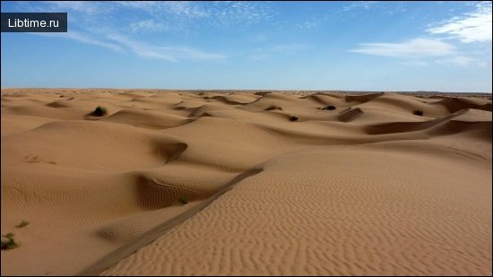
Desert navigation is hard because the terrain offers few fixed landmarks, shifting dunes, and deceptive distances. Clear air makes objects look closer than they are, so range estimation errors are common and consistent — distant features are routinely judged far nearer than reality. Cover and concealment are scarce, which historically shaped how forces moved across open ground in Africa and Afghanistan. Practical desert methods lean on the sun and stars, on the Sun Compass for daytime bearings immune to local metal, and on disciplined dead reckoning, since natural landmarks cannot be relied on. Distinctive rock formations, when they exist, become precious control points.
Navigation in Taiga and Low-Visibility Conditions
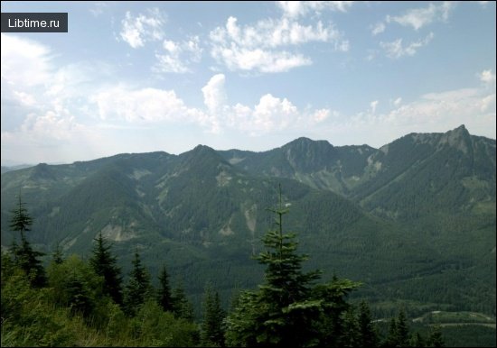
In taiga, jungle, and fog, where visibility is short and landmarks vanish, azimuth travel becomes the primary technique. Jungle terrain across Central America, the Amazon River basin, South-Eastern Asia, and parts of India presents dense canopy, limited sightlines, and a sky often hidden, so you set a bearing and pick close successive markers metre by metre. Mountain fog brings the same problem at altitude: in the Lake District, Scottish Munros, and on great peaks up to Mount Everest, cloud can drop visibility to a few metres, and dead space behind ridges hides hazards. Here weather forecasting services such as MWIS, ridges used as handrails, and careful contour interpretation keep you on line. If you lose orientation, the old rule holds: do not panic or rush. On a managed route, keep moving until you reach a road or village; on a harder trip, stop and reconnoitre, and if that fails, descend to a river and follow it to shelter.
Modern Navigation Tools
Modern electronic tools extend, but never replace, map-and-compass skill. GPS receivers, smartphone apps, altimeters, and satellite beacons add precision and a safety margin, yet each fails in predictable ways — flat batteries, lost signal, cracked screens — which is why they sit on top of traditional methods rather than instead of them.
GPS Units and Dedicated Navigational Devices
Dedicated GPS units are more rugged and reliable in the field than a phone, with longer battery life and better satellite reception under canopy. Handhelds such as the Garmin Montana 700i and powersport units like the Garmin zūmo XT2 are built for hard outdoor use. Smartphone hiking apps remain hugely useful for planning and on-trail reference — Gaia GPS, Outdooractive, PeakVisor, Google Maps, Apple Maps, and Google Earth for armchair scouting all have a place — but relying solely on app navigation is hazardous: a phone is fragile, drains fast in the cold, and depends on downloaded maps once signal disappears. Use digital and paper navigation together, treating the paper map and compass as the backup that never powers off. Communities like Moto Camp Nerd document real-world device choices for overlanders weighing these trade-offs.
Altimeter Usage in Navigation
An altimeter pins down your position on a slope by measuring height, the one coordinate GPS struggles to fix precisely. A barometric altimeter reads altitude from air pressure, so combined with a single contour line or a known bearing it can resolve exactly where you are on a ridge or in a valley. Because pressure changes with weather, recalibrate the altimeter at known-elevation points — a summit, trig pillar, or marked col — for it to stay accurate through the day.
Emergency Beacon Technology and Tracking
Emergency beacons and satellite messengers summon help and share your location where there is no phone signal. A satellite messenger such as the Garmin inReach Mini or ZOLEO is a hybrid messenger-beacon device: it sends two-way text messages and triggers an SOS to rescue coordination centres over satellite networks, with tracking that lets contacts follow your progress. National Oceanic and Atmospheric Administration systems handle distress signals from registered beacons. Two cautions apply: satellite communication is legally restricted in some countries, including India, so check local rules before you travel; and solo walkers in remote areas should always leave a route plan and expected return time with someone before setting out, because a beacon supplements, but does not replace, good safety communication.
Practicing Your Navigation Skills
Navigation is a skill that decays without practice, so the time to build it is before you need it, on ground where a mistake costs nothing. Structured wilderness survival courses and dedicated land navigation instruction — including online land navigation courses such as those from Collingwood Publications LLC — teach the fundamentals, but most learning happens through repetition in familiar terrain.
Armchair Navigation Training
Armchair navigation lets you rehearse route-reading without leaving home. Using Google Earth and a topographic map together, you can pre-plan a trip, trace contours, identify control points and attack points, and predict what the ground will look like, then verify your reading against the satellite imagery. This pre-trip planning — studying the OS map, plotting bearings, noting escape routes — is exactly the preparation that turns a vague intention into a safe, deliberate route.
Common Navigation Mistakes to Avoid
Most navigation failures come from a handful of avoidable mistakes:
- trusting one method only — always cross-check sun, compass, map, and GPS against each other;
- relying solely on a phone app until the battery dies or signal vanishes;
- ignoring magnetic declination when converting map bearings to field bearings;
- following green dashed lines on a map onto scrambling or climbing routes meant for hands, not boots;
- misjudging distance in open or desert terrain, where features look far closer than they are;
- pushing on when lost instead of stopping, calming down, and reconnoitring;
- setting out solo into remote areas without leaving a route plan and return time.
Proper orientation on the terrain, practised until it is second nature and backed by a map, a compass, and a charged beacon, is the real key to a successful trip.