Compass orienteering
Nowadays, having a smartphone or tablet, you can easily determine your location using GPS. But let's not forget that orienteering by compass is more interesting and a bit more exciting. In addition, it works almost anywhere. 
Why does the compass arrow point north?
You have certainly heard of the magnetic North Pole. It is in the direction towards it that the northern end of the magnetic hand is set. It is known that the globe is one huge magnet with poles. The magnetic force field extends around the Earth, and the magnetic force lines break out of one pole in a powerful beam, circle the Earth and join at the other pole (Fig. 1).
These lines are called magnetic meridians. Thus, a magnetic meridian passes through each point of the Earth's surface, "directing" the compass arrow one end to the north and the other end to the south. 
But knowing these two directions is not enough for compass orientation. A more accurate way to determine the direction you need is to use azimuth. You probably know how a ship in the open sea keeps the direction of its path. It follows a course pre-calculated on a map, with the help of a compass and, crossing seas and oceans, comes exactly to the appointed port.
For example, "course - 90°", "course - 220°". In the same way we use a compass on land, using instead of the word "course" the word "azimuth" (from Arabic "assumut", which means: path, road). An azimuth (magnetic azimuth) is the angle between the direction of the magnetic meridian and the direction to an object located in a given area.
Magnetic azimuths are measured in degrees from 0 to 360° and are counted from the north direction of the magnetic hand in a clockwise direction. For example, the azimuth for a single house is 300°, for a single tree is 120°, and for a mound is 60° (Figure 2). 
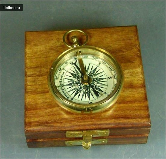
Knowing the azimuth of your way, you can move at night, in fog, blizzard or in a dense forest and go to the intended goal. To determine the direction on the ground by a given azimuth, one should face the object. By turning the lid set the pointer (yellow triangle, fixed under the glass against the fly) on the given azimuth count.
Then unclip the arrow and orient the compass, that is, align the northern end of its arrow with the zero division of the degree ring of the compass and, aiming (like aiming from a rifle), mark in the direction of the fly any object: a tree, a bush, a hillock (it is necessary to make sure that the arrow does not go from zero).
Until the skill is acquired, it is better to put the compass on some post, stump or work in two: one holds the compass, watching the position of the arrow, the other aims through the sights and notices the direction.
To practice, determine on what azimuth from your house are located school, store, movie theater, on what azimuths you go to school and return home. Once you have learned to determine the sides of the horizon and azimuths, it is very important to be able to follow the necessary direction.
When traveling, memorize the original north-south direction and constantly watch for deviations from it. For example: at first you went north, and then from the oak tree turned to the northeast, came to a large mossy boulder and from it, turning to the southeast, went on.
The "mischief" of the magnetic hand of the compass
The magnetic compass hand roughly points north and south; more precisely this direction is expressed by the noon line, i.e. the line of direction of the shortest shadow from vertically placed objects at astronomical noon (at 14 o'clock in summer and at 13 o'clock in winter).
The Earth, rotating on its axis, makes one complete revolution per day. The axis of rotation is an imaginary line passing through two opposite points of its intersection with the Earth's surface, called the poles.
The pole facing toward Polaris is called the North Geographic Pole, and the opposite pole is called the South Geographic Pole. At the geographical poles all the meridians of the Earth intersect. Consequently, a geographical meridian passes through every point on the Earth's surface, the direction of which is shown by the noon line.
The angle between the north direction of the geographic meridian passing through a given point and the direction to a local object is called the true (geographic) azimuth. The value of azimuth is counted clockwise from 0 to 360° (Figure 3). 
The magnetic poles of the Earth do not coincide with the geographic poles. Therefore, the directions of the geographic and magnetic meridians do not coincide either, but form an angle called magnetic declination, or magnetic declination. Magnetic declination does not remain constant for each location, it changes slowly within 3-8°.
During a day, the magnetic hand can move away from its average position by 1°, 5, during a thunderstorm - by 2° and more. On the territory of the USSR magnetic declination varies from +25° (in the Far North, along the shores of the Kara Sea) to -13° (Yakutia ASSR). In Moscow it is about 7°, in Kiev -4°.
It has been established that when sunspots increase on the Sun, so-called magnetic storms occur on the Earth, during which the arrow begins to fluctuate irregularly. In some places on the globe, it suddenly deviates sharply to the side.
This indicates that in this place in the bowels of the Earth are large deposits of magnetic ironstone, the attraction of which overpowers the magnetic force lines of the permanent magnetic field of the Earth. Such a phenomenon is called a magnetic anomaly. As you can see, orienting by compass in some situations can show the wrong route.
The largest magnetic anomaly on the globe is located in the Kursk region. Here in a number of places the declination of the magnetic arrow changes by 130-170° within one or two kilometers! Krivorozhskaya anomalous zone, anomaly zone from Odessa to Vinnitsa with a width of 50 to 100 kilometers and a length of about 400 kilometers; anomalies on the Kola Peninsula, in the Urals, the Far East, etc. are also known.
A compass in places of magnetic anomalies can certainly not be used. Such a curious fact (now firmly established) as the displacement of the magnetic poles also affects the change of magnetic declination. For six years (from 1948 to 1954) the North Magnetic Pole shifted to the north and approached the geographic pole by almost one and a half hundred kilometers.
With an average speed of 2 meters per hour "drifts" the South magnetic pole on Antarctica. As observations of magnetologists showed, the general direction of the pole movement is north-west - from the Victoria Land to the Adelie Land. For the last fifty years the South magnetic pole has moved already on 800 km.
According to calculations of geophysicists, in the nearest years the South magnetic pole will leave Antarctica and will take a place in the Indian Ocean, and in 200 years will appear on the new Continent - in the south of Africa. This general direction of movement of the pole is confirmed by the recently observed strengthening of the so-called South African anomaly.
There is a place on the Earth between the magnetic pole of the northern hemisphere and the Northern geographical pole, where the magnetic hand cannot be trusted at all, as it under the action of the Earth's magnetism its northern end points to the south, and the southern end - to the north.
Compass Orienteering and the Story of Captain Hatteras
Captain Hatteras, the hero of Jules Verne's famous novel "The Adventures of Captain Hatteras" (1866), devoted all his thoughts, all his life to one dream - to reach the North Pole. At the North Pole there is only one side of the horizon - south.
Therefore it is possible to approach it only from the south, both ends of the magnetic arrow will point only to the south. Whatever side the wind blows from, it will always be south at the North Pole. So, let's mentally trace part of the journey of Jules Verne's heroes.
Brave Captain Gatteras on the ship "Forward" far behind left the waters of Baffin Bay (Baffin Sea) and, trusting the arrow of the compass, led the ship strictly to the west. Easily maneuvering among small ice floes in Lancaster Strait between the islands of Baffin's Land, Somerset and Dondas Harbor (Devon), the ship came to the meridian of 96° west longitude (Fig. 4).
Here a course was set strictly northward towards the Pole. 
The helmsman followed the direction of the north end of the magnetic compass hand. When the sky cleared up and the sun appeared, the captain of the ship used it to check the course and, to his amazement, found that the ship was going with an error of 180° southward to the coast of the Butia peninsula.
At the time of Gatteras' voyage, the place where the magnetic arrow pointed south at its northern end and north at its southern end had a coordinate of 96° west longitude. It is often heard that the magnetic pole is close to the North Geographic Pole. Are these two poles really such close neighbors? If we were told, for example, that Simferopol is close to Moscow, we would take it as a joke.
After all, there are approximately 1600 kilometers between them. However, the distance between the North Geographic Pole and the North Magnetic Pole is much greater. And at the moment it is 2230 kilometers. We say "at the present moment", because the position of the magnetic poles is constantly changing.
In 1831 coordinates of the North magnetic pole were: 70°05′ north latitude and 96°53′ west longitude, and the South magnetic pole in 1841 on definition of Jems Ross was on 73° south latitude and 150° east longitude. According to data obtained by Amundsen in 1903, the North Magnetic Pole was at 70°30′ west longitude, that is, on the Butia Peninsula in North America.
Nowadays the North Magnetic Pole is located on one of the islands of the Canadian Arctic Archipelago - on the Prince of Wales Land and has such geographical coordinates: 74° North latitude and 100° West longitude, and the South Magnetic Pole is located on the coast of Antarctica on the King George V Coast (68° South latitude and 143° East longitude).
Thus, the compass arrow with its northern end (usually blue in color) does not always point accurately north. It should also be remembered that when determining the sides of the horizon by compass and when moving along azimuths calculated directly on the ground, magnetic declination, if it is not anomalous, does not affect the accuracy of orientation.
The data for moving along azimuths prepared on a topographic map are used differently. Here it is necessary to take into account magnetic declination exceeding 3°. At the same time it is necessary to learn to find the "natural" north. Nature itself will tell you how the sides of the horizon are located. We hope that orienteering with a compass will be easier now that you have learned some of the secrets of this device.
Read also: orienteering in the forest.


