Turanian Speleological Country: Karst Caves of the Ustyurt and Mangyshlak Plateaus
 libre
libre
The Turan speleological country spans the plains and flat plateaus of Central Asia, and its richest concentration of caves lies in the Ustyurt-Mangyshlak karst area. This karst area is divided into two speleological provinces — Mangyshlak and Ustyurt — each defined by karst cavities dissolved into the Neogene limestones and gypsums that underlie the region. For the wider framework that places these provinces within the global cave taxonomy, see the Speleological classification of caves.
Where is the Turan speleological country?
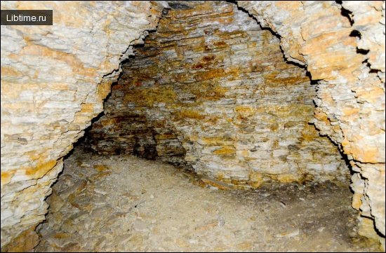
The Turan speleological country occupies the low plains and tablelands of Central Asia, west of the great mountain belts. Unlike alpine karst, where caves form in folded mountain limestone, the caves here develop in flat-lying sedimentary rocks — chiefly Neogene limestones and gypsums — beneath plateaus such as Mangyshlak and Ustyurt. The flatness of the terrain and the solubility of gypsum give the region a distinctive style of shallow, horizontally branching cavities.

What characterises the Mangyshlak speleological province?
The Mangyshlak province, which includes the South Mangyshlak plateau, is marked by a significant spread of underground karst cavities in Neogene limestones and gypsums. Eighteen caves have been explored within the province to date. Their development in soluble Sarmatian limestones and gypsum beds produces grottoes and short horizontal passages rather than the deep vertical systems typical of mountain karst.
The Omarata cave
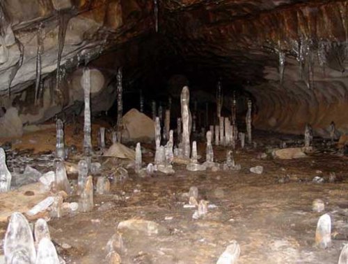
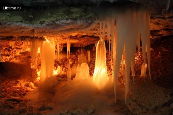
The Omarata cave is the largest in the Mangyshlak province, measuring 342 metres in length. It lies on the Caspian Sea coast near the Bekdash rock and was formed in Sarmatian limestones.
Omarata begins with a well-shaped entrance that drops to a small grotto at a depth of about 6 metres. From this grotto several horizontal passages branch outward. The explored part of the cave contains nine grottoes, the largest reaching up to 2 metres high, 13 metres long and 3 metres wide.
What characterises the Ustyurt speleological province?
The Ustyurt speleological province covers the Ustyurt plateau, which is bounded on every side by steep escarpments known as chinks. Surveyors have identified 52 caves within the province, all confined to Neogene limestones and gypsums. The two largest are the Sarykamysh cave and the Utebay cave.
Sarykamysh cave
The Sarykamysh cave is a through-cave linking two karst basins, with a total length of 200 metres. It opens into a large grotto set at a depth of 42–44 metres, measuring roughly 120 metres long, 25 metres wide and 8 metres high. The grotto ceilings are vaulted and uneven, while the floor is strewn with rock fragments fallen from above.
Utebay cave
The Utebay cave begins at the bottom of a large karst sinkhole about 22 metres deep. In its near part the cave takes the form of an inclined pipe that, at a depth of 56 metres, opens into a horizontal cavity 52 metres long, 20 metres wide and up to 3 metres high.
The far part of the Utebay cave holds two ponors shaped like small sinkholes, each up to 2 metres in diameter and depth. These ponors pass downward into cracks that swallow the rain and snowmelt draining into the cave from a wide surrounding area, making the cave an active hydrological sink.
What are the deepest karst features in the region?
Among the karst mines of the Turan country, the Boloyuk mine is the most notable, reaching a depth of 120 metres. At its bottom lies a large grotto, most of which is filled by a lake up to 5 metres deep. Vertical features like this contrast sharply with the shallow horizontal caves of Mangyshlak and show how varied the karst can be even within a single speleological country. For a comparable single-cave profile, see also the Red Cave.
Caves of the Turan country at a glance
| Cave / feature | Province | Key measurement |
|---|---|---|
| Omarata cave | Mangyshlak | 342 m long |
| Sarykamysh cave | Ustyurt | 200 m long |
| Utebay cave | Ustyurt | 100 m long |
| Boloyuk mine | Ustyurt-Mangyshlak karst area | 120 m deep |
Taken together, the Mangyshlak and Ustyurt provinces show how flat-lying Neogene limestones and gypsums shape the caves of the Turan speleological country: shallow entrances, branching grottoes, ponors that drain surface water, and the occasional deep mine that ends in an underground lake.