What Is Subantarctica: Location, Climate, and Temperature of This Southern Ocean Zone
 libre
libre
Subantarctica is a broad belt of ocean studded with small areas of land, whose southern edge runs almost against the coast of Antarctica (the Antarctic Front) and whose northern edge lies around 50–52° south latitude (the Polar Front). In short, Subantarctica is the cold transitional ring of the Southern Ocean that separates Antarctica from the temperate latitudes of the southern continents.

What is Subantarctica?
Subantarctica is the climatic and oceanographic zone surrounding Antarctica, distinguished from the polar continent itself by milder, ocean-dominated conditions and by the presence of vegetated islands rather than permanent ice sheets. The term is often used loosely, but it does not describe the entire stretch of ocean reaching from the Antarctic coast almost to the southern tips of Africa, South America and Australia. Subantarctica is more precisely a defined band framed by two oceanic fronts, where surface waters cool sharply on their way south toward the Antarctic Convergence.
The defining feature of Subantarctica is the meeting of water masses. Cold polar water sinks beneath warmer subtropical water along a series of fronts, producing the distinctive temperature, salinity and biological boundaries that set the region apart. This land-sea interface — small islands embedded in a vast, productive ocean — is what gives Subantarctica its character, from its weather to its wildlife.
Defining the Subantarctic Zone
The Subantarctic Zone is the part of the Southern Ocean lying between the Subtropical Front to the north and the Antarctic Polar Front to the south. Within this framework, the southern hemisphere's temperate belt is roughly 2,000 km wide, but its exact area has never been precisely calculated. The area enclosed by the +10° isotherm of the warmest month was estimated by G. Kozak at 67.8 million km²; subtracting the area of Antarctica (23.4 million km²) leaves about 44.4 million km² — approximately the size of Asia. Because the temperate zone extends north beyond the annual +10° isotherm, its true area is considerably larger than 44.4 million km².
Geographic Boundaries: Antarctic and Polar Fronts
The geographic boundaries of Subantarctica are marked by oceanic fronts rather than coastlines. The northern limit is the Subtropical Front (also called the Subtropical Convergence), while the southern limit is the Antarctic Polar Front, sometimes called the Subantarctic Front where the surface gradient is sharpest. Between these lies the Polar Frontal Zone, a transitional band of mixing water masses. This frontal system, not any line of land, is what scientifically distinguishes the Subantarctic from both the subtropics to the north and Antarctica to the south.
The Antarctic Convergence and Its Significance
The Antarctic Convergence is the zone where cold, northward-flowing Antarctic surface water sinks beneath warmer subantarctic water, forming a natural biological and thermal boundary around the entire continent. Crossing the Antarctic Convergence brings an abrupt drop in sea-surface temperature, a change in salinity, and a shift in the species that live on either side. The Antarctic Convergence is significant because it effectively isolates the Antarctic marine ecosystem, concentrates nutrients, and underpins the extraordinary productivity of subantarctic waters — the foundation for the krill, fish, seabirds and whales of the region.
Area and Extent of the Subantarctic Region
The Subantarctic region covers tens of millions of square kilometres of ocean but only a tiny fraction of land. Within the temperate zone of the southern hemisphere, the only land masses are a narrow extension of South America, part of New Zealand's South Island, a negligible sliver of Tasmania, and a scattering of small islands totalling just 14,100 km². The contrast is stark: this is a hemisphere of water, where the great frontal zones and not the continents govern climate and biology.
The Antarctic Circumpolar Current
The Antarctic Circumpolar Current is the world's largest ocean current, flowing clockwise around Antarctica and connecting the Atlantic, Pacific and Indian Oceans through the Southern Ocean. Driven by the relentless westerly winds of the high southern latitudes, the Antarctic Circumpolar Current keeps warm subtropical water from reaching the continent and so helps maintain Antarctica's deep cold. Its flow shapes the position of the fronts that define Subantarctica and feeds the thermohaline circulation, the global "conveyor belt" of deep ocean water.
Climate of Subantarctica
The climate of Subantarctica is cold, wet, windy and strongly oceanic, with small temperature swings between seasons. The temperate zone of the southern hemisphere resembles its northern counterpart in atmospheric circulation, but differs sharply in its low temperatures and the dominance of the ocean. Two influences combine to make it so cool: the chilling effect of Antarctica's ice and the overwhelming amount of ocean rather than land at these latitudes.
Temperature Characteristics
The temperatures of Subantarctica are driven down by the ice of Antarctica, which cools not only the polar region but the entire southern temperate zone. Powerful cold currents off Africa, South America and Australia run northward from Antarctica and push even the thermal equator into the northern hemisphere. The sharp difference in temperature at high latitudes between the two hemispheres can be illustrated by the following figures from E. S. Rubinstein.
| Northern hemisphere | Southern hemisphere | ||
| July (summer) (°C) | geogr. latitude | January (summer) (°C) | difference (°C) |
| +27.6 | 30° | +22.9 | 4.7 |
| +23.2 | 40° | +16.1 | 7.1 |
| +17.0 | 50° | +8.8 | 8.2 |
| +13.4 | 60° | +2.1 | 11.3 |
| +7.4 | 70° | -3.4 | 10.8 |
The temperate zone of the southern hemisphere is colder than that of the northern hemisphere at midsummer by about 7–8° for equivalent latitudes. Approaching the main cooling source — Antarctica, in the subantarctic and antarctic zones — this difference grows to 11° and more.

The scale of this is easy to picture: the latitude of the coast of Enderby Land in Antarctica is close to that of Kandalaksha in the northern hemisphere, while the northern-hemisphere latitudinal equivalents of the southern and northern boundaries of the southern temperate zone are the latitudes of Kiev and Baku. Yet the general cooling effect of Antarctic ice is not the only cause of the chill in the southern temperate zone.
Comparison with the Northern Hemisphere
The second reason for the cool summers is the oceanic nature of the southern hemisphere. Oceanic climates of the temperate latitudes are marked by comparatively low summer temperatures and comparatively mild winters. On the same calculations by E. S. Rubinstein, winter in the southern hemisphere at the fiftieth parallel is 11.3° warmer than winter in the northern hemisphere. To gauge how far the mild southern winter is a consequence of that oceanic dominance, the proportion of land at different latitudes is telling.
Percentage of land area at various latitudes:
| Northern hemisphere | Geographic latitude | Southern hemisphere |
| 43.5 | 30° | 20 |
| 45 | 40° | 4 |
| 58 | 50° | 2 |
| 61 | 60° | 0 |
| 53 | 70° | 71 |
These figures speak for themselves, especially in the temperate zones of both hemispheres, which lie mainly between 40 and 60° latitude. In the southern hemisphere there is only a narrow promontory of South America, part of New Zealand's South Island, a tiny portion of Tasmania, and small island areas (just 14,100 km²) compared with the vastness of ocean.
Oceanic Influence on Climate
The oceanic dominance of the southern hemisphere can even reverse what latitude alone would suggest. Summer on the Kerguelen Islands, far from any large landmass, is colder than on the Falkland Islands, which sit close to South America. According to K. Vallaux (General Geography of the Seas, 1948, p. 79), midsummer temperature on the Falkland Islands is +8.9° and on Kerguelen +6.2°, even though Kerguelen lies somewhat farther north.
The Kerguelen Islands are in a certain sense more oceanic than the Falklands,
wrote Vallaux. By contrast, Antarctica itself has no maritime climate at all: it is a continental glacial climate. Antarctica is the coldest region on Earth, colder than the Arctic in both summer and winter.

Weather Patterns and Seasonal Variation
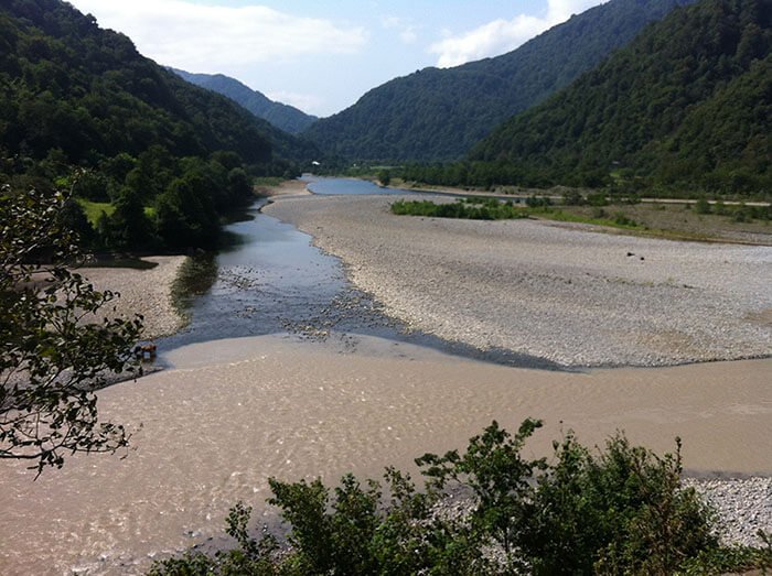
The weather of Subantarctica is defined by ferocious westerly winds, abundant precipitation and small annual and daily temperature ranges. Mariners named the latitudinal wind belts the Roaring Forties, the Furious Fifties and the Shrieking Sixties for the increasing violence of the winds toward the pole. The oceanic climate of the Southern Ocean islands shows itself in this combination of muted temperature swings and persistent rain, with conditions changing rapidly through a single day rather than across distinct seasons.
These same conditions produce a distinctive form of slope movement known as solifluction — literally "soil flow." The term and concept were born in the southern temperate zone after studies on the Falkland Islands by Andersson, a member of the Swedish South Polar Expedition. On rock surfaces kept constantly wet by rain, fragments of stone creep downhill to form "stone runs."

Long before Andersson, Charles Darwin described these stone runs on the Falklands, and before him A.-J. Pernety. Darwin wrote:
In many parts of the island the bottoms of the valleys are singularly covered by myriads of separate large angular fragments of quartzite, forming stone runs. All travellers from Pernety onward mention them with astonishment. The stones are not water-worn — their angles are only slightly blunted... They are not heaped in irregular piles, but distributed in even layers or vast streams. Their thickness cannot be determined, but at a depth of many feet beneath the surface the water of small rivulets can be heard trickling between the stones.
Darwin then quotes the old traveller Antoine-Joseph Pernety, who sailed with Captain Bougainville in 1763:
We were no less seized with amazement at the sight of a countless multitude of stones of all sizes, heaped one upon another and yet arranged as though carelessly thrown down to fill the hollows. One never ceases to marvel at the wonderful works of nature!
Solifluction is a process characteristic of the land throughout the southern temperate zone; it was recorded by the Drygalski expedition on the Kerguelen Islands. On Macquarie Island, "wet" chemical weathering has produced an accumulation of iron (more on this: Ferrous and non-ferrous metals and their ores) in the lower part of soil profiles, indicating leaching of iron and the formation of an illuvial ferruginous horizon — though the "dry" chemical weathering seen on the rocks of Antarctica is entirely absent here.
Subantarctica vs. Antarctica
The difference between Subantarctica and Antarctica is fundamentally one of ice versus ocean: Subantarctica is a maritime zone of vegetated islands and open water, while Antarctica is a continent buried under a continental glacial ice sheet. In winter, Subantarctica is almost as cold as the Subarctic, but Antarctica as a whole is far colder still. The distinction also runs through the very definition of "Antarctica": politically it is often taken as everything south of the 60th parallel under the Antarctic Treaty, while scientifically it is bounded by the Antarctic Convergence, which lies farther north and encloses much of the subantarctic ocean.
Climate and Physical Differences
The physical contrast between the two regions is dramatic. Antarctica is a high, ice-capped continent with a dry, continental climate and almost no vegetation, whereas the Subantarctic islands are low, wet and green, supporting tussock grasslands, megaherbs and, in places, southern forests. Antarctica's rock weathering is dominated by "dry" chemical and physical processes; the Subantarctic is dominated by "wet" weathering, solifluction and constant moisture. The following points summarise the core differences:
- Ice cover: Antarctica is permanently glaciated; Subantarctic islands carry only small glaciers and snowfields.
- Climate type: continental glacial on Antarctica versus cool oceanic in Subantarctica.
- Vegetation: virtually none on Antarctica; tussock, megaherbs and forest on subantarctic land.
- Wildlife: both host penguins, seals and seabirds, but Subantarctic islands hold far richer breeding land fauna and flora.
- Boundary: Antarctica is defined politically by the 60th parallel south and scientifically by the Antarctic Convergence.
Geography of Subantarctica
The geography of Subantarctica is one of scattered island groups ringing the Southern Ocean, separated by thousands of kilometres of open water and shaped by volcanism, glaciation and isolation. These islands fall into several clusters: the New Zealand Sub-Antarctic Islands, the islands of the South Atlantic and Scotia Sea, and the islands of the southern Indian Ocean. Many are volcanic in origin, some rest on fragments of continental crust, and almost all are managed as nature reserves because of their extreme remoteness and fragility.
Main Subantarctic Islands
The main Subantarctic Islands span every sector of the Southern Ocean. The principal groups include:
- New Zealand's subantarctic islands — the Auckland Islands, Campbell Island, Antipodes Islands, Bounty Islands and The Snares, administered by the Department of Conservation as National Nature Reserves.
- South Atlantic and Scotia Sea — South Georgia and the South Sandwich Islands, the Falkland Islands, Elephant Island and Bouvetøya.
- Southern Indian Ocean — the Kerguelen Islands, the Crozet Islands (Illes Crozet), the Prince Edward Islands, and Heard Island and McDonald Islands.
- Australian sector — Macquarie Island, managed by the Australian government.
South Georgia is the largest and most spectacular of the South Atlantic islands, rising in glaciated peaks above the Scotia Sea, with the abandoned whaling station of Grytviken and the research base at King Edward Point bearing witness to its history. The Snares, by contrast, are famed as one of the most pristine wildernesses on Earth, holding a density of breeding seabirds said to exceed that of all the British Isles combined.
Auckland Islands and Bouvetøya
The Auckland Islands are the largest of New Zealand's subantarctic groups, a chain of volcanic islands carved by glaciation and notorious for shipwrecks and failed colonial ventures, including Charles Enderby's short-lived 19th-century settlement at the main Auckland Island. Bouvetøya, by contrast, is the most isolated island on the planet — a tiny, ice-capped volcanic cone in the South Atlantic, hundreds of kilometres from any other land, first sighted in the early 18th century and almost entirely covered by glacier. Together they bracket the range of subantarctic land, from relatively accessible and historically settled to utterly remote and uninhabited.
Antarctic Peninsula and Surrounding Lands
The Antarctic Peninsula is the long, mountainous arm of Antarctica reaching north toward South America across the Drake Passage, flanked by the Weddell Sea to the east and the Scotia Sea to the north. Off its tip lies Elephant Island, where the men of Sir Ernest Shackleton's Endurance Expedition were marooned in 1916. Frank Wild held the stranded party together on Elephant Island while Ernest Shackleton crossed 1,300 km of the Southern Ocean to South Georgia to fetch rescue — one of the defining feats of polar exploration. The peninsula and its surrounding waters mark the transition between the truly Antarctic and the subantarctic worlds.
Climate and Vegetation Differences Among Regions
Climate and vegetation vary widely among the Subantarctic regions because of differences in latitude, ocean currents and rainfall. The warmer, more northerly islands such as the Falkland Islands and the New Zealand groups support lush tussock grasslands, giant megaherbs and even forest — Campbell Island and the Auckland Islands carry stands dominated by southern rātā (Metrosideros umbellata) and dense fields of megaherbs such as Stilbocarpa polaris. The colder, higher-latitude islands like the South Sandwich Islands and Heard Island are largely ice-bound, with vegetation reduced to mosses, lichens and a handful of hardy plants. This gradient of green-to-glacier mirrors the position of each island relative to the Antarctic Convergence.
Wildlife and Biodiversity
The wildlife of Subantarctica is globally important: the cold, nutrient-rich waters fuel vast colonies of seabirds, penguins, seals and whales, while isolation has produced remarkable endemic species found nowhere else. The land-sea interface is central — the ocean's productivity, built on Antarctic krill and other plankton, feeds the breeding millions ashore. Because so many islands have remained free of human settlement, they preserve some of the most intact ecosystems on the planet, though invasive species introduced in past centuries remain a serious conservation challenge.
Endemic Species of the Subantarctic
Endemic species are the hallmark of the Subantarctic, with each island group evolving its own distinctive birds and plants in isolation. Among the notable endemics are the Snares crested penguin (Eudyptes robustus), confined to The Snares; the yellow-eyed penguin (Megadyptes antipodes); the Bounty Island shag of the Bounty Islands; and the New Zealand sea lion (Phocarctos hookeri), whose main breeding grounds lie on the Auckland Islands. Endemic megaherbs such as Stilbocarpa polaris and the towering southern rātā (Metrosideros umbellata) give the New Zealand groups a flora unlike anywhere else, making these islands a living laboratory of evolutionary adaptation.
Marine Mammal Populations
Marine mammal populations in Subantarctica are among the densest on Earth, recovering strongly since the end of the whaling and sealing eras. South Georgia alone supports millions of Antarctic fur seals and enormous breeding colonies of the southern elephant seal (the largest of all seals), while the New Zealand sea lion breeds in the New Zealand groups. The surrounding seas are feeding grounds for whales drawn by abundant krill, including the southern right whale, which gathers in subantarctic waters to breed. These populations are a direct measure of how the region's marine productivity sustains life across the Southern Ocean.
Penguins and Breeding Rookeries
Penguins are the signature wildlife of Subantarctica, breeding in immense rookeries on almost every island group. The king penguin forms spectacular colonies hundreds of thousands strong on South Georgia, the Crozet Islands (Illes Crozet) and the Kerguelen Islands, with the Crozet group hosting one of the largest king penguin populations in the world. Other species crowd the rookeries too — Snares crested penguins on The Snares, gentoo and macaroni penguins across the South Atlantic islands — alongside seabirds such as the wandering albatross (Diomedea), the royal albatross (Diomedea epomophora) and the sooty shearwater (Puffinus griseus), which migrates between hemispheres each year.

Conservation and World Heritage Status
Conservation is central to how Subantarctica is managed, and several island groups carry the highest level of international protection. The New Zealand Sub-Antarctic Islands were inscribed on the UNESCO World Heritage List by the UNESCO World Heritage Committee for their outstanding biodiversity, high endemism and importance to seabirds and marine mammals. They are administered by the New Zealand government's Department of Conservation as National Nature Reserves, with strict limits on access, quarantine measures against invasive species, and ongoing eradication programmes. Wider conservation efforts in the Southern Ocean focus on marine reserves, reducing fishing bycatch, sustainable fisheries practices, and tackling plastic pollution that drifts even to these remote shores.
The Antarctic Treaty and the 60th Parallel South
The Antarctic Treaty governs all land and ice shelves south of the 60th parallel south, setting the region aside for peace and science and prohibiting military activity and mineral exploitation. This political boundary at 60° south differs from the scientific definition of Antarctica, which follows the Antarctic Convergence farther north. As a result, many subantarctic islands lie outside the Antarctic Treaty area and remain under the sovereignty of individual nations — the Falkland Islands and South Georgia under British administration, Macquarie Island under the Australian government, and the New Zealand groups under the New Zealand government — each applying its own protective legislation.
Visiting Subantarctica
Visiting Subantarctica means joining a small-ship expedition cruise, as there are no commercial flights or hotels on these remote islands and access is tightly regulated to protect their fragile ecosystems. Voyages typically depart from southern ports such as those in Southland, New Zealand, or from South America for the South Atlantic islands, and run during the austral summer when wildlife breeding is at its peak. Costs are high — reflecting the remoteness, the ice-strengthened vessels required, and strict passenger limits ashore — and many trips combine subantarctic islands with the Antarctic Peninsula. Operators such as CHIMU run itineraries through these regions, and travellers are well advised to read destination reviews and recommendations before booking.
Voyage Routes and Accessibility
Voyage routes through Subantarctica are shaped by geography and weather, crossing some of the roughest seas on Earth. Common itineraries include:
- The New Zealand subantarctic route, sailing south from Southland to The Snares, Auckland Islands, Campbell Island and sometimes Macquarie Island.
- The South Atlantic route, linking the Falkland Islands, South Georgia and the South Sandwich Islands, often continuing to the Antarctic Peninsula.
- The Drake Passage crossing between South America and the Antarctic Peninsula, frequently combined with subantarctic island stops.
Accessibility is genuinely limited: landings depend on weather and sea state, numbers ashore are capped, and visitors must follow strict biosecurity rules to avoid introducing invasive species to islands that are, in many cases, National Nature Reserves and World Heritage sites.
Adventure Activities
Adventure in Subantarctica centres on wildlife rather than thrill-seeking, though the landscapes are dramatic. The main activities are:
- Wildlife viewing — king penguin and other penguin colonies, fur seal and elephant seal haul-outs, and albatross breeding grounds.
- Photography and birding — the high seabird densities of The Snares and the megaherb meadows of Campbell Island are world-renowned.
- Whale and marine encounters — southern right whales and other cetaceans frequent these productive waters.
- Historical and cultural sites — the whaling station at Grytviken and Ernest Shackleton's grave on South Georgia, and the shipwreck and settlement relics of the Auckland Islands.
- Zodiac cruising and guided shore walks through tussock grasslands and southern forests.
Frequently Asked Questions
Subantarctica raises a number of recurring questions, the most common being how it differs from Antarctica. In short, Subantarctica is the cold, oceanic ring of islands and water between the Subtropical Front and the Antarctic Convergence, while Antarctica is the glaciated continent farther south. The Subantarctic is greener, wetter and richer in breeding land wildlife; Antarctica is colder, drier and locked in continental ice. For broader reading on travel, nature and science topics, explore the Nature and Travel sections.