How Sea Waves Erode Coastlines: The Destructive Power of Water
 libre
libre
The destructive work of water is especially visible along rocky sea coasts. By undercutting the shore and grinding down stone, the sea, over many thousands of years of its labour, produces significant changes in the coastline: it invades the mainland, forming bays and gulfs and cutting off numerous islands.
The destructive work of water: an overview
Water ranks among the most relentless natural forces shaping the Earth's surface, and its destructive power touches both natural landscapes and human structures. The sea grinds coastlines, rivers carve canyons, groundwater dissolves whole caverns, and floods can erase settlements in a single night. Understanding how water erodes, transports, and deposits material — and how communities have learned to defend against it — explains much of the world we live in and why modern flood forecasting and protective engineering matter so much.
This article traces water's destructive action from the pounding of sea waves on cliffs, through the slow collapse of high coasts, the historic struggle of the Netherlands against the North Sea, the violence of rivers and flash floods, and on to flood safety and the ways people now monitor and respond to the threat. Many of these same principles apply at a smaller scale to every building: water is the chief enemy of any roof, and the strategies for keeping water out of a home echo the larger battle against the sea.
The force of the sea wave
Anyone who has bathed in the sea knows from bitter experience how a breaking wave knocks you off your feet. The same energy, multiplied over centuries, is what reshapes entire shorelines.
Pressure and the physics of the sea wave
According to engineering calculations, the pressure of a wave in a severe storm can reach 30,000 kilograms per square metre. It is therefore no surprise that in strong storms waves sometimes overturn the huge concrete blocks of breakwaters that shield harbours from the raging sea. And such a "pebble" weighs more than a hundred tonnes! The storm-tossed sea hurls ashore, like wood chips, sailing vessels of several hundred tonnes. This same physical principle — water's enormous weight and momentum — explains why standing water and flowing water are both so destructive to buildings, and why even a few centimetres of pooled water on a flat roof imposes a serious structural load.
The Black Sea during a storm
The Black Sea during a storm is a majestic sight, when the enraged waves rush at the coastal cliffs somewhere near Simeiz. Foaming and seething, the huge breakers crash thunderously against the shoreline rocks, drenching them in a veil of spray as white and dense as the cumulus clouds in a blue sky.
The work of the sea on a high coast
The sea leaves traces of terrible devastation after floods on low-lying shores, but the results of the sea's work on a high coast are even more striking.
The formation of grottoes, caves and collapses
The sea hollows out not only mysterious grottoes but even whole caves, and by undermining steep banks it promotes their constant collapse. The process is cumulative: waves remove material at the base of a cliff, the unsupported rock above eventually falls, and the cycle repeats, steadily eating the coast back from the water. The same undercutting-and-collapse mechanism that destroys cliffs is what carves caverns and groynes along any exposed shore.
The Karadag Gates — a monument to the sea's work
The Karadag Gates in Crimea stand as one of the most expressive natural records of marine erosion, an arch sculpted purely by the patient assault of waves on volcanic rock. Such arches form where the sea exploits weaknesses in a headland, widening a sea cave until it breaks clean through.
The excavations of Chersonesus as evidence of centuries of the sea's work
Near Sevastopol, on the Chersonesus headland, interesting excavations are carried out of the ancient Greek colony of Chersonesus (in Greek, "chersonesos" means peninsula), founded as early as the 5th century BC. On the very shore of the sea, the remains of an ancient Greek temple were discovered, later converted into a Christian one. The altar part of the temple, together with the shore, collapsed into the sea long ago.
It is impossible to suppose that the ancient builders erected the temple directly above the very edge of a precipice: here we see the traces of the sea's work over almost two and a half thousand years.
The treacherous North Sea
The destructive work of water can be told through the example of the North Sea. Its waves reach such a height and force against the rocky coasts of Scotland that they sometimes shatter, with stones they have snatched up, the glass of lighthouses at a height of up to 80 metres above sea level.
The islands of Heligoland and Düne: disappearing land
Another convincing example is even more striking. In the eastern part of the North Sea, only on large-scale maps can one find two tiny islets — Heligoland and Düne. This is all that remains, over roughly a thousand years, of a once large and flourishing island with many settlements.
The process of Heligoland's destruction is going so fast that, perhaps within a century or two, no trace of it will remain. As recently as 1720, the islands of Heligoland and Düne formed a single whole, as is easy to conclude from the shoals that connect them.
The destructive work of water on a flat coast
The sea also produces no small destruction on a flat coast, especially in areas of slow subsidence of separate sections of the Earth's crust, for example on the south-eastern shore of the North Sea. For many centuries the industrious Dutch people have waged a stubborn struggle against the treacherous North Sea, fencing themselves off with mighty dikes from its sudden invasions.
The Netherlands' struggle with the sea: dikes and dams
This struggle demands constant attention, since roughly a quarter of the country lies below sea level and almost half is level with it. Hence the country's second geographical name — the Netherlands, which translates as "low-lying land". Floods threaten enormous disasters to a country that ranks second (after Belgium) in Europe by population density. The Dutch must always be on guard. In the most threatened places up to six rows of dikes have been built, reaching 10 metres in height and 50–100 metres in width.
Throughout the history of the Netherlands, especially in the Middle Ages, the sea repeatedly invaded deep into the country, causing terrible devastation and claiming hundreds of thousands of human lives.
At the beginning of our era, the map of the Netherlands, according to the records of the Roman conquerors, was entirely different: the north-western coast (until the second half of the 13th century) was defined by a continuous coastline running along the then non-existent Frisian Islands. South of this coastline of high sand dunes stretched a low-lying plain with the shallow Lake Flevo, surrounded by impassable swampy forests.
Two arms of the Lower Rhine flowed into the lake. A wide channel connected Lake Flevo with the sea. Centuries passed... And then, after a series of especially strong catastrophic floods, the coastal dune zone was broken up into the chain of Frisian Islands. Behind them, on the site of the low-lying plain, spread the surface of the newborn Zuiderzee gulf (that is, the Southern Sea) with an area of over 5,000 square kilometres.
The scale of the disaster can be judged from the fact that the raging sea, having destroyed the ancient dikes, flooded 72 settlements in a single night in 1285. A huge number of victims is also recorded in connection with the flood of 1421. The flood of 1570 was even stronger: the largest centres of the country — Amsterdam, Rotterdam and other cities — went under water, and about 400,000 people perished.
As technology developed, people fought the sea's element more successfully, yet floods, though with fewer human victims, still recur.
The Icelandic cyclone of 1953
Particularly large material losses were caused by the flood in the coastal regions of the North Sea in Holland, Belgium and England at the beginning of February 1953. The cause of these disasters lies in destructive winds. Strong winds blowing for a long time in one direction drive masses of water towards the shore. It is precisely they that create insurmountable water barriers at the mouths of rivers flowing into the sea.
The rivers halt their flow, overflow with water and begin to burst their banks. The sea rushes up the river channels, breaks through the dikes and invades the land. So it was in those terrible February days of 1953 on the southern and south-western coast of the North Sea. As early as the end of January a powerful cyclone arose in the region of Iceland — a rotating vortex hundreds of kilometres across.
The wind speed of the Icelandic cyclone reached 126 kilometres per hour! This hurricane drove the surface waters of the North Sea towards the shores of the Netherlands, Belgium and England. The disaster reached exceptional proportions on the territory of the Netherlands. Having breached the coastal dikes, the raging sea poured onto the land. In a number of places the water penetrated 65 kilometres into the interior of the country, flooding on its way a series of cities, including the largest centres.
The powerful flow of water carried off wooden buildings like chips of wood, destroyed factories and works, and washed away railway track. Rotterdam suffered especially — the second largest city of the country by population (over 600,000 people). Exceptional danger, moreover, was posed by the oil that gushed over the city from huge oil reservoirs overturned by the all-destroying torrent.
Summing up this disaster, it must be noted that in the Netherlands alone about a million people suffered material damage to a greater or lesser degree. 50,000 people lost their homes and all their acquired property, and 2,000 people perished in the depths of the raging element. The total loss is estimated at an enormous sum — over three billion roubles (in gold).
Besides the direct losses from the flood, one must also reckon with the enormous indirect damage that the salinisation of the soil, the washing away of its fertile layer, and the burial of arable land under sand caused agriculture for many years. The technically helpless person of the past fenced himself off from the sea with generally unreliable dikes.
Unable to withstand the onslaught of the waves, these dikes opened the way to the sea, which carried off hundreds of thousands of human lives and caused enormous material losses. Now, on the contrary, having secured themselves with reliable dike protection, the Dutch are advancing on the sea precisely in that area which was torn from the Dutch people roughly seven centuries ago.
Work on draining the Zuiderzee began in 1918. This enterprise of great national importance was based on the precise calculations of economists. During the First World War the Netherlands sold agricultural products to the warring countries at inflated prices. The land brought its owners enormous incomes, and its value correspondingly rose sharply.
It was initially assumed that the drainage works would be finished in 32 years, and that the low-lying plots of fertile land reclaimed from the sea (in Dutch, polders) would repay all costs with a profit. However, owing to the crisis in industry and agriculture, land prices fell considerably.
Draining the Zuiderzee no longer promised such colossal profit. The works were suspended and continued thereafter with great interruptions. Then came the Second World War. Nevertheless, after 40 years a reliable closing dam was built, over 100 metres wide and 30 kilometres long. It separated the sea from the Zuiderzee, which came to be called Lake IJssel.
Construction of the dam began in 1923 and ended in 1932. The total amount of land developed by the middle of the 20th century was 68,000 hectares. The eastern section, with an area of 560 hectares, has been developed since 1980. The agricultural development of the drained areas is associated with great expenditure.
This could not but affect the rent for the plots leased by the state at such high prices that only wealthy farmers can afford them.
Floods on the Neva
The destructive work of water and the work of wind, whose consequence was flooding, were well remembered by the inhabitants of old Saint Petersburg. The full-flowing, beautiful Neva gathers waters from a vast area, on which lie the largest lakes of Europe — Ladoga, Onega, Ilmen, White and thousands of small ones.
Despite the abundance of arms in the Neva delta, strong western winds nonetheless drive masses of water from the Gulf of Finland, "lock" the Neva, and it — especially in the old days, when additional canals did not sufficiently ensure the runoff of water — flooded the city. In vivid, unforgettable images Pushkin reproduced in "The Bronze Horseman" the scene of the flood of 7 (20) November 1824, which flooded many districts of the capital.
The water in the Neva rose 4 metres 16 centimetres above the usual level — that is, above the ordinary mark. The flood exactly a hundred years later, on 23 November 1924, was somewhat weaker, when the water rose 3 metres 18 centimetres.
Historical methods of protection against floods
Historical water control methods evolved from simple earthen embankments to the vast engineered barrier systems of today, driven by repeated catastrophe. The earliest defences were unreliable dikes that, when overtopped, opened the way to the sea; over centuries communities learned to build wider, higher, multi-row dikes, drainage canals, and finally great closing dams such as the one that sealed off the Zuiderzee. These methods share a single logic: hold the water back, give excess water a controlled path away from settlements, and reinforce in advance the places most exposed to the water element.
The same defensive thinking scales down to the modern building. A roof is the primary historical and engineering defence against water intrusion, just as a dike defends a polder. Where the Dutch built embankments against the sea, builders give a roof slope, drainage, and waterproof layers to shed rain before it can pool, penetrate, or impose dangerous weight on the structure below.
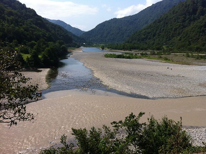
The destructive work of rivers and fast water
The waters of the land, especially in mountainous countries, accomplish destruction no less than the sea. A vivid example of this work is the Colorado River in North America (Colorado, from the Spanish, means "coloured river," more accurately the red river, after the predominant colour of the rocks forming its banks).
The entire Colorado basin is cut by a labyrinth of deep gorges. The most remarkable of them — the Grand Canyon (in Spanish "cañón" means tube) — stretches for more than 350 kilometres and reaches in places 800 metres in depth, with a gorge width of one and a half to two kilometres. The walls of the canyon fall absolutely sheer, sometimes for 600–900 metres.
The river, only 60–90 metres wide, has already cut through the whole thickness of soft sedimentary rocks and is now gradually deepening into granite. The eroding activity of water — erosion (from the Latin verb "erodere," to gnaw away) — depends in rivers chiefly on the slope of the channel: the steeper the fall of the river, the faster its current and the more powerful the processes of erosion. This same relationship between slope and speed is the key to understanding why flash floods are so dangerous.
The formation and development of flash floods
Flash floods form when intense rainfall, sudden snowmelt, or a dam-like blockage delivers more water to a channel than it can carry, producing a fast, sharply rising surge within minutes to a few hours. They develop most violently in steep terrain and narrow valleys, where, as the Colorado example shows, a steep channel turns ordinary runoff into a battering torrent. Flash floods are characterised by their speed of onset, their suddenness, and the lack of warning — water can rise from a dry channel to a destructive wall in a remarkably short time.
The same forces that drive flash floods also trigger secondary hazards. On saturated, steep slopes a flash flood can set off mud slides, where the ground itself, lubricated by water, slides downhill and buries roads and buildings. Both phenomena share the lesson of river erosion: water gathers, accelerates, and overwhelms whatever lies in its path.
Meteorological research underpins modern flood forecasting. The National Oceanic and Atmospheric Administration (NOAA), through bodies such as the NOAA Office of Oceanic and Atmospheric Research, studies rainfall, river levels, and storm behaviour to predict where and when flash floods will form. The United States Geological Survey (USGS) operates stream gauges that feed real-time water-level data into these forecasts, allowing alerts to be issued before the surge arrives.
Causes of floods: ice jams and debris dams
Floods are also caused by ice jams and debris dams — natural blockages that pen water up until they fail catastrophically. An ice jam forms when broken river ice piles up at a constriction, damming the flow and backing water over the surrounding land; when the jam finally breaks, the released water rushes downstream as a sudden flood. Debris dams work the same way: fallen trees, branches, and washed-down material accumulate at a narrow point, hold back a growing reservoir, and then give way all at once.
The example of the Niagara River and its falls illustrates how relentlessly fast water cuts through even hard rock. The short Niagara River (about 55 kilometres) connects, in a turbulent channel up to two kilometres wide in places, the two last Great Lakes of North America — Erie and Ontario. The water levels of these lakes differ by exactly 100 metres, and this difference determines the swiftness of the river's flow and its destructive activity.
The river plunges over a 50-metre ledge in two majestic falls, and frost, spray, and water steadily undermine the rock. Beneath the hard limestone lie clay shales; the water erodes the soft shale, the limestone ledge overhangs like a "visor" some 12 metres, and then collapses with a deafening roar — collapses whose force recalls earthquakes. As a result, the falls retreat towards Lake Erie at about 90 centimetres a year on the American side and around a metre and a half on the Canadian side. The same processes of blockage, build-up, and sudden release govern ice jams and debris dams on smaller rivers everywhere.
The danger of fast-moving water: facts and statistics
Fast-moving water is far more dangerous than its depth suggests, and flood waters are the leading weather-related killer in many flood-prone regions. According to NOAA flood-safety guidance, just six inches (about 15 centimetres) of moving water can knock an adult off their feet, and one to two feet (roughly 30–60 centimetres) of water can float and sweep away most vehicles, including SUVs and trucks. The reason is the same physics that lets storm waves toss hundred-tonne breakwater blocks: moving water carries enormous momentum, and its force rises sharply with speed.
This is why the great majority of flood deaths occur in vehicles and why agencies emphasise that people consistently underestimate the power of a shallow, fast current. The campaign slogan "Turn Around Don't Drown," promoted during initiatives such as National Flood Safety Awareness Week, captures the single most important rule: never attempt to walk or drive through flood water of unknown depth or speed.
Flood damage to infrastructure and the landscape
Floods damage both built infrastructure and the natural landscape, often with consequences that last far longer than the flood itself. As the 1953 North Sea disaster showed, flood water washes away railway track, destroys factories, sweeps off wooden buildings, and contaminates whole districts. Beyond the direct destruction, floods inflict lasting indirect damage on the landscape: salinisation of soil, the washing away of fertile topsoil, the burial of arable land under sand, and the carving of gullies and ravines into the terrain.
Rain torrents and spring meltwaters do much of this landscape damage. In loose rocks such as loess and loess-like loams, on which the black-earth soils lie, they cut deep gullies and ruts. Growing and deepening, these ruts turn in the black-earth zone into a branching network of ravines.
Ravines are "the scourge of the farmer." A stubborn struggle is waged against them: special structures regulating the runoff of water are built, slopes are reinforced and planted with trees and shrubs. Wide ravines with gentle turf-covered slopes are called gullies (balki). In gullies and ravines artificial reservoirs are built, which are of great importance in agriculture and at the same time soften the dry climate.
Flooded roadways and transport safety
Flooded roadways are among the deadliest and most underestimated flood hazards, because moving water hides its depth, its current, and the condition of the road surface beneath it. A roadway may be undermined or washed out entirely while the water above still looks passable, and even a modest current can lift a vehicle and carry it off. The safe rule is absolute: turn around and find another route rather than enter water of unknown depth.
Recognising flood hazards at night is especially difficult, because darkness conceals how deep the water is, how fast it is moving, and whether the road still exists beneath it. Nighttime flood recognition is one of the main reasons drivers are caught out, which is why authorities urge people to avoid travel during flood warnings and never to drive around barricades. The combination of fast water, hidden roadway damage, and poor visibility makes flooded roads the single most common place where flood deaths occur.
How to identify and avoid the danger of water
Identifying and avoiding water hazards comes down to knowing the warning signs, monitoring official alerts, and never overestimating your own ability against moving water. The same patient force that grinds away coastlines and undercuts cliffs can overwhelm a person or a vehicle in seconds, so awareness and preparation matter more than reaction.
Flood safety awareness
Flood safety awareness begins with understanding the alerts issued by NOAA and acting on them promptly. NOAA classifies flood messages into distinct types: a flood watch means conditions are favourable for flooding and you should be prepared; a flood warning means flooding is imminent or already occurring and you must act; and a flash flood warning signals an immediate, life-threatening situation requiring you to move to higher ground at once. Knowing the difference between a watch and a warning is the foundation of staying safe.
Weather monitoring is the practical core of awareness. NOAA's prediction and monitoring technology — including river gauges operated with the USGS and the broadcast network NOAA Weather Radio All Hazards — delivers continuous alerts directly to the public. Recommended practice is to keep a NOAA Weather Radio or a phone with emergency alerts enabled, to check forecasts before travel during wet weather, and to pay special attention during periods such as National Flood Safety Awareness Week, when agencies concentrate public education on these risks.
Emergency response during flooding events
The most important emergency response during a flood is to move to higher ground immediately and never enter moving water — the principle summed up as "Turn Around Don't Drown." If a flash flood warning is issued, do not wait to see the water rise; evacuate low-lying areas, abandon a stalled vehicle only if you can reach higher ground safely, and avoid bridges over fast-moving water. The following steps reduce the danger:
- Move to higher ground at the first warning and stay away from streams, drainage channels, and low spots.
- Never walk, swim, or drive through flood waters — six inches of moving water can knock you down and a foot can sweep away a car.
- Turn around at flooded roads and barricades rather than attempting to cross.
- Monitor NOAA Weather Radio All Hazards and local emergency broadcasts for updated instructions.
- Take extra care at night, when the depth and current of flood water are nearly impossible to judge.
How water threatens buildings — and how roofs defend against it
Just as the sea is the enemy of the coast, water is the chief destructive force acting on every building, and the roof is its first line of defence against water intrusion. The same weight that lets storm waves move hundred-tonne blocks applies in miniature on a flat or low-slope roof: ponded water and accumulated snow impose a structural load that can approach a building's engineering limits, and water weight on a roof is a genuine factor in design, since each centimetre of standing water adds roughly ten kilograms per square metre.
Water that breaches a roof causes a chain of damage that mirrors flood damage at building scale. Roof leaks soak insulation and compromise its performance, promote the deterioration of wood and the corrosion of metal, and create the damp conditions behind indoor air-quality problems and mould. In cold weather, water trapped in pipes can freeze, expand, and burst them, adding another path for water to wreck a structure from within. Detecting and repairing leaks early is therefore central to protecting any building.
Modern leak detection borrows technology from the same toolkit used to monitor the environment. Infrared technology reveals hidden moisture by detecting the temperature differences that wet insulation creates, allowing technicians to find leaks that are invisible to the eye. Aerial infrared surveys flown by drone pilots extend this across large roofs quickly: drone mapping with infrared scanning produces a thermal picture of an entire roof system, pinpointing trapped water before it causes structural failure.
Cost-effective roof management rests on prevention rather than emergency repair. Annual roof inspections, routine maintenance, and prompt repair of small leaks extend roof life and avoid the far larger cost of replacing water-damaged structure. Professional roofing services such as TeamCraft Roofing provide consultation, infrared and drone surveys, and planned maintenance programmes designed to keep roof systems watertight over their full service life — the building-scale equivalent of the dikes and barriers that hold back the sea.
The dissolving activity of water
Groundwater, acting on easily soluble rocks such as rock salt, gypsum, and limestone, leaves behind enormous voids — caves that sometimes exceed tens of square kilometres in area. Further removal of soluble rock can eventually lead to the collapse of the "roof," which is sometimes the cause of perceptible tremors of the Earth's crust. Such phenomena are called karst, and they are especially sharply expressed in the limestone highlands of the Dinaric Mountains.
When water saturated with carbon dioxide seeps through the ceiling of a cave, icicle-like forms gradually grow downward — stalactites, sometimes reaching huge sizes. As the water evaporates the carbon dioxide is released into the air while the lime falls out as a mineral deposit, forming these hanging stalactites. From the drops falling onto the floor, thicker formations grow upward to meet them — stalagmites — and often the two join to form fantastic columns. The same dissolving action shows that there is no water in nature without impurities; even snow and rainwater carry substances captured from the atmosphere (more: What snow is like in winter).
The presence of various impurities in water is explained by the fact that, on the one hand, there are no absolutely impermeable rocks in nature, and on the other, there are also no completely insoluble minerals, except for diamond, graphite and platinum. The rocks themselves — and the way water works through and dissolves them — are described in more detail in the material on the rocks that make up the Earth's crust, and the collapses these processes trigger are comparable in force to the events covered in which earthquakes changed the face of the Earth.
Karst caves
Karst caves sometimes reach exceptional sizes. World-famous is the Mammoth Cave in the USA (Kentucky), whose total extent reaches 240 kilometres. Travellers are astonished by the grandiose stalactite halls up to 30 metres high and the galleries, magical grottoes adorned with sparkling gypsum crystals, capricious passages, and deep abysses from which not even the sound of a thrown stone returns.
Underground rivers — the Styx and the Lethe — flow through the cave, navigable by boat. In the deepest parts of the cave a remarkable constancy of temperature (+15°) is noted regardless of the season.
Postojna Cave
In Slovenia, not far from the border with Italy, halfway between Trieste and Ljubljana, lies the famous Postojna Cave (the former Adelsberg Cave), known since deep antiquity. Judging by inscriptions, it was visited as early as the 13th century. The total length of the cave reaches 20 kilometres. For the convenience of tourists a rail track has been partly laid through it and electric lighting installed.
In its beauty Postojna Cave surpasses Mammoth Cave. It is especially renowned for the variety and brightness of the colouring of its stalactites. Hundreds of columns of enormous size pass imperceptibly in colour from snow-white to blood-red.
Kungur Cave
Of our own caves, the most famous is the Kungur Cave (Perm region, Kungur district) on the Sylva River. Legend connects it with the name of the conqueror of Siberia, Yermak Timofeyevich, who in the autumn of 1578 turned aside with his army onto the Sylva River and wintered here. The low temperature of the cave, −2 to −3°, made it unsuitable for habitation. The first description of the cave was made by Academician I. I. Lepekhin (1740–1802), who visited it in 1770.
A huge number of various obstacles — branches filled with ice, narrowed passages, screes, water barriers and the like — still do not allow the true dimensions of the Kungur Cave to be fully determined. A visit to the Kungur Cave leaves an indelible impression. As if in a fairy tale, magical chambers pass before you, one more beautiful than the next.
Caves are also found in regions of limestone and gypsum rocks, especially in Crimea, the Volga region, and the Caucasus. Among caves, the Azure Grotto on the island of Capri near Naples (in Italy) enjoys well-deserved fame. It can be entered only by boat through a low arch.
Imagine that on a bright sunny day a local boatman has brought you here. In the grotto it is dark. You can barely make out the person sitting beside you, and suddenly you notice that the water beyond the side of the boat glows with a transparent, cold, blue phosphorescent light, as if rising from the depths of the water. The oars dipped into the water shine with a turquoise edging, and your hand, lowered into the water, also turns blue.
The dissolving activity and deposits of water
The dissolving activity of water is tied not only to the formation of stalactites and stalagmites but also to the deposition of minerals that fill cracks and voids in rocks. The presence of dissolved salts and gases sometimes gives mineral springs their healing properties, used in medicine to treat various diseases. Heating water increases its dissolving power; when hot springs emerge and cool, the dissolved substances fall out as deposits — iron ores from ferruginous springs, calcareous tufas from calcareous ones, salts from saline ones.
Emerging onto the Earth's surface, the waters of springs enter rivers, and from them lakes, seas, and oceans. Rivers are the channels by which salts are delivered to the seas and oceans, and they also carry a mass of tiny insoluble particles — fine silt and clay that keep the water turbid. River deposits noticeably lengthen the arms of rivers (for the Mississippi, by 60–90 metres a year) and form spits and bars.
Of the world's rivers, the greatest amount of sediment is carried out by the Huang He, or Yellow River (China) — roughly 900 million cubic metres a year — and the Ganges (India), no less than 177 million cubic metres a year. All the rivers of the globe annually carry off from the land surface at least 10 cubic kilometres of silt and sand, which over 10,000 years should lower the land by about 1 metre. Scientists note that water exhibits two kinds of activity:
- mechanical, when crushed material of various rocks is destroyed, transported, and deposited;
- chemical, when rocks are dissolved.
The first activity belongs to surface waters, the second is characteristic mainly of groundwaters. Deep wells that tap water under pressure from a synclinal fold are called artesian, after the French province of Artois, where water first began to be drawn this way as early as the 12th century. Artesian waters are distinguished by good quality and high sanitary value, since they usually contain no microbes and therefore require no purification.
Landslides
Groundwater, by moistening the surface of gently dipping strata, creates favourable conditions for the displacement and downslope sliding of significant masses of earth. This is how landslides form on high sea and river banks. This phenomenon is widespread on the Black Sea coast and in the Volga region.
In the process of landslide formation, significant shifts and partial displacements of ground occur. This leads to the appearance of cracks in buildings and the so-called "drunken forest," with wavy, bent trunks.
With strong landslides, significant destruction of buildings sometimes occurs. A record of the Simbirsk (now Ulyanovsk) chronicle notes:
In 1785 in Simbirsk a mountain slid down. The collapse was so great that many houses were destroyed, including the workhouse, as well as the chapel near the Smolensk Church.
Modern construction wages a successful struggle against the destructive work of water and landslide phenomena, reinforcing in advance those places that are under threat from the water element.
Conclusion
Water is at once the most patient and the most violent sculptor of the Earth, capable of grinding cliffs over millennia and of destroying a city in a single night. From the storm waves of the Black and North Seas, through the dikes of the Netherlands and the flash floods of steep river valleys, to the quiet dissolving of underground caverns, every example points to the same truth: water finds and exploits every weakness in its path. The defences that work — whether national flood-warning systems run by NOAA and the USGS, the great Dutch dams, or the watertight roof systems maintained by professionals such as TeamCraft Roofing — all rest on the same principle: understand the force, monitor it constantly, and build protection before disaster arrives. When fast water threatens, the rule never changes — turn around, don't drown.