How Waves Erode Coastlines: The Destructive Action of Sea Waves
 libre
libre
The Destructive Action of Waves: An Overview
The coastline of all the continents on our planet stretches roughly 250,000 kilometres, and along the whole of this enormous expanse, day and night without pause, marine and oceanic waves of greater or lesser force are constantly at work. The destructive action of waves is immense: during a strong wind, waves can strike the shore with a force of about 30 tonnes per square metre. Over time they wear away coastal rock and granite, break down cliffs, and trigger the collapse of vast headlands.
Wave action is the dominant force shaping the world's coastlines, and the energy it carries is what makes it so destructive. The same battering that erodes a granite headland also moves hundreds of thousands of tonnes of sediment, redrawing the boundary between land and sea. Understanding why waves form, how their energy reaches the shore, and what they do when they arrive explains both the slow retreat of cliffs and the sudden devastation of a single storm.

What Causes Ocean Waves
Most ocean waves are caused by wind blowing across the surface of the sea, transferring kinetic energy from the air into the water. The longer, stronger, and more sustained the wind, and the greater the stretch of open water it crosses (the fetch), the larger the resulting waves. Surface waves driven by wind are the most familiar type, but waves are classified more broadly by their energy source: wind-generated surface waves, tides driven by the gravitational pull of the Moon and Sun, storm surges raised by atmospheric pressure and wind, and tsunamis generated by earthquakes or landslides.
The key thing wind-driven waves carry is energy, not water. A wave is a travelling pulse of energy moving through the sea; the water itself stays largely in place. This distinction between the movement of energy and the movement of water is the foundation of all wave mechanics, and it explains why a cork on the surface bobs up and down rather than racing toward the shore.
Circular Motion of Water Within Waves
Within a wave in deep water, individual water particles move in near-circular orbits, returning close to their starting point as each wave passes. The crest is the highest point of the wave, the trough the lowest, the wavelength the distance between successive crests, and the wave height the vertical difference between crest and trough. The orbital motion shrinks with depth, so the energy of a surface wave is concentrated near the top of the water column. When this orbital motion reaches shallow water near the coast and the seabed interferes with the lower part of each orbit, the wave slows, steepens, and eventually breaks — converting orbital energy into the turbulent rush of water that does the work of erosion.
Definition of Destructive Waves
Destructive waves are high-energy waves that remove more material from a beach than they deposit, steepening and eroding the shoreline. They are tall relative to their length, break frequently and steeply, and have a weak swash (the rush of water up the beach) but a powerful backwash (the return flow). Because the backwash outpaces the swash, sediment is dragged seaward, so destructive waves lower and narrow beaches over time.
Constructive waves are their counterpart: low, long, gently breaking waves with a strong swash and weak backwash that build beaches up by carrying material onshore. A single coast typically experiences both — constructive waves dominating in calm conditions and destructive waves taking over during storms — which is why beaches grow and shrink in seasonal and storm-driven cycles.
How Wave Force Erodes the Coastline
Wave erosion wears down the coast through several distinct mechanical and chemical processes, most powerful where high-energy destructive waves concentrate against rock. Sometimes, even over a comparatively short span of time, the action of marine waves sharply changes the outline of the shore. In some places the coast is cut back into steep cliffs and crags overhanging the sea.
Coastal Erosion Processes
Wave erosion operates through four main processes that act together on rock and cliff:
- Hydraulic action — the sheer force of water and the compression of air trapped in rock cracks, which shatters the rock as the air is suddenly released.
- Corrasion (abrasion) — waves hurling sand, shingle, and pebbles against the cliff face, grinding it away.
- Attrition — rock fragments carried by the waves colliding and breaking down into ever smaller, rounder particles.
- Corrosion (solution) — the chemical dissolving of soluble rocks such as limestone and chalk by seawater.
Once detached, that material is moved by four transport processes: solution (dissolved material carried in the water), suspension (fine particles held in the water column), saltation (sand-sized grains bouncing along the bed), and traction (large pebbles rolled along the seabed). The net movement of sediment along a coast under angled wave attack is longshore drift, the conveyor belt that feeds and starves beaches further along the shore.
Cliff Failure and Coastal Infrastructure Damage
Cliff failure happens when waves undercut the base of a cliff, removing support until the overhanging rock above collapses under its own weight. The degree and speed of this change depend on the geological rock the cliff is made of and on the shape of the seabed in the basin offshore. Soft clays and sands retreat rapidly, while resistant granite and chalk endure far longer. On the open sea the wave performs work of grand proportions, producing damage that cannot be ignored — landslides and cliff retreat regularly threaten coastal buildings, roads, and harbour structures, which is why this destructive action must be studied for the construction of ports, breakwaters, and other shoreline works, water — friend and enemy of man.
Changing the Shape of Sea Coasts
Waves continually reshape coastlines by eroding material in one place and depositing it in another, producing a recognisable family of landforms. In some stretches the shore becomes a line of cliffs and headlands; in others, by contrast, enormous deposits build up — long "spits" of sand and shell debris that can run for hundreds of kilometres.
Erosional Landforms (Capes, Bays, Cliffs, Wave-Cut Platforms)
Erosional coasts develop capes (headlands) of hard rock, bays where softer rock has been worn back, cliffs, and wave-cut platforms. Wave refraction bends incoming wave energy so that it concentrates on protruding headlands and spreads out across bays — eroding the headlands and sheltering the bays. As a cliff is undercut and retreats, it leaves behind a wave-cut platform, a gently sloping rock shelf exposed at low tide that marks where the cliff once stood. The White Cliffs of Dover are a classic example of chalk cliffs cut by the sea.
Cliff-Related Landforms (Caves, Arches, Stacks, Stumps)
Where waves exploit lines of weakness in a headland, they carve a sequence of landforms: a cave bored into the rock, an arch where two caves meet through the headland, a sea stack when the arch roof collapses, and finally a stump as the stack is worn down. Durdle Door is a celebrated sea arch, while the Old Man of Hoy in Orkney and the stacks of St. Kilda are dramatic sea stacks. Specialised features also form, including geos — narrow steep-sided clefts such as Wife Geo — and blowholes, where wave-compressed air bursts up through a roof opening. Holborn Head and Cape Three Points show how rugged headlands take the brunt of wave attack.
Beach Material Removal Mechanisms
Waves strip material from a beach mainly through the dominance of backwash over swash and through longshore drift carrying sediment away faster than it is replaced. During storms, destructive waves haul sand and shingle offshore into submerged bars; on the Volga and at other water bodies, the same principle of moving sediment is managed deliberately — sandbanks are cleared with dredgers and suction excavators to keep navigation channels open. Beach material can be sandy, pebble, or shingle, and the coarser the material, the steeper and more stable the beach tends to be against removal.
Coastal Depositional Processes and Factors
Coastal deposition occurs wherever waves and currents lose energy and can no longer carry their sediment load, dropping material to build new landforms. The main controls are the supply of sediment (the sediment budget), the strength of longshore drift, the gradient and shelter of the coast, and the presence of vegetation that traps and binds loose material. Where rivers such as the Mississippi, Nile, Volga, and Danube meet the sea, they erode their banks, carry torn-off masses of land seaward, and leave part of that load at their mouths; over time these accumulations build deltas that genuinely add "dry surface" to the planet, their final shape determined by the balance between river supply and wave reworking.
Formation of Sand Spits and Bars
A spit is a long ridge of sand or shingle built out from the coast by longshore drift where the shoreline changes direction, growing into open water and often curving landward at its end. When such a ridge extends right across a bay or river mouth it becomes a bar, sometimes enclosing a lagoon behind it. A tombolo forms where a spit grows out to link an island to the mainland. These features can stretch for great distances along the coast, fed continuously by the drift of sand and shell debris.
Barrier Islands and Their Formation
Barrier islands are long, narrow, shore-parallel ridges of sand separated from the mainland by a lagoon or marsh, built and maintained by wave and tide action together with abundant sediment supply. They form a first line of defence for the coast behind them, absorbing storm energy before it reaches the mainland. Their resilience differs markedly: natural barrier islands can migrate, overwash, and rebuild their dunes, whereas urbanised barrier islands armoured with buildings and seawalls lose that flexibility and often erode faster. The Southeastern United States and parts of the coastline of Japan illustrate how barrier and dune systems shield developed shores.
Beach Formation and Types (Shingle, Pebble, Sandy)
Beaches form where constructive waves deposit more material than is removed, and their character depends on the size of that material. Sandy beaches, built of fine grains, are wide and gently sloping; pebble and shingle beaches, made of coarser fragments, are steeper and absorb wave energy through the gaps between stones. The composition reflects both the local rock being eroded and the sediment delivered by longshore drift, and the same beach can shift seasonally between a broad summer profile and a stripped-down winter one.
Storm Impacts on Coastal Morphology
Storms reshape the coast far faster than everyday conditions, with hurricanes, tropical cyclones, winter storms, and extratropical cyclones doing in hours what fair-weather waves take years to achieve. Storm surge — a rise in sea level driven by low atmospheric pressure and strong onshore winds — lets large destructive waves attack higher up the beach and dunes than usual, while the interaction of surge with high tide determines how much of the coast is overtopped. Researchers including Robert A. Morton of the USGS, through the Coastal & Marine Geology Program and the National Assessment of Coastal Change Hazards, have documented how hurricanes and tsunamis reshape developed coastlines. The 2011 Tohoku Earthquake and its tsunami on the Northeastern Coast of Japan showed how seismic waves can devastate a built-up shore in minutes.
Alongshore Variability in Storm Impacts
Storm damage is rarely uniform along a coast; one stretch may lose metres of dune while a neighbouring section is barely touched. This alongshore variability arises from differences in beach width, dune height, sediment supply, nearshore bar position, and the way wave refraction focuses energy on some segments more than others. Wave runup and overtopping of structures, dune slumping during extreme events, and infragravity waves — long-period waves generated in the surf zone that drive much of the highest runup — all contribute to the patchy pattern of erosion. Field studies such as the RealDune/REFLEX experiments and the STONE project, alongside numerical model work by researchers including Reniers, Moulton, de Vries, van Wiechen, Tissier, and others associated with the U.S. Coastal Research Program, refine the parameterizations that couple hydrodynamics and morphodynamics to predict where a coast will fail.
Beach Erosion and Recovery Timescales
A beach can be eroded in a single storm but takes months to years of constructive wave action to recover, and not every storm-stripped beach fully rebuilds. After a storm drags sand offshore into bars, calmer constructive waves gradually feed it back onshore, where wind and vegetation rebuild the dunes — a cyclical pattern of loss and recovery. Recovery slows or stalls when sediment supply is low, when storms cluster too closely together, or when climate patterns such as El Niño raise water levels and wave energy for extended periods. Understanding these post-storm recovery dynamics is central to forecasting long-term coastal change.
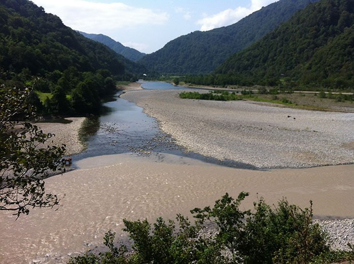
The Water Element Changes River Channels

In other places, usually along the right bank, water erodes the soil over a great distance. This sometimes produces large landslides that frequently endanger riverside structures. At such points on the Volga, dams are built and large stone barriers are erected to hold the bank.
Turbulent Spring Floodwaters and Soil Erosion
Everyone knows the destructive power of turbulent spring floodwaters, or even the comparatively small streams that form after rain. Every year in the fields we watch new gullies appear and see how badly the old ones are washed out and deepened. This sometimes renders large areas of arable land useless. Powerful flows of water often snap trees and tear them up by the roots.
Water Penetrates Deep Into the Earth
Water, in its constant cycle, penetrates even deep into the Earth and there continues its destructive work: it washes away huge masses of various rocks, carries them into gullies, into small rivers, into the tributaries of large rivers, and finally everything the rivers carry — everything that once formed part of the continent — enters the seas and is ultimately swallowed by the insatiable ocean.
As a result of the destructive action of waves and the work of rivers and streams, hundreds of thousands of tonnes of shingle, sand, silt, and the like are carried into the seas and oceans every year. By the calculations of the French geologist de Lapparent, the continents lose an enormous quantity of material to the destructive action of water each year — no less than 25 cubic kilometres.
Such is the colossal mass the sea absorbs every year! Such is the vast capacity of the ocean!
Continental Land Loss: Causes and Scale
Continental land loss is the net wearing-away of land by water, wind, and human activity, and along developed coasts it is accelerating. Beyond wave erosion and river transport, several distinct drivers strip the land:
- Wave action and storm surge eroding beaches, dunes, and cliffs.
- Relative sea level change, which raises the reach of waves and submerges low-lying ground.
- Hydrocarbon and groundwater extraction, which causes the land surface to subside.
- River modification — dams and channelisation that starve deltas and coasts of replenishing sediment.
- Wetland and mudflat losses, as fringing marshes and tidal flats that once buffered the shore disappear.
The scale is sobering. The combined area of all the continents is a little more than a quarter of the planet's surface; they rise above the level of the seas and oceans, and their volume is put at roughly 100 million cubic kilometres. Yet marine waves, rivers, streams, and rain gnaw at these continents day after day, while winds, storms, and hurricanes assist the destructive action of water. It can be estimated that, were there no opposing forces, four million years would suffice for all the continents to be cast down into the sea, turning the surface of the globe into a boundless, limitless ocean.
Changes in the Relief of the Land
Wherever there is water and an atmosphere, and wherever streams of sunlight penetrate, an unceasing change in the relief of the land takes place, and the continent is constantly destroyed. Even in deserts, where there is no water at all, the land is endlessly subjected to the destructive action of the wind. Storms and whirlwinds lift colossal masses of sand and other material into the air and carry them far out to sea, or build them into great deposits and spits, and sometimes level large valleys and gullies.
But this destruction would only be the whole story were it not for the action of the Earth's internal forces and many other factors that counteract the destructive power of water and wind. The volume of land grows through the uplift of the Earth's crust, as a result of which — though very rarely — new islands sometimes appear out in the open ocean. Over many millennia the tiniest corals and polyps build shoals and reefs in the depths of the ocean, raising grand structures in the form of coral islands that constitute a new kind of land.
Masses of volcanic eruption products in the form of lava and other rocks settle in thick layers over the Earth's surface, increasing the volume of land. On the Sandwich Islands, for example, a volcano once ejected about 30 thousand cubic kilometres of material from its vent. As a result of this colossal eruption, enormous voids formed deep in the Earth and grand collapses occurred — as much mass was thrown out then as is carried into the sea by the destructive work of water over a period of 12 thousand years. Such mass eruptions have happened more than once; the catastrophic eruptions of Vesuvius, which buried whole cities under ash and flooded vast areas with lava, are known to all.
Coastal Protection Structures
Coastal protection structures defend the shore by either absorbing wave energy or trapping and holding sediment in place. The main hard-engineering options are:
- Seawalls — solid barriers along the shore that reflect or absorb wave energy and protect the land behind, though they can worsen erosion at their base and ends.
- Breakwaters — offshore barriers that break waves before they reach the coast, sheltering the water inshore.
- Groynes (groins) — barriers built out into the sea to interrupt longshore drift and trap sediment.
Choosing among them involves a cost-benefit analysis: hard structures are expensive and can shift erosion elsewhere, while softer, more sustainable approaches work with natural processes. Community involvement matters too, since coastal management affects whole settlements, and coastal property owners benefit from understanding which defences suit their stretch of shore.

Beach Nourishment Methods
Beach nourishment is a soft-engineering technique that rebuilds an eroded beach by importing sand from elsewhere, usually dredged from offshore and pumped or trucked onto the shore. A wider, higher beach absorbs more wave energy and protects the land behind it without the rigid footprint of a seawall, but it is not permanent — the new sand erodes over time and must be periodically replenished. Nourishment is often combined with dune planting, where vegetation is established to bind the sand and rebuild a protective dune belt, and with geotextiles used to reinforce soil and hold material in place.
Building Groynes for Sediment Management
Groynes manage sediment by trapping the material moving along the coast in longshore drift, building up the beach on their updrift side. A series of groynes can hold a wide protective beach in front of vulnerable cliffs or property. The trade-off is that sediment trapped by one community is sediment denied to the coast further along, where it may cause increased erosion — which is why groyne schemes must be planned along the whole sediment cell rather than property by property. Recent technological advances combine such structures with monitoring and numerical modelling so that engineers can predict their downdrift effects before construction.
Sea Storms and Wave Hazards for Shipping
Many know how majestic the picture of the sea storm can be. Waves, each larger than the last, run one upon another; they strike the shore with tremendous force and roll back. When a person is sailing in such wild weather, with a sinking heart they watch the wave that rolls over the ship's side or strikes the hull with mighty force. The ship is thrown from side to side; at times it seems about to keel over. An inexperienced sailor finds it hard to stay on deck during heavy rolling. No less terrifying and dangerous is the pitching, when the ship, like a spirited horse, rears up and then drops back to level again.
The heart aches not only for the ordinary sailor but for the seasoned mariner too, when a ship in a storm finds itself in a shallow patch in the open sea or over a shoal near the coast. In these places, when the sea is rough, part of the energy of the lower water layers in contact with the seabed passes to the upper water masses, increasing the height of the waves running over the shallows. Their height reaches about a third of their length, and dreadful breakers form that are extremely dangerous to navigation.
There are many recorded cases of ships caught in a storm where sea and ocean breakers prevail, taking heavy blows from the waves, suffering severe damage, and being wrecked. Vessels that have lost steering — and therefore the ability to escape into the open sea away from the destructive zone of breakers — are especially prone to damage; their hulls break up quickly and their crews often perish. Every year a great many ships and people are lost in the depths of the sea, and the "work" of marine and oceanic waves does enormous harm to harbour structures and to merchant and naval fleets. Ships built without sufficient account of the sea's destructive action are wrecked particularly often in storms, which is why, when designing new vessels, hull strength must be calculated with the destructive action of waves firmly in mind.