Natural Zones of Antarctica and Its Geographic Regions
 libre
libre
Antarctica's natural zones — together with the ocean and ice that surround the continent — are a permanent object of study for polar researchers and glaciologists. This page explains how the natural zones of the southern high latitudes are defined, what climate, ice, plant and animal life they contain, and how the continent is explored and governed.

The natural zones of Antarctica: an overview
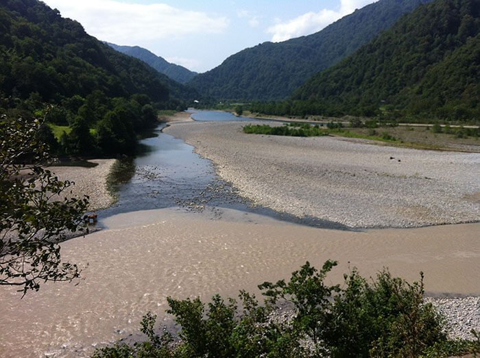
The natural zones of Antarctica are the main geographic regions of the southern high latitudes, defined chiefly by atmospheric circulation rather than by surface features alone. They form a strikingly regular, latitude-oriented (zonal) pattern centred on the South Pole: an inner ice-covered land zone, a surrounding belt of cold ocean and sea ice, and the transitional sub-Antarctic and temperate zones beyond. This zonal clarity is far simpler than in the Northern Hemisphere, because a polar-centred continent is encircled by a continuous ring of ocean stretching north to roughly the fortieth parallels.
Antarctica is the southernmost, coldest, driest, windiest and highest continent on Earth, lying almost entirely south of the Antarctic Circle. About 98% of its surface is buried under the Antarctic ice sheet. The natural zones described here capture how that ice, the encircling Southern Ocean, and the narrow ice-free margins together create distinct environments, each with its own climate, glaciology, flora and fauna.
Geographic names of Antarctica
Three geographic names are used for the southern polar region, and each carries a different meaning:
- Antarctica — the southern polar landmass (the continent itself);
- The Antarctic — the land plus the surrounding ocean;
- The Sub-Antarctic — the wider spaces of the Southern Ocean.
These names need to do two things at once: emphasise the uniqueness of the southern polar land and its surrounding ocean, while also reflecting the features the high southern latitudes share with the rest of the planet. The natural zones of Antarctica make up the principal geographic regions within this framework.
Antarctica — the southern polar continent
Antarctica is the southern polar continent, and of the three names it is the one with the clearest, most settled meaning in usage. It refers to the landmass alone, a more restricted meaning than "the Antarctic." The continent covers about 14 million square kilometres including its ice shelves, making it the fifth-largest continent. The Greek-derived name means "opposite the Arctic"; the idea of a southern landmass balancing the north reaches back to Aristotle, while the modern circular map projection of the region is associated with cartographer John George Bartholomew.
The Antarctic — land and surrounding ocean
The Antarctic embraces both the polar land and the sea around it, and is a less precise term than "Antarctica" because the northern marine boundary of the Antarctic is itself uncertain. Where exactly the cold polar water gives way to warmer water is not a fixed line, which is why this name covers a region rather than a sharply bounded area.
The Sub-Antarctic and the Southern Ocean
The Sub-Antarctic is the name often applied to the broad spaces of the Southern Ocean, which is frequently treated as an oceanographic unity formed by the southern parts of the Pacific, Indian and Atlantic oceans.

One often reads, for example, that the Mirny research station stands on the shore of the Indian Ocean. It remains unclear where the southern and northern boundaries of the Sub-Antarctic should be drawn. North of the Sub-Antarctic lies the subtropical zone of the Southern Hemisphere, which raises a further difficulty of real importance: no room is left for the temperate zone (the zone of temperate latitudes) of the Southern Hemisphere. The principle of dividing the high southern latitudes into zones, set out below, is neither universally accepted nor new — it underlies the climatology guide by B. P. Alisov, O. A. Drozdov and E. S. Rubinstein, the Marine Atlas, and, specifically for the Antarctic, the work of G. M. Tauber.
The principle behind defining the natural zones of the Southern Hemisphere
The natural zones of the Southern Hemisphere are defined on the basis of atmospheric circulation and the resulting division of air masses, climatic regions and geographic zones. This is the same principle used to define the natural zones of the Northern Hemisphere, which has been studied far more thoroughly than the South. Keeping the same principle as the foundation for regionalising the Southern Hemisphere is what guarantees a unified view of the whole of Earth's surface and makes the conclusions for both hemispheres comparable — the differences between them never erasing the deep similarities in their nature.
Atmospheric circulation as the basis for regionalisation
Atmospheric circulation governs where one natural zone ends and the next begins, because the prevailing type of air movement defines each belt. The Southern Hemisphere differs from the Northern in the simplicity of its surface structure: a polar-centred Antarctic continent is encircled by a zonal, ring-shaped ocean reaching north to the fortieth parallels. This simplicity makes the zonal boundaries unusually distinct, and several of them can actually be observed on the ground and at sea:
- the edge of the Antarctic continent, marked by the Antarctic atmospheric front;
- the limit of floating sea ice, along the belt of the Antarctic Convergence — the polar front.
What is striking is the clarity of this zonal structure and the importance of the zonal principle as the primary basis for the physical-geographic regionalisation of the Southern Hemisphere. Around the continent the cold polar surface water meets warmer northern water along the Antarctic Convergence, a real, mappable line rather than an abstraction.
Comparison with the natural zones of the Northern Hemisphere
The northern zones provide the template, because the Arctic and temperate zones there are defined by the dominance of a particular type of atmospheric circulation and air mass. Applying the same logic to the South lets researchers compare the two hemispheres directly.
The Arctic zone
The Arctic zone (region) of the Northern Hemisphere is dominated by east-to-west air transport and, comparatively more stably than in the temperate zone, by an anticyclonic state of the atmosphere. This circulation pattern is what marks the Arctic zone off from the belts to its south.
The temperate zone
The temperate zone differs from the Arctic by the dominance of a cyclonic atmospheric regime and west-to-east transport of air masses. The contrast in prevailing circulation, rather than any single weather feature, is what separates these two zones.
The Sub-Arctic zone
The Sub-Arctic zone (sub-zone) is characterised by the alternating dominance of two circulation types — temperate in summer and Arctic in winter. This picture holds true only with qualifications, such as the role of the winter Siberian anticyclone of the temperate zone. Because this regularity is accepted even for the complexly built Northern Hemisphere, it should likewise be applied when defining the main zonal differences in the Southern Hemisphere. On these grounds — following G. M. Tauber, with some changes — the scheme below is proposed for the South, supplemented by considerations about the position and features of the southern temperate zone.
The scheme of natural zones of the Antarctic
The Antarctic divides into a sequence of latitude-oriented zones, each explained in turn below. The most general boundaries and the more particular, observable ones alike run along lines of latitude, which is what gives the southern polar region its distinctive concentric structure.
The Antarctic (ice) zone
The Antarctic zone is the "ice zone" of physical geographers, broadly centred on the South Pole, and it is in the Southern Hemisphere — unlike the Northern — that the ice zone appears in its classic form. By G. Kozak's calculations the entire Antarctic zone covers 23.4 million square kilometres. Of this, the continent of Antarctica without its islands but with its ice shelves accounts for 14.1 million square kilometres, while the oceanic sub-zone of the Antarctic zone accounts for 9.3 million square kilometres. The continental part is divided into three sub-zones (two sub-zones and a sub-region). Glaciological research (more on this: Ice researchers) established the grounds for this division as follows:
- The central glacial sub-region occupies the overwhelming majority of the whole continent of Antarctica, but not the entire landmass and not even the whole ice cover. This central part consists only of ice of snow origin. There is still no data for sub-dividing the vast interior glacial region, which is the size of Europe; it is certainly far from uniform in relief, nourishment and ice balance. Areas with negligible precipitation — glacial deserts — predominate.
- The marginal sub-zone is the part of the Antarctic ice cover formed both by ice of snow origin and, at the surface, by another genetic type of ice. It is fed by ice that forms from meltwater seeping in from above, freezing on the ice, in pores between the grains of firn (granular, multi-year, tightly packed snow), and in ice fissures. More snow falls in the peripheral belt of the continent than in its centre, so the marginal sub-zone is a region of especially intense and partly unusual accumulation. The boundary of the nourishment area lies at sea level, and in places (in the oases) somewhat above it. The ice surface here is uneven, fissured, often showing bare ice or firn with no snow, with traces of melting and meltwater; the snow is swept away by fierce katabatic winds.
- The third is the periglacial sub-zone, the rocky districts — oases — especially at the continental margin. These patches are small, but undoubtedly numerous, and they form a necklace of rock outcrops along the continent's edge, on islands and some distance inland within the ice cover where it thins. One can speak here also of nunataks — peaks of bedrock projecting above the ice — as oases.
Studies of the Bunger oasis showed that the surface heat balance of an oasis is sharply positive in summer while its snow balance is negative: the ice around the oasis melts and the snow blows away. Oases and their immediate surroundings lie below the nourishment boundary of the ice cover. This strongly suggests that the glaciation of Antarctica's outermost periphery is sustained by allochthonous (incoming) ice. The processes dominating the Antarctic oases are unusual; the oases are tracts of a peculiar peri-glacial Antarctic desert, with desquamation, desert varnish, salt efflorescence and saline lakes. They are deserts biogeographically too, since lichens, mosses and algae cover only a small part of the ice-free surface. The periglacial sub-zone of Antarctica is an arena of dry weathering — much like the famous Dry Valleys of Victoria Land, the largest ice-free areas on the continent.
The oceanic sub-zone of the Antarctic zone is bounded on the south by the continental coast and on the north by the Antarctic front — the dividing line between the dominance of two opposite rings of air circulation: the inner east-to-west ring and the outer west-to-east ring.

The influence of Antarctic continental air, though not absolute, is characteristic here. The ring of ocean adjoining the continent — shallow water, the shelf — is formed by a layer of cold Antarctic water chilled almost to -2 °C. This space is covered through the winter, and partly in summer, by floating sea ice (more on this: The activity of glaciers). Icebergs are comparatively widespread. The northern boundary of the sub-zone, and with it the whole Antarctic zone, is the Antarctic front, which advances northward from the coast in winter and retreats back towards the continent in summer to roughly 66° S.
The Sub-Antarctic zone
G. M. Tauber distinguishes a separate Sub-Antarctic zone on the same grounds as the Sub-Arctic zone of the Northern Hemisphere — both are zones of the alternating dominance of different air masses: predominantly Antarctic (Arctic) maritime air in winter, and air of temperate latitudes in summer. The Sub-Antarctic zone is more than 1000 km wide. In winter sea ice dominates the surface of the cold Antarctic water; in summer the cold Antarctic water itself. Many of the larger islands of the Southern Ocean lie outside (north of) the Sub-Antarctic zone, with the apparent exceptions of the Balleny and South Shetland Islands, Heard Island, and the northern part of the continental projection — Graham Land, on the Antarctic Peninsula.
The temperate zone of the Southern Hemisphere
The temperate zone of the Southern Hemisphere occupies the latitudes north of the Sub-Antarctic, where west-to-east transport of air masses and a cyclonic atmospheric regime prevail year-round over open ocean. Recognising this zone resolves the difficulty noted earlier — without it, the subtropical belt would sit directly against the Sub-Antarctic and leave no room for the temperate latitudes that the zonal principle requires. Here the Antarctic Convergence marks the southern limit, beyond which surface waters warm rapidly and the ecosystem shifts away from the cold-water communities of the polar zone.
Climate and temperature extremes of the natural zones
Antarctica holds Earth's records for cold, with the lowest reliably measured natural surface temperature, about -89.2 °C, recorded at the Vostok Research Station on the high interior plateau near Dome A. The continent is also the driest: most of the interior is a polar desert receiving only a few centimetres of snow-water equivalent a year, less precipitation than many hot deserts. The high average elevation — Antarctica is the highest continent on average, raised by kilometres of ice — intensifies the cold, while a persistent polar vortex isolates the interior atmosphere through the dark winter.
Weather conditions and wind regime
Wind, not just cold, defines daily life in the Antarctic zone: dense, cold air drains off the high ice dome under gravity, producing fierce katabatic (drainage) winds that strip snow from the marginal sub-zone and bare the ice or firn beneath. Coastal stations such as those along Victoria Land record some of the strongest sustained surface winds on Earth. Conditions vary sharply by region — the Antarctic Peninsula, reaching far north toward South America, is markedly milder and wetter than the deep East Antarctic interior, and is one of the fastest-warming places on the planet.
The ice cover and glaciation of Antarctica
The Antarctic ice sheet is the largest single mass of ice on Earth, holding roughly 60% of the world's fresh water and about 90% of all glacier ice. If it melted entirely, global sea level would rise by tens of metres, which is why the ice sheet's behaviour is central to climate-change projections. The ice is conventionally divided into the East Antarctic Ice Sheet, the West Antarctic ice sheet, and the smaller Antarctic Peninsula Ice Sheet, separated by the Transantarctic Mountains.
Composition and thickness of the ice sheet
The Antarctic ice sheet averages roughly 2 km thick and exceeds 4 km in places, as mapped by ice-thickness compilations such as BEDMAP 2. The East Antarctic Ice Sheet sits largely on bedrock above sea level and is relatively stable, while the West Antarctic ice sheet is a marine-based sheet grounded below sea level, making it far more vulnerable to warming ocean water — fast-flowing outlets such as Pine Island Glacier and the Thwaites Ice Stream are thinning rapidly. Beneath the ice lies hidden topography including the buried Gamburtsev Mountains and subglacial lakes, the largest being Lake Vostok, sealed beneath kilometres of ice and studied as an analogue for extreme environments.
Ice shelves and sea ice
Floating ice shelves fringe much of the coast where the ice sheet flows out over the sea, the largest being the Ross Ice Shelf and the Filchner-Ronne Ice Shelf (the Ronne Ice Shelf bordering the Weddell Sea), each comparable in area to a large country. These shelves buttress the ice behind them, so their collapse — as with the Larsen Ice Shelf, where the Larsen B ice shelf disintegrated in 2002 — can accelerate glacier flow. Separately, seasonal sea ice freezes across the Southern Ocean each winter, roughly doubling the apparent size of the continent before melting back in summer, and the formation of this dense, cold, salty water drives the global ocean's deep circulation.
Relief features and the subglacial landscape
Mountains, peaks and volcanoes punctuate the ice. The Transantarctic Mountains run across the continent, dividing Greater Antarctica (East Antarctica) from Lesser Antarctica (West Antarctica); the highest summit is Mount Vinson in the Vinson Massif of the Ellsworth Mountains, at about 4,892 m — higher than Mont Blanc or Ben Nevis. Antarctica is also volcanically active, part of the broader Pacific Ring of Fire system: Mount Erebus on Ross Island is one of the few persistently active volcanoes, with others including Mt Melbourne and Deception Island in the South Shetland Islands. Rock peaks projecting through the ice are called nunataks, and the ice-free Dry Valleys near McMurdo expose a bare, wind-carved landscape.
Plant life of Antarctica's natural zones
Vegetation in Antarctica is sparse and confined almost entirely to the ice-free margins, the Maritime Antarctic and the Sub-Antarctic, because temperature, available water, and the short growing season tightly limit where plants can survive. Only two native flowering plants grow on the continent — Antarctic hair grass and Antarctic pearlwort — both restricted to the warmer Antarctic Peninsula. Researcher Sharon Robinson and colleagues have documented how climate change, including shifting moisture and increased UV, is stressing these communities, drying out long-lived moss beds.
Mosses, lichens and microorganisms
Mosses, lichens and microbes are the dominant land flora, clinging to rock and soil in the oases and on coastal outcrops. Hardy mosses such as Schistidium antarctici form ancient cushions that can record decades of climate history, while lichens colonise bare rock even in the harsh periglacial sub-zone. Microbial mats and communities thrive in unexpected places — including fumarole and geothermal habitats around volcanic vents on peaks like Mount Erebus, and within subglacial lakes — making Antarctica a natural laboratory for life in extreme environments. The fossil record tells of a very different past: the seed-fern Glossopteris from the supercontinent Gondwana shows Antarctica once carried forests.
Algae and phytoplankton of the Southern Ocean
Phytoplankton, not land plants, form the productive base of Antarctic life, blooming in the sunlit summer surface waters of the Southern Ocean. These microscopic algae, including coccolithophorids, carry out the primary production that feeds the entire food web, and their seasonal blooms make the cold polar seas among the most biologically productive on Earth. Ocean acidification driven by rising carbon dioxide threatens shelled plankton such as pteropods, while warming may reshape the timing and distribution of blooms — changes that ripple up to krill, fish, penguins and whales.
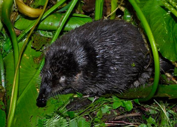
Wildlife of Antarctica and its surrounding waters
Antarctic animal life is overwhelmingly marine, concentrated in the rich Southern Ocean rather than on the frozen land, and includes some of the largest and most abundant animals on Earth. Terrestrial animals are limited to tiny invertebrates — the largest purely land animal is a wingless midge, Belgica antarctica, only a few millimetres long — while the seas teem with fish, krill, seals, whales and the birds that depend on them. Cold-adapted fish of the suborder Notothenioidei, some carrying antifreeze proteins in their blood, dominate the shelf waters.
Penguins of Antarctica
Penguins are the iconic Antarctic birds, breeding on coasts and sea ice and feeding in the surrounding ocean. The Emperor penguin, the largest species, breeds through the dark continental winter on the sea ice, while the Adélie penguin nests in vast colonies on rocky coasts and islands. Penguin breeding success is tightly linked to sea ice and krill, so shifts in those conditions are early indicators of ecosystem change.
Seals and whales
Seals and whales are the great marine mammals of the Antarctic. The Southern elephant seal is the largest of all seals, the predatory leopard seal hunts penguins and other seals along the ice edge, and the Southern Ocean is summer feeding ground for the largest animal ever known to exist — the Southern blue whale, one of several Antarctic whale species that migrate south to gorge on krill. Antarctic seal and Antarctic whale populations alike track the abundance of their prey.
Antarctic krill and its role in the ecosystem
Antarctic krill (Euphausia superba) is the keystone of the Southern Ocean food web, one of the most abundant animal species on Earth by total biomass. These small, shrimp-like crustaceans, a form of zooplankton grazing on phytoplankton, occur in immense swarms and are the primary food of whales, seals, penguins and fish. Because so much of the ecosystem funnels through krill, changes in sea ice — on which krill larvae depend — can affect the entire web from microbes to whales.
Exploration of Antarctica's natural zones
Antarctica was the last continent to be discovered and explored, first sighted in 1820 by an expedition under Fabian Gottlieb von Bellingshausen, with the South Pole reached in 1911 by Roald Amundsen. Australian geologist and explorer Douglas Mawson led pioneering scientific expeditions to the East Antarctic coast. Today exploration is overwhelmingly scientific, conducted from permanent research stations rather than by lone expeditions, and supported by bodies such as the British Antarctic Survey.
Polar stations and scientific expeditions
Research stations are the bases from which the natural zones are studied year-round, ranging from large hubs to small specialist outposts. The principal stations include:
- McMurdo Station — the largest Antarctic base, a U.S. logistics hub at McMurdo on Ross Island, near the McMurdo Ice Shelf;
- Vostok Research Station — a remote Russian interior station above Lake Vostok, site of the record cold;
- Davis Station and Casey station — Australian stations supporting biological and glaciological research and everyday polar living;
- Base Esperanza — an Argentine station on the Antarctic Peninsula, notable as the birthplace of Emilio Marcos Palma in 1978, the first person born on the continent.
Sampling in these zones is genuinely difficult: drilling kilometres into the ice to reach subglacial lakes, working in katabatic winds and extreme cold, and reaching the remote interior all demand specialised logistics, which is why long continuous records from sites like Vostok are so scientifically valuable.
Territorial claims and the Antarctic Treaty
Antarctica is governed not by any single nation but by the Antarctic Treaty, signed in 1959 and in force since 1961, which sets the continent aside for peaceful scientific cooperation and freezes all territorial claims. Several countries had earlier asserted overlapping sector claims, but under the Antarctic Treaty System these are neither recognised nor disputed, military activity and mineral exploitation are prohibited, and environmental protection is paramount. Tourism and other human activities are increasing and are regulated within this framework, balancing access against the need to preserve one of Earth's last near-pristine wildernesses. The role of the Antarctic ice sheet and the Southern Ocean in global heat balance, sea-level rise and deep-ocean circulation makes this protected continent central to understanding climate change worldwide.
Frequently asked questions about the natural zones of Antarctica
The natural zones of Antarctica raise recurring questions about climate, ice and life, addressed throughout the sections above. The continent's defining facts — coldest, driest, windiest and highest, almost entirely ice-covered, encircled by the Southern Ocean and governed by the Antarctic Treaty — frame nearly every question about how its zones work and why they matter to the rest of the planet. For related reading on nature and science topics, explore more articles in our Nature and Astronomy sections.
For more on glaciers and ice, see also our coverage of glaciers.