Iceland: Land of Fire and Ice, Volcanoes, and Geysers
 libre
libre
Iceland — the land of volcanoes and geysers
Iceland is one of the most geologically active places on Earth, a rugged North Atlantic island whose very name translates as "land of ice" yet which is dominated by fire — volcanoes, lava deserts and the spouting hot-water fountains that gave the world the word "geyser." Here the volcanic phenomena display features so distinctive that they are repeated nowhere else.
Standing in Iceland feels like watching the planet's youngest and most turbulent chapters replay before your eyes — the earliest periods of Earth's life and the long formation and development of the crust. Few landscapes anywhere make those deep-time processes so visible at the surface.
Origin of the name and a general portrait of the island
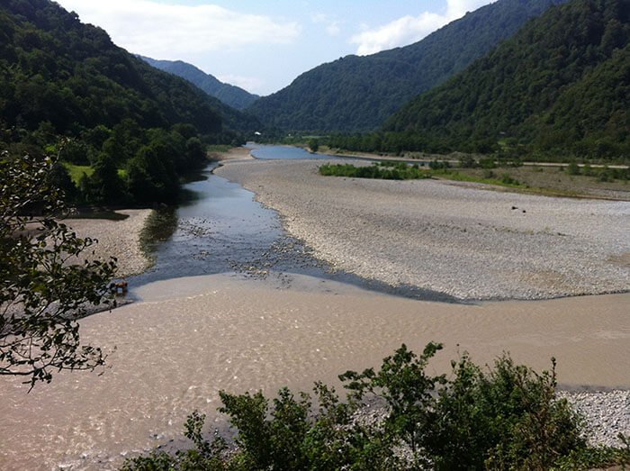
The name Iceland sits in revealing contrast with the island's true character. According to tradition, Norse settlers — Vikings who arrived in the late ninth century, with the conventional settlement date given as 874 A.D. — named the country for its glaciers, while its warmer, greener neighbour was called Greenland. In reality Iceland's surface is shaped less by ice than by basalt, geothermal heat and active fissures, with the capital Reykjavik and most of the population clustered along the milder coast.
The geological structure of Iceland
Iceland exists because it straddles a boundary between two of the Earth's great tectonic plates, sitting astride the Mid-Atlantic Ridge where the North American and Eurasian plates pull apart. This rifting is the root cause of the island's volcanoes, geysers and hot springs: the crust here is thin, young and constantly renewed by rising magma. Iceland is, in effect, a section of an ocean-floor spreading centre lifted above sea level.
Movement of lithospheric plates and the Mid-Ocean Ridge
The Mid-Ocean Ridge is the planet's longest mountain system, a submarine chain running tens of thousands of kilometres along the lines where tectonic plates separate. As plates move apart by a few centimetres a year, molten basalt wells up to fill the gap and solidifies into new crust. Iceland is one of the very few places where this normally hidden process breaks the ocean surface, which is why continental-plate movement can be observed directly in its rift valleys, fissures and fresh lava fields.
Volcanic activity in Iceland
For sheer intensity of volcanic activity, Iceland is the most remarkable region on the globe. The volcanism that operated on a grand scale here during the Tertiary period has never fully calmed down, and eruptions continue into the present day. The island is monitored by institutions such as the Nordic Volcanological Institute, reflecting how scientifically valuable this living laboratory remains.
Lava flows and stony deserts (Ódáðahraun)
Lava flows from the most ancient eruptions stretch across the country as continuous stony deserts, sometimes running for dozens of kilometres. The largest, Ódáðahraun in the north-eastern half of the island, measures more than 130 kilometres in length and 30 kilometres in width. Lava flow
The total area buried under lava flows reaches roughly 7,000 square kilometres — an expanse comparable in size to a large lake. Such fields of bare basalt give much of the Icelandic interior its dark, almost lunar appearance.
Iceland compared with other volcanic regions of the world
Iceland concentrates volcanic and geothermal phenomena more densely than almost anywhere else on Earth, though it is not alone in being volcanically active. Yellowstone National Park in the United States, the Kamchatka Peninsula in Russia and the volcanic belts of New Zealand, Chile and Indonesia all share related features. What sets Iceland apart is the combination — active volcanoes, fissure eruptions, glaciers and major geyser fields packed into a single island — making it a prime destination for both tourism and scientific research.
The volcano Hekla
Iceland has 26 large active volcanoes and a great many smaller ones, and the most famous of all is Hekla, a 1,447-metre peak crowned by three summits. The blend of black basaltic crags, black ash and white patches of snow gives Hekla a distinctly grim, forbidding look.
Hekla's largest eruptions and their consequences
Hekla is one of the most persistently active volcanoes on the planet: since the twelfth century it has been credited with more than 70 eruptions. One of its largest occurred in 1947.
That 1947 eruption lasted more than a year, and the roar of the volcano could be heard 400 kilometres away. Hekla's most recent eruption came in 2000. Alongside lava, its large and small craters throw out masses of the finest ash, which plunges much of the island into darkness and blankets vast areas, while the wind carries it far afield — in 1947 the ash was detected in southern England, Scandinavia and Finland.
The aftermath of that eruption brought widespread hardship, turning once-flourishing districts nearest the volcano into desert. Not only crops and pastures suffered: sheep, deprived of grazing, died in large numbers, underscoring how directly volcanic hazards translate into risk for the population.
The character of Icelandic volcanic lava
A striking feature of Iceland is that lava is discharged not only through volcanoes but also directly from enormous fissures. These cracks run for tens of kilometres, splitting apart the uplands in their path, and the fractures descend 150 to 200 metres into the depths. They are especially numerous in the north-eastern part of the island, and during eruptions low cones up to 50 metres high build up along them.
Fissure eruption: Laki (Skaftár) of 1783
A colossal fissure eruption struck the Skaftár (Laki) fissure, 24 kilometres long, in 1783. More than 90 volcanic craters and cones formed along it (34 of them up to 50 metres high). The lava that poured out covered 900 square kilometres, the flow averaged 30 metres thick, and the total volume of erupted material was estimated at roughly 27 cubic kilometres — one of the greatest lava eruptions of recorded history.
Famine and the catastrophic consequences of the Laki eruption
The 1783 Laki eruption destroyed the fodder on which livestock depended, and the chain of disaster that followed was devastating. Between earthquakes, famine and epidemic disease, 9,000 people died — almost one fifth of the island's population. The consequences reached far beyond Iceland: ash ruined the harvest in Scotland, roughly 1,000 kilometres from the eruption, where famine likewise took hold and many people perished. Laki remains one of the clearest historical examples of how a single eruption can trigger continent-scale humanitarian catastrophe.
The 1973 Heimaey eruption and the destruction of a town
One of Iceland's most dramatic modern eruptions occurred in 1973 on Heimaey, the main island of the Vestmannaeyjar archipelago off the south coast. A fissure opened beside the harbour town with almost no warning, forcing the overnight evacuation of the entire population. Advancing lava and falling cinders buried or burned hundreds of houses, and only a determined effort to cool the flow front with seawater kept the lava from sealing off the harbour. The town survived, but the eruption is remembered as a stark demonstration of volcanic risk to inhabited settlements.
Eruptions of volcanoes beneath glaciers and mudflows
The most destructive catastrophes of all occur when Icelandic volcanoes erupt from beneath glaciers (more detail: The work of snow and ice), because the outpouring lava causes massive melting of ice and produces mudflows that wreak terrible devastation. These glacial outburst floods can carry vast volumes of water, ice and debris across the lowlands. Subglacial volcanoes such as Grímsvötn beneath the Vatnajökull ice cap are classic sources of such floods.
Colonisation of new volcanic islands by ecosystems
When Iceland's volcanism builds entirely new land, it offers scientists a rare chance to watch life arrive from scratch. The island of Surtsey rose from the sea in a 1963–1967 eruption off the south coast and was immediately set aside as a protected natural laboratory. Researchers have since documented, step by step, how bare basalt is colonised — first by microbes and wind-blown seeds, then mosses, plants, insects and nesting birds. Surtsey shows island formation through basalt lava flows and the slow assembly of an ecosystem happening in real time.
The geysers of Iceland
Besides its volcanoes, Iceland is celebrated for its remarkable geysers — distinctive steam-and-water "volcanoes" that periodically hurl up fountains of hot water and steam. The English word derives from the Icelandic name Geysir, in turn from the verb geysa, "to gush." Deep hot waters here carry a substantial quantity of dissolved silica, and as the water cools the silica is deposited as a white sediment called geyserite.
What geysers are: definition and characteristics
A geyser is a hot spring that erupts intermittently, throwing a column of boiling water and steam into the air before subsiding and recharging. Over time geyserite builds a low, flat cone with a basin-shaped hollow, and at the bottom of this bowl-like pool lies the mouth of a channel descending 20 to 30 metres into the depths. Hot water rising through the channel gradually fills the basin.
After a time the water boils, and in an instant a huge column of water and steam shoots 20 to 40 metres into the air. Part of the water falls back into the basin, the geyser falls quiet, and then — after 10 to 20 minutes, or sometimes after as long as 20 hours — the same spectacle repeats.
Geysers are broadly divided into two types by their plumbing. Fountain geysers erupt from a pool in a series of bursts that fan outward, while cone geysers jet a steady narrow column from a built-up geyserite cone; both are sometimes simply called spouting geysers.
Origin and history of the word "geyser"
The word "geyser" travelled into every major language from a single Icelandic feature: the Great Geysir in the Haukadalur Valley of South Iceland. Geysir, recorded from the medieval period, gave its proper name to the whole class of erupting hot springs. The Great Geysir once threw water to great heights but has become largely dormant, erupting only rarely; for most visitors its lively neighbour Strokkur now provides the show.
Conditions for geyser formation and the geological factors involved
The periodic action of a geyser is explained by the way superheated water collects right at the bottom of the channel, reaching about 126–127 °C. Even at that temperature it does not boil, because the overlying layers of water press down on it, and their temperature gradually falls to 70–80 °C.
Gradually, as heat flows in from below, the temperature in the water column rises, bubbles of steam begin to form, and then the water boils at the surface — the pressure suddenly drops, and the superheated water flashing into steam erupts instantaneously. The water thrown up as a fountain cools, partly returns to the basin and drains back into the channel, and the inflow of superheated deep water generates a fresh explosion. Three conditions must coincide for any geyser to exist: an abundant water supply, an intense underground heat source, and a constricted plumbing system that lets pressure build.
Factors affecting geyser activity and dormancy
Geysers are delicate systems whose behaviour can change or stop entirely. Some erupt with unflagging regularity for centuries, while others gradually fade — declining into a simple hot spring or vanishing altogether. Earthquakes, shifts in the water table, mineral clogging of the channel and human interference can all alter eruption intervals or silence a geyser for good, which is why intervals between eruptions vary so widely from one vent to another.
How geysers differ from hot springs
The key difference is that a geyser erupts and a hot spring does not. Both are fed by geothermally heated groundwater, but a hot spring releases its heat by steady overflow or convection, whereas a geyser has a narrow, constricted conduit that traps pressure until it releases violently. Remove or widen that constriction and the geyser quietly becomes an ordinary hot spring.
Geyserite and mineral deposits
Geyserite is the pale, often crusty silica that gives geyser basins their characteristic rims and cones. As silica-laden water repeatedly floods and evaporates around a vent, layer upon layer of the mineral accumulates, slowly building the flat cone with its central pool. These deposits are themselves a record of a geyser's history, and their growth or staining can signal changes in water chemistry and activity.
Geothermal springs and hot lagoons of Iceland
Beyond its erupting geysers, Iceland turns its underground heat into both relaxation and power. Geothermal areas such as Hveravellir in the highlands of North Iceland and bathing sites like Gamla Laugin — the "Secret Lagoon" in the south — let visitors soak in naturally heated mineral water, while regions around Lake Mývatn add steaming fumaroles and mud pots to the scene. The same heat is harnessed nationally as geothermal energy, supplying district heating and electricity and powering industrial uses, making Iceland a model for geothermal energy utilisation.
Visiting Iceland's geysers: tours, seasons and travel
The classic way to see Iceland's geysers is the Golden Circle, a popular day route from Reykjavik that links the Geysir geothermal field with other South Iceland landmarks and is accessible year-round by road or organised tour. At Geysir, Strokkur is the star, erupting roughly every few minutes to heights of 15–20 metres or more, while the small geyser Litli Geysir bubbles nearby and the Geysir Centre museum interprets the area's geology for visitors. Travellers often combine a summer geyser trip with long daylight hours, or visit in the darker months to pair the steaming vents with Northern Lights viewing.
Geysers in other regions of the world
Geysers are globally rare, requiring an unusual coincidence of heat, water and the right plumbing, so they cluster in just a handful of volcanic regions. Apart from Iceland, geysers occur in New Zealand, in the United States — above all in Yellowstone National Park — and in other countries where volcanic activity is or once was present, because lava retains heat for a long time. Yellowstone alone holds the world's largest concentration, with celebrated vents such as Old Faithful, Grand Geyser and Steamboat Geyser, the tallest active geyser on Earth, monitored by the USGS.
Some geysers stay vigorous for centuries while others go quiet; on New Zealand's North Island the famous Waimangu geyser, which until 1904 threw the most powerful fountain in the world at 450 metres, has long fallen silent. Russia's Kamchatka Peninsula is also rich in geysers, especially near the fading Kikhpinych volcano south of Lake Kronotskoye, where the main cluster — no fewer than 22 large and about 100 small vents — fills the famous Valley of Geysers along the Geysernaya River, a field discovered in 1941 by the geologist Tatyana Ustinova.
Kamchatka's mightiest geyser, the Giant (Velikan), throws a fountain of water and steam almost 40 metres high every 2 hours and 50 minutes; its basin measures 3 by 1.5 metres and is at least 3 metres deep, and the water temperature of the Kamchatka geysers is 94–99 °C. Kamchatka is also rich in hot (50–100 °C) and warm (20–50 °C) mineral springs of varied chemistry, and around active and especially fading volcanoes one finds mud volcanoes — low hills with a hollow at the summit. The Kamchatka mud volcanoes are miniature, just 30 centimetres high with a crater 10–15 centimetres across; from time to time they pour out streams of mud and emit gases. Mud volcanoes can be hot or cold, the former tied to volcanic districts and the latter more to oil-bearing regions such as the Baku fields, the island of Java and Mexico.
The El Tatio geyser field in Chile
El Tatio, high in the Andes of northern Chile at about 4,300 metres, is the largest geyser field in the southern hemisphere and the third largest in the world. Its dozens of vents are most active at dawn, when cold air makes the steam columns spectacular, and the site has become a major natural attraction. El Tatio illustrates how the world's significant geyser fields remain confined to a few extraordinary volcanic settings.
Extraterrestrial geysers and cryogeysers
Geyser-like eruptions are not unique to Earth. Spacecraft have observed cryogeysers — fountains driven by volatiles such as water, nitrogen or carbon dioxide rather than boiling water — on several worlds. Saturn's moon Enceladus jets icy plumes from fractures near its south pole, Neptune's moon Triton vents dark nitrogen geysers, and seasonal carbon-dioxide jets have been inferred near the south polar cap of Mars. These extraterrestrial geysers help scientists probe the hidden oceans and interiors of distant bodies.
Biotechnology applications of thermophiles
The scalding water of geysers and hot springs is home to thermophiles and hyperthermophiles — microorganisms that thrive at temperatures lethal to most life — and these have proved enormously valuable to biotechnology. The best-known example is the bacterium Thermus aquaticus, first isolated from a Yellowstone hot spring; its heat-stable enzyme made the polymerase chain reaction possible and underpins much of modern molecular biology. Geyser ecosystems thus turn out to be not just spectacles but reservoirs of scientifically and commercially important biology.
For more articles on nature, science and travel, visit the main page, or explore related sections such as Travel, Astronomy and Speleology.