How the Earth's Crust Formed: Layers, Composition, and Mountain Building
 libre
libre
Earth's crust forms through a chain of processes that reshape the structure, composition, and position of rocks over geological time. The crust is the planet's thin outermost solid shell, separated from the underlying mantle by the Mohorovičić discontinuity, and it exists in two fundamentally different forms — thick, light continental crust and thin, dense oceanic crust. This page explains how the crust originates, what it is made of, how it has evolved since the Hadean eon, and how mountain-building, magmatism, plate tectonics, and earthquakes continue to remodel it today.
How does Earth's crust form? Main processes
Earth's crust forms by the cooling, crystallization, and chemical sorting of molten rock, then is continually rebuilt by plate tectonics. The earliest crust solidified from a global magma ocean as the young planet lost heat; later crust grows at mid-ocean ridges, thickens during mountain-building, and is recycled at subduction zones. As this cycle repeats, the face of Earth changes beyond recognition — sedimentary layers that once lay flat are folded, bent, fractured, and thrust deep into the planet's interior.
Over time the face of the Earth has changed beyond recognition. Mountain-building played a major part in this transformation (more on this: Old and young mountains), acting especially powerfully during certain periods of Earth's history. In many places, particularly in mountainous regions, you can see how much the sedimentary beds — normally lying horizontally — have been displaced: they are gathered into folds, bent, and broken by fractures that reach deep into the Earth.
Structure of Earth's crust
Earth has three main layers — crust, mantle, and core — and the crust is by far the thinnest. The crust together with the rigid uppermost mantle forms the lithosphere, which is broken into the tectonic plates that drift over the hotter, weaker rock below. The base of the crust is marked by the Mohorovičić discontinuity (the "Moho"), a sharp change in seismic-wave speed that geologists use to define where crust ends and mantle begins.
Thickness and layers of the crust
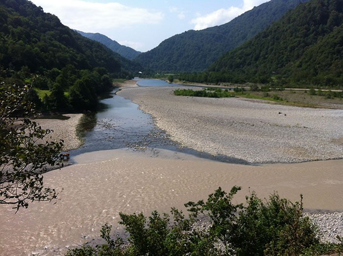
Crustal thickness varies dramatically, from roughly 5–10 km under the oceans to 30–70 km beneath the continents. The thickest crust sits under high mountain ranges such as the Himalayas and the Tibetan Plateau, where collision has piled the crust up; the thinnest crust lies along mid-ocean ridges. This variation is tied to isostasy — the principle that the crust "floats" on the denser mantle like a raft, so that thicker, lighter blocks ride higher and push deep roots downward to stay in balance. Where mass is added at the surface, the crust sinks; where it is eroded away, the crust slowly rises in compensation.
Chemical composition of Earth's crust
Earth's crust is dominated by just a handful of chemical elements, with oxygen and silicon together making up roughly three-quarters of its mass, followed by aluminium, iron, calcium, sodium, potassium, and magnesium. These combine into silicate minerals — the rock-forming minerals that build most of the crust, including feldspar, quartz, amphibole, and the micas. Feldspar is the single most abundant mineral group in the crust, while quartz dominates many continental rocks such as granite.
Crustal rocks fall into three broad families:
- Igneous rocks, crystallized from molten magma or lava (for example basalt and granite);
- Sedimentary rocks, built from compacted fragments, chemical precipitates, or organic debris;
- Metamorphic rocks, formed when existing rock is transformed by heat and pressure without fully melting.
Types of Earth's crust
Earth has two distinct kinds of crust — continental and oceanic — that differ in composition, thickness, density, and age. Understanding the contrast between them is the key to understanding how the surface behaves: which areas stand high and dry, which lie beneath the oceans, and which are destroyed and renewed by plate motion.
Continental crust
Continental crust is the thick, light, granite-rich crust that makes up the landmasses. It is broadly felsic — enriched in silica, aluminium, sodium, and potassium — giving it an average composition close to granite and a relatively low density of about 2.7 g/cm³. Because it is buoyant, continental crust resists subduction and can survive for billions of years, which is why the oldest rocks on the planet are found within it.
Oceanic crust
Oceanic crust is the thin, dense, basaltic crust that floors the ocean basins. It forms at mid-ocean ridges, where mantle rock melts as it rises and erupts as basaltic magma, then cools into new crust that spreads outward in both directions. Beneath the basalt lies gabbro and, deeper still, mantle peridotite. Oceanic crust has a higher density (around 3.0 g/cm³) than continental crust, so it sits lower and is the part of a plate that dives back into the mantle at subduction zones.
Differences between continental and oceanic crust
| Property | Continental crust | Oceanic crust |
|---|---|---|
| Thickness | ~30–70 km | ~5–10 km |
| Dominant rock | Granite (felsic) | Basalt (mafic) |
| Density | ~2.7 g/cm³ | ~3.0 g/cm³ |
| Buoyancy | Floats high, resists subduction | Sinks, is subducted and recycled |
| Age | Up to ~4 billion years | Generally younger than ~200 million years |
Age of continental and oceanic crust
Continental and oceanic crust differ enormously in age because of recycling. Oceanic crust is constantly created at ridges and destroyed at subduction zones, so almost none of it is older than about 180–200 million years. Continental crust, being too buoyant to subduct, preserves a far longer record: the Acasta Gneiss of northern Canada is around 4 billion years old, and individual zircon grains from the Narryer Gneiss terrane in Western Australia date to roughly 4.4 billion years, making them the oldest known fragments of Earth's surface.
Evolution and development of Earth's crust
Earth's crust has grown and reorganized itself throughout the planet's history, from a primitive shell in the Hadean eon to the patchwork of continents we know today. Geologists reconstruct this story from the rock record and from radioactive dating of minerals such as zircon, building a "crustal growth curve" that tracks how much continental crust existed at each point in deep time. The broad pattern is one of repeated creation, collision, and recycling.
Crust formation in the Archean: the oldest rocks
The earliest stable continental crust formed during the Archean and consists largely of TTG rocks — the tonalite–trondhjemite–granodiorite suite. These pale, silica-rich rocks make up the cores of the most ancient continents and record how early felsic crust was extracted from a basaltic precursor. Hadean zircon grains carry oxygen-isotope signatures suggesting that liquid water and reworked surface material existed remarkably early, hinting that some form of crustal processing began within a few hundred million years of the planet's birth.
One line of evidence comes from the Eoarchaean tonalites and trondhjemites of the East Pilbara Terrane and other ancient blocks. Experimental and geochemical work — including studies by Anastassia Y. Borisova and colleagues at the Géosciences Environnement Toulouse laboratory and the University of Toulouse III, with researchers such as Michael J. Toplis, Nail Zagrtdenov, and Muhammad Nawaz — has tested how interaction between basaltic magma and hydrated rock such as serpentinite could generate TTG-like melts, offering a route to felsic crust on the Eoarchaean Earth.
Cratons, shields, and platforms
Cratons are the ancient, stable hearts of the continents, and they are exposed at the surface as shields or buried beneath younger sediment as platforms. A shield is a broad area where old crystalline crust crops out directly — examples include the Canadian Shield and the Fennoscandian Shield (also called the Baltic Shield). Where these same ancient rocks are covered by a veneer of flat-lying younger strata, the structure is called a platform. Cratons preserve the oldest crustal rocks and act as the rigid nuclei around which continents grow.
Crust formation through plate tectonics
Plate tectonics is the engine that builds and destroys crust today. New oceanic crust is generated at mid-ocean ridges, where seafloor spreading and ridge push drive plates apart; continental crust grows above subduction zones, where one plate sinks beneath another and triggers the melting that feeds volcanic arcs such as the Andes and the Aleutian Islands. Over hundreds of millions of years this motion assembles and breaks apart supercontinents — Rodinia, Pangaea, and the fragment Gondwana — in a long cycle of collision and rifting.
Crustal reworking processes
Crustal reworking is the remelting, deformation, and recycling of crust that already exists, as opposed to the addition of brand-new material from the mantle. When buried deeply or caught in a collision, older crust can partially melt and re-crystallize, producing new granites from old rock and resetting the chemical clocks geologists rely on. Because reworking masks the original age of material, distinguishing genuine new growth from recycled crust is one of the central challenges in reading the crustal growth curve.
Mountain-building processes
Mountain-building, or orogeny, is the set of processes that lift and crumple the crust into ranges, and it is one of the most powerful agents reshaping the surface. It is driven mainly by plate collisions: where two continental blocks converge, the crust thickens and rises, producing ranges like the Himalayan mountain range. Mountains also form where blocks are uplifted along faults rather than folded.
Folding of mountains: anticlines and synclines
Sedimentary beds, under the pressure of mountain-building, are forced out of their horizontal position, producing folds of varying size and shape. A fold arched upward is an anticline (from the Greek klino, "to bend"), sometimes called a saddle; a fold bowed downward is a syncline. The word mulde (German for a trough or hollow) is also used in place of syncline. Mountainous regions show a great variety of folding.
Geologists distinguish folds that are:
- upright,
- standing,
- oblique,
- inclined,
- overturned,
- recumbent.
Unconformable bedding also occurs, where flat-lying layers rest on eroded or planed-off folds. The horizontal arrangement of crustal beds can be disrupted not only by folding but by rupture during subsidence or uplift. Breaks caused by uplift are called reverse faults, and those caused by subsidence are normal faults.
Horizontal displacement of broken parts of a bed is a strike-slip fault. Such faults typically develop in sequence: a recumbent fold forms, then ruptures, and continued pressure shifts one limb of the fold relative to the other. Distinct from these are thrust faults, where a slab of crust is pushed up an inclined plane over neighbouring ground, independent of folding. More complex disruptions develop along several normal-fault fractures at once.
Such surface forms include horsts and grabens. A horst (German horst, "ridge") is an uplifted block flanked on both sides by ground that has dropped significantly along normal faults. Mountains formed this way are called fault-block (rather than fold) mountains; the Altai Mountains are an example.
The exact opposite of horsts are the depressions formed when blocks of crust drop along normal faults. These trough-like or rounded depressions are called grabens (German graben, "ditch, trench"). Some occupy vast areas, such as the grabens of the Red Sea and Lake Baikal.
Magma as the origin of rocks
By their origin, rocks trace back to magma (from the ancient Greek for "kneaded, doughy mass"). What, then, is magma? In terms of its chemical make-up, magma contains all known chemical elements in the form of various compounds, with some, as it were, dissolved within others. Magma is the starting material from which all minerals and rocks are derived.
Chemical composition of magma and mineralizing gases
Magma is a complex melt that also carries enormous quantities of vapours and gases, which play a large part in mineral formation — hence their name, mineralizing gases.
Magma that poured out through fractures in Earth's crust during the planet's most ancient periods formed what are known as sheets, which sometimes cover huge areas.
Igneous formations of Earth's crust
When magma cools — whether erupted at the surface or trapped at depth — it builds a family of igneous formations that record how the crust grew. These bodies range from vast flood-basalt sheets to deep granite masses, and they reveal both the chemistry of the parent melt and the depth at which it solidified.
Lava sheets and traps
In Eastern Siberia, for instance, between the Yenisei and the headwaters of the Lena, outcrops of igneous rock — chiefly basalts — lie across a colossal area roughly equal to the Sea of Okhotsk together with Sakhalin Island.
These are called traps. The word "trap" comes from Swedish and means ancient lava flow. Another extensive trap region is the western part of the Deccan Plateau (on the Indian subcontinent), where the traps cover an area roughly the size of Finland. In the Deccan traps, too, the principal rock is basalt.
Veins in Earth's crust
Fractures in Earth's crust filled with some kind of deposit are called veins. Highly varied in extent and thickness, veins sometimes run for tens of kilometres, and the width of individual sections often exceeds 100 metres. Mikhail Lomonosov correctly explained the origin of ore veins long ago, suggesting that ore veins could form in fractures of the crust.
These fractures arise from
the trembling of the earth
and are then filled with
masses melted by the internal heat of the earth
or with minerals settling out of solutions flowing through the fractures. Besides fractures and sheets, other characteristic formations occupy a notable place in the structure of Earth's crust.
Batholiths
Batholiths are among these formations. The name comes from ancient Greek and means deep-lying rock (from bathys, "deep," and lithos, "stone"). Batholiths are bodies of solidified magma within the crust. They almost always consist of granitic rock and have no floor, since their roots reach down into the magmatic belt.
Laccoliths
The rise of magma along fractures can produce separate, comparatively small loaf-shaped swellings within crustal beds, called laccoliths. The name comes from ancient Greek for stone cellars (from lakkos, "pit, cellar," and lithos, "stone"). Laccoliths vary greatly in form. Sometimes, after the overlying rocks are worn away and removed, laccoliths emerge at the surface as isolated mountains.
Such are, for example, Ayu-Dag (Bear Mountain) near Gurzuf in Crimea, as well as Mashuk, Beshtau, and other mountains in the North Caucasus near Pyatigorsk.
Continental margins and their types
Continental margins are the transition zones where thick continental crust gives way to thin oceanic crust, and they come in two main types. A passive margin sits within a single plate, far from any plate boundary, and is geologically quiet — a wide, gently sloping shelf built of accumulated sediment. An active margin coincides with a plate boundary, typically a subduction zone, and is marked by earthquakes, volcanoes, deep trenches, and mountain ranges such as the Andes. Recognizing the margin type tells geologists whether crust is being quietly buried or actively destroyed.
Earth's crust and earthquakes
Earthquakes are sudden releases of stored energy in the crust, generated mostly along the boundaries between tectonic plates. As plates grind past, pull apart, or push against one another, stress builds along faults until the rock fails and slips, sending out seismic waves that shake the surface and can reshape landscapes by uplifting ground, triggering landslides, and rupturing faults at the surface. This makes plate boundaries the planet's primary earthquake zones.
The Bay Area of California is a textbook example of a hazardous plate boundary. There the Pacific plate grinds northwestward past the North American plate along the San Andreas fault system, producing a long history of damaging earthquakes; offshore to the north, the small Juan de Fuca plate is being subducted, adding a separate source of large quakes. Earthquake science education and community preparedness strategies — drawing on multimedia learning resources from organizations such as the National Geographic Society — help residents understand regional seismic activity and reduce their risk.
Preparing for crustal hazards combines personal safety measures with broader disaster response and planning:
- secure heavy furniture and learn to "drop, cover, and hold on";
- keep emergency water, food, and supplies on hand;
- agree on a family communication and meeting plan;
- support community preparedness strategies and resilient building codes;
- follow guidance from local authorities during and after a quake.
Comparing crust formation on Earth and Mars
Earth and its planetary neighbours all built crusts, but only Earth developed long-lived plate tectonics, and that difference explains why their surfaces look so unlike. The rocky planets and moons each crystallized an early crust from a cooling magma ocean, much as Earth did, but most of them then went geologically quiet, freezing that primitive crust in place.
- Mars preserves an ancient, basalt-dominated crust and never sustained mobile plates, so its surface records early conditions that have been erased on Earth — making it a key comparison for studying Eoarchaean crust formation.
- Venus is Earth's near-twin in size but has a hotter surface and a different style of resurfacing, with no clear system of drifting plates.
- Mercury and the Moon have thick, ancient crusts that record heavy meteorite impacts and early magma-ocean crystallization; the lunar highlands are a classic example of a feldspar-rich crust that floated atop a magma ocean.
- Io, a moon orbiting Jupiter, is intensely volcanic, showing yet another way a crust can be continually rebuilt without plate tectonics.
Studying these worlds, alongside ophiolites — slices of ancient oceanic crust thrust onto land, such as the Semail ophiolite in Oman — and high-pressure laboratory experiments, lets researchers reconstruct what early Earth was like. Field evidence from oceanic-plateau analogues like the Ontong Java Plateau, together with thermodynamic modelling of melting under early-Earth geothermal gradients, fills gaps the rock record alone cannot, though the deep-time data remain incomplete.
The record of Earth's history: rocks and minerals
Rocks and minerals are the two complementary archives geologists read to reconstruct Earth's history, and studying how rock bodies lie has great practical value in mineral exploration because it points the way to particular resources. Rocks preserve the large-scale story — folding, faulting, layering, and intrusion — while individual minerals such as zircon act as tiny clocks and chemical recorders, capturing the age and conditions of crust formation down to the level of trace elements and rare-earth-element patterns.
For example, sedimentary beds do not always lie strictly horizontal even where folding is absent: they may be slightly tilted and broken by fractures at various angles. Knowing the dip of a bed and its direction of inclination, a geologist draws conclusions and, after precise calculation, can confidently determine at what depth and distance a lost bed should reappear — one containing, say, coal or other useful minerals (more on this: Ferrous and non-ferrous metals and their ores).
In the same way, knowing the position of a reverse or normal fault, a geologist confidently tracks down a vanished coal seam or ore-bearing vein. In the search for oil, convex (anticlinal) folds are decisive, since concave (synclinal) folds essentially rule out the presence of oil. Suppose a geologist has established the presence of an anticline.
In which part of it should the exploratory borehole be sunk? Precise calculation is needed here, because in a productive anticlinal fold oil, being the lighter fluid, sits above the water, while gas sits above the oil, right at the crest of the fold. One should therefore not drill straight into the very top of the fold, because the escape of gas spoils the proper use of the well.
Likewise a borehole carried down as far as the water will not give the desired results. Conversely, when a borehole reaches the oil, the gas — under enormous pressure and striving to escape — will push the oil up into the well.