Volcanoes Explained: Active and Extinct Volcanoes of Our Continent
 libre
libre
A volcano is an opening in Earth's crust through which molten rock, gas, and fragmented material reach the surface, building the conical mountains that have terrified and fascinated humanity throughout history. Earthquakes have always frightened people who could not grasp their origins, yet the eruption of a volcano — often accompanied by a destructive earthquake — leaves an even deeper impression. What follows is a description of the volcanoes of our continent, set within the wider story of how volcanoes form and behave across the planet.
Description of the volcanoes of our continent
Eurasia and the Far East are rich in volcanoes, both in the distant geological past and in the present. On Earth there are roughly 1,500 volcanoes considered potentially active over the past 10,000 years, according to the Smithsonian Institution Global Volcanism Program, and a large share of them lie along the margins of the Pacific Ocean. Across the Eurasian plate, volcanic activity ranges from long-extinct ranges to the violently active cones of Kamchatka and the Kuril Islands.
What is a volcano: structure and signs
Volcanoes — or "fire-breathing mountains," as Russian people called them in older times — have features that make them easy to distinguish from other mountains. The most obvious of these is a conical shape, though some volcanoes appear as very gentle domes.
The conical shape and domes of volcanoes
The conical or dome-like outline of a volcano records the kind of material it erupts and the viscosity of its lava. Tall, steep cones build up where thick, sticky lava and explosive eruptions pile fragments around a central vent, while broad, gentle domes form where fluid lava spreads far before solidifying. The same logic governs volcano shapes worldwide: the steep symmetry of Mount Fuji in Japan contrasts sharply with the wide profile of Mauna Loa in Hawaii.
The crater and vent of a volcano
At the top of the mountain, always somewhat flattened, sits a funnel-shaped opening — the crater — ending in a vent, the channel that descends into the depths of the Earth. The width of a crater sometimes reaches 50–75 kilometres (in ancient extinct African volcanoes), and the depth does not always match the width: a wide crater may be shallow, while a narrow one may be deep.
Some volcanoes constantly release various vapours and gases from their depths, which curl above them as a faint haze.
Classification of volcanoes: active, dormant, and extinct
Volcanoes are classified by their level of activity into active, dormant, and extinct types. The distinction rests on whether a volcano is erupting now, has erupted within recorded history, or shows no sign of life across the memory of generations. Modern agencies such as the USGS and the Smithsonian Institution Global Volcanism Program refine these categories using eruption records, seismic monitoring, and satellite imaging.
Definition of active versus extinct volcanoes
Active volcanoes are those that periodically erupt with terrible force — throwing out stones and ash, then pouring forth streams of fiery lava — whereas extinct volcanoes show no signs of life within the historical memory of generations. The contrast is one of behaviour over time rather than appearance, since an extinct cone can look much like an active one.
An indescribable horror seizes a person when a bright sunny day suddenly turns to impenetrable darkness, torn by blinding lightning. Streams of liquid mud pour from the sky. People and animals are killed by stones, sometimes of enormous size. Drifts of ash quickly build up, burying gardens, houses, and streets. An ominous river of lava advances, destroying everything in its path.
Panicked people rush about, suffocate from volcanic gases, perish beneath the ruins of buildings, and burn in the streams of lava. A volcanic eruption can last a long time. This majestic and terrible natural phenomenon is a convincing manifestation of the living Earth. Even at the dawn of Earth's geological life, volcanoes smoked and poured out lava on the Kola Peninsula and in Karelia, and possibly in other regions of Europe as well.
Signs of dormant (sleeping) volcanoes
Dormant volcanoes are those that have not erupted within recent history but retain a magma supply and may awaken after long silence. They occupy the middle ground between active and extinct, and the clearest warning signs include swarms of small earthquakes, ground swelling, rising heat, and the escape of gases such as sulfur dioxide. Volcanoes long believed extinct sometimes return to activity, even after a break of several hundred years — a reminder that "dormant" is never a guarantee of safety.
The volcano on Krakatau, located in the archipelago between Java and Sumatra, erupted with tremendous force after 200 years of quiet. The eruption of Krakatau in 1883 was one of the most deadly: about 40,000 people died and 300 settlements were destroyed. Mount Greater Ararat (5,156 metres, near the Turkish border), which had shown no signs of volcanism in historical times, suddenly came to life in 1840, releasing suffocating sulfurous gases, mudflows, and showers of stone that buried the village of Ahura and an ancient monastery within an hour.
Types of volcanoes by form and structure
Volcanoes are grouped by shape and construction into several main types: cinder cones, shield volcanoes, lava domes, stratovolcanoes, and the vast collapse features called calderas. Each form reflects the magma composition, gas content, and eruption style that built it.
Stratovolcanoes (composite volcanoes)
Stratovolcanoes, also called composite volcanoes, are steep, layered cones built from alternating beds of lava, ash, and volcanic debris erupted at convergent plate boundaries. Their silica-rich, viscous magma traps gas and produces explosive eruptions, giving them the classic tall, symmetrical profile. Mount Fuji in Japan, Mayon in the Philippines, Mount Rainier and Mount Hood in the Cascade Range, and Mount St. Helens are textbook stratovolcanoes, as is the Mount Mazama edifice whose collapse created Crater Lake.
Calderas: formation and examples
A caldera forms when a volcano empties a large magma reservoir during an enormous eruption and the summit collapses into the void, leaving a broad basin far wider than an ordinary crater. The size of the magma reservoir governs the magnitude of such events, and the largest produce the continental "supervolcano" calderas. The Yellowstone Caldera, fed by a continental hot spot beneath the North American plate, and the Valdez Caldera are prime examples, while Krakatau and Tambora show how oceanic and island calderas form through catastrophic collapse.
Shield volcanoes and lava domes
Shield volcanoes are broad, gently sloping mountains built from fluid, low-silica basaltic lava that flows far before cooling, while lava domes are steep mounds of stiff, viscous lava squeezed out over a vent. The Hawaiian Islands grew as shield volcanoes above a mantle hot spot — Mauna Loa and Kilauea are the classic examples, protected within Hawai'i Volcanoes National Park. Lava domes, by contrast, often grow inside the craters of stratovolcanoes after explosive eruptions, as happened on the volcano described later in this article.
How a volcano erupts
A volcano erupts when magma, gas, and fragmented rock are driven from a underground reservoir to the surface, sometimes quietly as flowing lava and sometimes in violent explosions. The character of an eruption depends above all on the viscosity of the magma and the amount of dissolved gas it carries.
Definition and characteristics of eruptions
A volcanic eruption is the discharge of lava, ash, gas, and rock fragments from a vent, and its style ranges from gentle effusion to catastrophic explosion. Fluid, gas-poor magmas produce calm lava flows, whereas viscous, gas-rich magmas trap pressure until it is released explosively. Phreatomagmatic eruptions occur when rising magma meets groundwater or seawater, flashing it to steam and shattering the magma into fine volcanic ash. Such eruptions can continue for a long time and rank among the most powerful expressions of the living Earth.
Stages and pulsation of eruptions
Eruptions proceed in pulses and phases rather than as a single steady event, with bursts of activity separated by intervals of relative calm. A typical sequence opens with earthquakes and gas emission, builds to explosive ejection of ash and the growth of new craters, and may end with the slow extrusion of a lava dome. The same volcano can pass through repeated eruptive pulses over months, then return to a quiet stage before reawakening.
The force of eruptions and explosive behaviour
The explosive force of an eruption is set by how much gas is dissolved in the magma and how readily that gas can escape as the magma rises. When silica-rich magma cannot release its gas gradually, vesiculation — the rapid growth of gas bubbles — fragments it and drives violent blasts. The 1991 eruption of Mount Pinatubo in the Philippines, the 1883 Krakatau event, and the 1815 Tambora eruption rank among the most powerful in recorded history, each injecting vast quantities of ash and sulfur dioxide high into the atmosphere.
How volcanoes form: the geology of the process
Volcanoes form where magma generated in Earth's mantle rises through the crust and reaches the surface, a process controlled by the movement of tectonic plates. Most of the world's volcanoes lie along plate boundaries, with a smaller number above isolated mantle hot spots. As geologists explain, the basis of all volcanism is the movement of magma: travelling from the depths of the Earth, magma intrudes into the crust or emerges at the surface, mainly through volcanic eruptions.
Tectonic plates and subduction zones
Subduction zones form where one tectonic plate dives beneath another, dragging water-laden oceanic crust deep into the mantle and triggering the melting that feeds chains of volcanoes. The Ring of Fire — a horseshoe of volcanic arcs and trenches around the Pacific Ocean — is the world's greatest concentration of such activity, where the Pacific Plate, the Juan de Fuca plate, the Philippine Plate, and others descend beneath neighbouring plates. The Aleutian Islands, the Cascade Range, and the volcanic arcs of Japan and the Kuril Islands all owe their existence to subduction.
Convergent plate boundaries
At convergent boundaries, the descending plate releases water that lowers the melting point of the overlying mantle, changing the composition of the magma toward silica-rich, gas-charged melts. This is why convergent-margin volcanoes tend to build explosive stratovolcanoes rather than gentle shields. The interaction of the North American plate, the South American plate, and the Pacific Plate around the Pacific Rim, and of the Eurasian plate with the Philippine Plate near Japan, produces the most hazardous volcanoes on Earth.
Continental rift valleys
Continental rifts form where the lithosphere stretches and thins, allowing the mantle below to rise, decompress, and melt, opening volcanic valleys along the spreading axis. The East African rift, where the African plate is slowly tearing apart, is the classic example, and similar spreading drives volcanism along mid-oceanic ridges such as the Mid-Atlantic Ridge, exposed above sea level in Iceland. These spreading margins quietly produce more lava than any other setting on the planet.
Magma melting: decompression and flux melting
Magma is generated by two main processes: decompression melting, where rising mantle melts as pressure drops, and flux melting, where added water lowers the rock's melting point. Decompression melting dominates at mid-oceanic ridges, continental rifts, and hot spots, while flux melting prevails at subduction zones where the down-going plate sheds water into the mantle wedge. Together these mechanisms explain why volcanoes cluster where they do.
The role of gases and their exsolution in magma
Dissolved gases — chiefly water vapour, carbon dioxide, and sulfur dioxide — are the engine of explosive volcanism, and their behaviour depends on the silica content and viscosity of the magma. As magma rises and pressure falls, these volatiles exsolve and form bubbles through vesiculation; in fluid, low-silica magma the bubbles escape easily, but in viscous, high-silica magma they remain trapped until they shatter the rock. Gas content, more than any other single factor, decides whether a volcano oozes lava or detonates.
The formation of volcanoes on our continent
The volcanoes of Eurasia formed over hundreds of millions of years, recording successive episodes of mountain building and plate collision. Research into the geological age of the Earth speaks more definitely of volcanism during the Paleozoic, in the Urals, the Caucasus, the Altai, Central Asia, Kazakhstan, the Sayan Mountains, and Transbaikalia.
Volcanism in the Paleozoic: the Urals, Caucasus, Altai, Siberia
In the Mesozoic, the intensification of volcanic activity appeared in the Caucasus, Crimea, Eastern Siberia, Sakhalin, and Kamchatka. The continent's oldest volcanic traces reach back to the dawn of its geological life on the Kola Peninsula and in Karelia, while the Paleozoic and Mesozoic episodes laid down the volcanic rocks now folded into ranges from the Urals to the Far East.
Volcanoes of the Caucasus: Elbrus and Kazbek
At the end of the Tertiary period, volcanoes formed in the Caucasus, including the twin-peaked Elbrus.
And the handsome Kazbek, with a chain of volcanoes stretching between them.
The failed laccolith volcanoes of Pyatigorye
Somewhat earlier, a group of so-called failed laccolith volcanoes formed in the Pyatigorsk–Mineralnye Vody region. These volcanoes are called "failed" because the magma lacked the force to break through the layers of sedimentary rock, which remained bulging up over the plain. Such is the origin of Beshtau, Mount Zheleznaya, Razvalka, and fourteen other low mountains.
The Alagez (Aragats) volcanic massif in Armenia
Many volcanoes were active in western and eastern Transcaucasia. The activity of the huge Alagez volcanic massif — otherwise known as Aragats — in Armenia was especially violent and formidable. In the turbulent Tertiary time, volcanoes thundered, besides the regions already mentioned, also in the territory of Ukraine and on the Kuril Islands. In Crimea and on Sakhalin, volcanic life died away.
Active volcanoes of Eurasia
Today Kamchatka and the "Kuril necklace" are especially rich in active volcanoes, forming part of the Pacific Ring of Fire where the Pacific Plate subducts beneath the Eurasian plate. These two regions hold many of the most active volcanoes in all of Eurasia.
Volcanoes of Kamchatka: Klyuchevskaya Sopka and Karymsky
Among the Kamchatka volcanoes stands one of the most beautiful volcanoes in the world — Klyuchevskaya Sopka (about 4,750 metres). It is one of the giants among the active volcanoes of the globe.
In terms of activity, the comparatively small but strikingly regular Karymsky volcano (1,380 metres) stands out among the Kamchatka volcanoes.
The snow-capped Kronotsky volcano (3,700 metres), picturesquely set on the shore of the lake of the same name, is justly famed for its enchanting beauty, especially in the colourful autumn dress of the forest belt.
In all, 13 volcanoes are active on the Kamchatka Peninsula, 19 are in a fading stage, and 158 are considered already extinct. Kamchatka is monitored alongside other Ring of Fire systems, much as the U.S. Geological Survey and its Hawaiian Volcano Observatory track activity in the Pacific, including towering Shiveluch Volcano farther north.
The Kuril necklace: the volcanoes of the islands
Among the volcanoes of the Kuril Islands, the most active are Alaid (2,339 metres) on the island of the same name and the Sarychev Peak (1,497 metres) on the small island of Matua, while among the fading volcanoes is Tyatya on the southernmost large island of the "Kuril necklace." Of the hundred volcanoes of the Kuril Islands, 38 are in a stage of greater or lesser activity, while the remaining 62 may have gone completely extinct.
Tyatya volcano is distinctive in shape: from a distance the volcano seems two-storied, as though a small volcano rises above a massive base. In reality this is, so to speak, a "volcano within a volcano." The inner volcano rises 336 metres from a crater (in Greek, "krater" means "bowl") — that is, from a bowl-shaped depression rimming the volcano. The total height of Tyatya is 1,822 metres.
The origin of this volcano's name is interesting. The native inhabitants of the island — the Kurils — called the mountain "Chacha-nupri," that is, "father-mountain." The Japanese language has no syllable "cha," so in Japanese it became "Tyatya-yama," that is, Mount Tyatya. Russian people, dropping the Japanese "yama," restored the historical name of the volcano.
Active volcanoes of Japan: statistics
Japan sits at the meeting point of four tectonic plates — the Pacific Plate, the Philippine Plate, the Eurasian plate, and the North American plate — which is why it counts more than 100 active volcanoes, roughly a tenth of the world's total. As one of the most volcanically active nations on the Pacific Rim, Japan protects its volcanic landscapes in national parks such as Fuji-Hakone-Izu National Park, Bandai-Asahi National Park, and Shikotsu-Toya National Park. Mount Fuji, the country's highest peak, is a classic stratovolcano whose last eruption in 1707 left a deep cultural and spiritual significance; nearby cones such as Mount Azuma-Kofuji, Mount Niigata Yakeyama in Niigata Prefecture, and Mount Suribachi on the Ogasawara Islands add to the chain. The volcanic byproducts include the hot springs and steaming valley of Jigokudani, fed by the same heat that drives the eruptions.
The distribution of volcanic activity on Earth
Volcanic activity is not spread evenly but concentrated along plate boundaries and over hot spots, with the densest belt forming the Ring of Fire around the Pacific Ocean. The United States ranks among the leading volcanic nations: the USGS Volcano Hazards Program monitors more than 160 volcanoes, with Hawaii, Alaska, and the Cascade Range holding the most. National parks preserve the legacy of past eruptions — Crater Lake at Mount Mazama, the Novarupta eruption recorded in Katmai National Park and Preserve, Redoubt Volcano in Lake Clark National Park and Preserve, Lassen Peak in California, and the cinder cones of the San Francisco Volcanic Field, including Sunset Crater Volcano and Capulin Volcano. The Smithsonian Institution Global Volcanism Program, Oregon State University Volcano World, and the National Park Service together document this distribution and rank the world's most hazardous systems. Hot spots away from boundaries — the Hawaiian hot spot beneath the Hawaiian Islands and the continental hot spot beneath the Yellowstone Caldera — show that mantle plumes can build volcanoes far from any plate edge.
Volcanoes of Australia
Australia has no currently active volcanoes on its mainland, but it carries a long geological history of volcanism and manages active centres on its remote external territories. Geoscience Australia records the Newer Volcanics Province of the southeast — including Mount Gambier, whose eruptions a few thousand years ago are among the youngest on the continent — as the most recently active mainland field. The active Australian volcanoes lie offshore at Heard Island and the McDonald Islands in the Southern Ocean, where the Department of Foreign Affairs and Trade administers the territory. Elsewhere in the Pacific Rim, comparable island volcanism appears at Taranaki, Ruapehu, and other peaks of New Zealand, at Taveuni in Fiji, at Niuafo'ou and Rabaul to the north, at Sinabung and Merapi in Indonesia, and at Pico Basile on Bioko Island off Africa.
The benefits of volcanic eruptions
Despite their hazards, volcanoes bring lasting benefits — fertile soils, geothermal energy, and the very land we stand on. Volcanic activity has built much of Earth's surface over geological time, and the heat stored in volcanic regions can be tapped as geothermal energy for power and heating. Volcanic ash and gases also influence weather and climate: large eruptions inject sulfur dioxide into the stratosphere, temporarily cooling the planet, while ash that settles on the land slowly weathers into rich ground.
The formation of fertile soils from volcanic materials
Volcanic ash and lava weather over time into some of the most fertile soils on Earth, releasing minerals such as potassium, phosphorus, and magnesium that nourish crops. This is why farming communities have settled around active and dormant volcanoes for millennia, accepting the risk in exchange for productive land. The same eruptions that destroy in the short term renew the soil over generations — a balance that links volcanism to agriculture and the long-term productivity of volcanic regions.
The awakening of volcanoes
The awakening of a long-quiet volcano is driven by the renewed movement of magma toward the surface, and it can occur quickly or build slowly over months. Volcanoes considered extinct for a long time sometimes return to volcanic activity, even after a break of several hundred years, which is why volcano monitoring and hazard assessment are central to reducing risk.
The volcano of Krakatau
As an example, the volcano of Krakatau, located in the archipelago between Java and Sumatra, erupted with the most powerful explosions after 200 years of quiet. The eruption of Krakatau in 1883 was one of the most deadly: about 40,000 people died and 300 settlements were destroyed.
Mount Greater Ararat
Mount Greater Ararat (5,156 metres high, near the border with Turkey), which had shown no signs of volcanism in historical times, suddenly came to life in 1840.
Its immediate surroundings were shaken by a terrible earthquake. From the cracks that opened in the mountain, suffocating gases burst out, spreading the smell of sulfur over a considerable distance. Black clouds enveloped the mountain. Showers of stone and mudflows reached such force that within one hour the village of Ahura and the ancient monastery of St. Elijah were destroyed and buried in mud.
Bezymyannaya Sopka volcano
The awakening of a volcano sometimes happens more gradually. An example is the extraordinary eruption of one of the extinct Kamchatka volcanoes — Bezymyannaya Sopka (the "Nameless Hill").
After centuries of rest, in the autumn of 1955 it unexpectedly began to show signs of some revival; yet only at the end of March the following year did a grandiose volcanic explosion occur, the equal of which in force had not been observed in the last 100 years. Then, six months later, in late autumn, a stage of rest set in again.
The Kamchatka Volcanic Station gathered a rich body of material on the extraordinary eruption of Bezymyannaya Sopka, which the reader may find of interest. In height (3,085 metres), Bezymyannaya Sopka is considerably lower than the famous Klyuchevskaya Sopka (4,750 metres). In the area of Bezymyannaya Sopka, single underground tremors began to be recorded on 29 September 1955.
Soon they turned into a swarm of volcanic earthquakes — up to a hundred shocks a day. In the nine months since the awakening of the volcano, more than 33,000 tremors were registered — that is, on average, earthquakes alternated every 12 minutes. The eruption of Bezymyannaya Sopka began on 22 October. It was accompanied by the abundant release of gaseous and solid volcanic products.
A new crater 250 metres in diameter formed on the volcano. Ash fell in such masses that 25 kilometres from the volcano it was as dark as night in the daytime. Even the headlights of the car in which the staff of the volcanological station were heading toward the observation point could not pierce this gloom.
During the heavy ashfalls, in the settlement of Klyuchi (45 kilometres from Bezymyannaya Sopka) there stood a murky twilight; cars drove with their headlights on, and street lamps and the lit windows of houses could not be seen at a distance of 200 metres. After the eruption the crater took on an oval shape (up to 800 metres across). Inside the crater a volcanic cone was noticeably growing.
The emission of ash gradually began to decrease toward the second half of March. The volcano seemed to be calming down, when suddenly and quite unexpectedly, on 30 March 1956, a grandiose explosion occurred that blew apart the summit of Bezymyannaya Sopka. The cloud of ash that burst from its depths grew rapidly, billowed, changed its outlines, and spread fan-wise outward and upward.
The upper edge of this colossal, heavy, fan-shaped cloud reached 40 kilometres, the lower edge passing at a level of 5–8 kilometres. Blinding lightning flashed continuously and the rumble of thunder grew. An ashfall of exceptional force began. In Klyuchi such darkness fell that it was impossible even to see one's own hand at eye level.
Residents of the settlement, returning home from work, wandered around their dwellings without finding them. The air was so charged with electricity that telephones rang continuously, loudspeakers burned out, and sparks showered from the antenna lead into the radio. As a result of the explosion, Bezymyannaya Sopka changed beyond recognition: first of all, it became 180 metres lower, and the crater grew to two kilometres across, occupying not only the summit but the entire south-eastern slope.
Sand, ash, and other volcanic products burst from the crater during the explosion with such force that the observation post located 12 kilometres from Bezymyannaya Sopka was literally "blown away" to its foundations: nothing remained of the little house — not a single board. The areas nearest to the volcano were buried in an easterly direction for 10–13 kilometres in volcanic sand and ash.
The thickness of the layer reached half a metre. The blast wave broke and toppled mighty trees. The red-hot ash scorched bushes and trees at a distance of 30 kilometres; the trunks of dead standing wood burned up entirely. The layer of snow, reaching up to two metres, melted from the red-hot ash. The glacial streams nearest the volcano were heated by the falling ash to 45°.
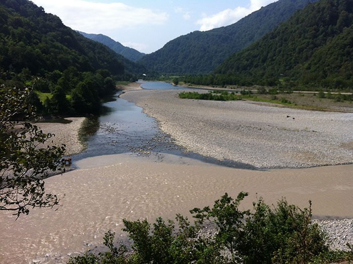
The waters of the Sukhaya Khapitsa, overloaded with the loose material that had tumbled into them, formed a thick yet very mobile mud, on which stones floated as easily as driftwood. Down the slopes of the volcanoes turbulent mudflows raced, rolling boulders and crushing everything in their path. Nearly impassable forests were literally washed away.
A powerful mudflow, having travelled 85 kilometres from the volcano, reached the Kamchatka River. The substances contained in the mud spoiled the water so badly that for a week it could be neither drunk nor used for technical purposes. A mass of fish died in the river. Soon after the explosion a lava dome again began to grow in the new crater. Within half a year it reached 320 metres.
The explosion of Bezymyannaya Sopka can in its force be compared with the greatest catastrophic eruptions — Krakatau, Mont Pelée, and especially Katmai in Alaska. The energy of the 30 March explosion corresponded, by scientists' estimates, to a year's work of the Volga hydroelectric station, while the force of the air wave exceeded that of the blast wave of the Tunguska meteorite or a modern hydrogen bomb by tens of times.
Sensitive instruments everywhere recorded at seismic stations the blast wave, which travelled around the entire globe one and a half times.