The Climate of Antarctica: Weather, Facts, and Climate Change Impacts
 libre
libre
The climate of Antarctica is shaped by three main factors that govern weather everywhere on Earth: solar radiation, atmospheric circulation, and the geography of the place itself. Antarctica is the coldest, driest, and windiest continent on the planet, and its climate is defined by a permanent ice sheet that survives even the height of summer.

What is Antarctica's climate and what shapes it?
Antarctica's climate is a polar ice-cap climate (the EF class in the Köppen climate classification) in which average temperatures stay below freezing year-round and almost all moisture falls as snow. Three forces combine to produce it: how much solar energy the surface receives, how the atmosphere moves heat and cold around the continent, and the physical setting — a high, ice-covered landmass at the bottom of the world surrounded by the Southern Ocean.
What makes the place a paradox is that in summer parts of Antarctica receive almost as much solar heat as the subtropics, yet nothing grows there — not grapes, not even grass. The land lies under a thick layer of snow and ice that does not melt even in summer. Understanding why so much sunlight arrives but so little warmth remains is the central puzzle of the Antarctic climate, and the rest of this article works through each piece of the answer.
Solar radiation over Antarctica
Antarctica receives a surprisingly large amount of solar energy in summer despite being the coldest continent. On a clear summer day on the Antarctic coast, every square centimetre of surface gathers roughly 0.5 calories of solar heat per minute. Over a single summer month the incoming total reaches almost 20,000 calories (20 large calories) — one and a half to two times more than the same latitudes in the Northern Hemisphere, and only slightly less than the cotton fields near Tashkent collect.
If all of that energy went into melting the glaciers, the ice would thin by about ten metres in a single summer, and within 10–15 years the ice around Mirny — a station on the Antarctic coast — would vanish entirely.

Atmospheric circulation and katabatic winds
Atmospheric circulation is what saves Antarctica's surface from cooling without limit, and it is the dominant control on coastal temperatures. The continent's most distinctive winds are katabatic winds — dense, cold air that drains off the high interior plateau under gravity. Like rainwater rushing down a mountainside, the chilled, heavier air accelerates as it slides down the long slope of the ice plateau, often reaching hurricane force by the time it reaches the coast.
Unlike water, this descending air warms as it falls — roughly 1°C for every 100 metres of descent — so it arrives cold but far warmer than it would be in still conditions. Observations confirmed the effect: on a clear 12 August, while a storm raged at Mirny, a point 13 km away on the fast ice (sea ice firmly attached to the land) lay calm, and the air there was 11° colder than at Mirny. The katabatic wind, in this sense, behaves like a "cold föhn."
Winds near the coast and far inland blow almost all year from a single sector, roughly from north-northeast to south-southeast, yet small shifts within that sector change the weather dramatically. Easterly winds ride with cyclones and bring warmth; southeasterly winds carry the drainage of cold inland air and bring cold. The circumpolar trough — a belt of low pressure ringing the continent — steers these systems, and the resulting circulation over Antarctica is unlike anywhere else on Earth.
Moving air also imports warmth. At Mirny there was never a winter month in which the arrival of a maritime air mass failed to lift temperatures to between -3° and -6°. Between 29 and 30 April of the studied year, the temperature rose within a day from -25° to -8°; the warming even reached Pionerskaya, where over the same day it climbed from -50° to -30°. During these spells the surface stops radiating heat and instead absorbs it from the atmosphere, the radiation balance turns positive, and temperatures rise quickly.
Geography and the continent's ice cover
Geography intensifies Antarctica's cold, especially through high elevation and the thin air of the interior plateau. Local terrain alone can produce wildly different weather within a few kilometres — a fierce blizzard at one site while another nearby lies dead calm, even with little change in relief. Members of the expedition described driving out from Mirny into a band of drifting snow that thickened into a "milky-white river" of blowing snow, blinding the vehicle, while a station on the fast ice just a short distance away was so still that off-duty crew were skiing and an emperor penguin colony was hatching chicks.
Elevation drives the most extreme cold. Pionerskaya station (69°44′ S), perched at about 3 km altitude, recorded a mean annual air temperature below -38°. By comparison, Kola station near Murmansk at almost the same latitude in the Northern Hemisphere (68°53′ N) averages -5°, and where Pionerskaya's warmest reading was -13°, Kola's reached +32°.
The rarefied air at high inland elevations adds another hardship.

Antarctica's geography and ice coverage
Antarctica covers about 14 million square kilometres, making it the fifth-largest continent, and roughly 98% of it lies beneath the Antarctic ice sheet. That ice sheet holds the great majority of the world's fresh water and reaches an average thickness of around 2 km, exceeding 4 km in places over the East Antarctic Plateau. The continent divides into East Antarctica, a high and very cold plateau, and West Antarctica, lower and more vulnerable to warming, with the Antarctic Peninsula reaching north toward South America.
Ice sheets, ice shelves, and sea ice are three different things. The ice sheet is the land-based dome of glacial ice; ice shelves are its floating extensions where it meets the sea, such as the Ross Ice Shelf, the Filchner-Ronne Ice Shelf, the Larsen Ice Shelf, and the George VI Ice Shelf; and sea ice is frozen ocean water that expands and contracts with the seasons. When ice shelves break apart, they release icebergs in a process called calving — visible at glaciers like the Deville glacier — and their loss removes a brake that had been holding back land ice.
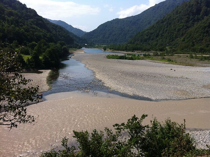
The Southern Ocean rings the entire continent and connects Antarctica to the rest of the planet. Sub-Antarctic islands and approaches — South Georgia Island, the South Shetland Islands, the Falkland Islands, and the Drake Passage between South America and the Peninsula — sit within or beside it, alongside the Weddell Sea, the Ross Sea, the Bellingshausen Sea, and McMurdo Sound.
The puzzle of Antarctica's climate: where does the sunlight go?
The answer to where Antarctica's summer sunshine disappears lies in three processes: most of it is reflected straight back to space, much of what remains is lost as thermal radiation, and only a small fraction is left to warm the continent. To measure each share, the first Soviet Antarctic expedition, based at Mirny and Pionerskaya, kept a continuous year-round "accounting" of solar heat — recording how much arrived, how much was reflected, how much was radiated away, and what net balance remained.
The radiation balance of the snow-and-ice surface
The radiation balance of Antarctica's snow-and-ice surface is small even in summer because so little of the incoming sunlight is retained. Of the 18–20% of sunlight that the surface does absorb and turn into heat, more than half — over 10% of total radiation — is lost again through thermal radiation, leaving only about 8–10% (and at Pionerskaya as little as 5%) available to the continent. Special self-recording instruments, the "electromechanical bookkeepers of the Sun," logged these flows automatically through the whole year.
Reflection of sunlight (the albedo of snow and ice)
Antarctica reflects most of the sunlight that reaches it because fresh snow and ice are extraordinarily bright surfaces. Measurements showed that, winter and summer alike, the snow-and-ice surface bounces roughly 80–82% of incoming solar rays straight back, sending that vast share of energy back into space almost untouched.

Thermal radiation from the Antarctic surface
Antarctica continuously loses heat through thermal radiation, and in winter this loss has nothing to replace it. From March to October the surface receives essentially no solar heat, yet it keeps radiating; monthly radiative losses in winter run to 2–3 large calories. Calculations show that by radiation alone the surface would cool by about 5–6° per hour — a rate that, left unchecked, would drive temperatures to impossible depths.
In practice that runaway cooling almost never happens, because moving air keeps feeding heat back to the surface. The first expedition, which reached Antarctica in January 1956, witnessed the unchecked process only once: on 20 August, in the depth of the harshest winter month, the evening katabatic wind unexpectedly died, the sky cleared, and within an hour and a half the temperature fell by 10° to -40.4° — the lowest ever recorded at Mirny. Then the wind returned and the southernmost land grew warmer again.
Antarctica's temperature regime by season
Antarctica has two broad seasons — a brief, comparatively mild summer and a long, dark, intensely cold winter — separated by enormous swings in sunlight rather than in incoming solar geometry. Summer runs from November to February, when the surface absorbs solar heat; winter runs from March to October, when it receives almost none. The continent holds the planet's coldest records precisely because high elevation, extreme reflectivity, winter darkness, and isolation by the Southern Ocean all compound one another.
Summer in Antarctica (November–February)
Summer is the only season the continent can be visited, and it brings long daylight and the mildest temperatures of the year. On the Antarctic Peninsula and coastal sites, summer highs often hover near or just above 0°C, while the interior plateau stays far below freezing even at midsummer. The Antarctic Circle experiences continuous daylight around the solstice, fuelling the burst of biological activity — penguin hatching, whale feeding, seal breeding — that defines the season. A month-by-month picture across November through March shows November and March as the cold shoulders of the window and December–January as the warmest, brightest core.
Winter in Antarctica (March–October)
Winter brings near-total darkness, savage cold, and the closure of tourism, leaving only research stations occupied. With no incoming sunlight and constant radiative loss, interior temperatures plunge and the surrounding sea ice expands dramatically, roughly doubling the apparent size of the continent. Blizzards, drifting and blowing snow, and whiteout conditions make travel hazardous, and the period from March to October is when expedition vessels stop sailing and personnel either overwinter at stations or leave.
Temperature records and extremes
Antarctica holds the lowest natural surface temperature ever recorded on Earth, measured at Vostok Station on the high interior plateau. The cold is driven by altitude, the ice-albedo effect, the long polar night, and the continent's thermal isolation. The World Meteorological Organization maintains the official archive of these extremes, while sites such as Deception Island, McMurdo Sound, and the South Pole give a sense of the range across the continent — relatively mild at the maritime fringe, brutally cold at elevation. The coldest readings occur in the deep interior; the "warmest" record extremes, by contrast, come from the northern Peninsula and were set near Esperanza Base.
Differences between coastal and inland climate
The gap between Antarctica's coast and its interior is among the largest climate contrasts anywhere on Earth, and it is mostly a matter of altitude and distance from the ocean. The Southern Ocean moderates the coast, delivering warmer maritime air, more cloud, and heavier snowfall, while the high inland plateau is colder, drier, and far calmer between katabatic episodes. East Antarctica, anchored by its towering plateau, is markedly colder than lower-lying West Antarctica, and the Peninsula — reaching toward warmer latitudes — is the mildest region of all.
Atmospheric humidity and weather conditions
Antarctica is the driest continent on Earth, and much of its interior qualifies as a polar desert despite being buried in ice. Cold air holds very little moisture, so absolute humidity is extremely low and annual snowfall over the interior is minimal — what accumulates does so over centuries because almost nothing ever melts. Precipitation falls as snow, is heaviest along the coast where maritime air reaches it, and dwindles to almost nothing on the plateau.
Snow that has already fallen is endlessly reworked by wind, producing drifting snow near the surface and blowing snow lifted higher into the air. When wind, loose snow, and low visibility combine, the result is a blizzard; in the most extreme case the eye loses all reference points in a whiteout, an optical phenomenon in which ground and sky merge into a featureless white. Early observers also reported strange light effects — coloured halos, mock suns, and a reversed winter rainbow — born of ice crystals suspended in the frigid air. Today such conditions are tracked through automatic stations, webcams, and real-time monitoring, while agencies like the European Centre for Medium-Range Weather Forecasts model the systems that drive them.
Research into Antarctica's climate
Systematic climate research turned Antarctica from a blank on the map into one of the most closely monitored regions on Earth, and it remains essential because the continent both records and influences global climate. The earliest sustained measurements established the radiation budget and circulation patterns described above; modern programs add satellites, ocean instruments, and ice-core drilling that read past climate and project future change.
The first Soviet Antarctic expedition (Mirny and Pionerskaya stations)
The first Soviet Antarctic expedition, arriving in January 1956 and based at Mirny on the coast and Pionerskaya in the interior, produced the original year-round accounting of Antarctica's solar radiation. Working in low pressure and relentless blizzards, its members measured incoming, reflected, and radiated heat, documented katabatic winds and warming intrusions of maritime air, and launched the first radiosonde from deep within the continent — beginning the regular study of the upper atmosphere over the ice and exposing phenomena no scientist of the day could fully explain.
Methods and instruments for observing radiation
Antarctic radiation was first measured with continuous self-recording instruments and is now monitored largely by satellite. The early "electromechanical bookkeepers of the Sun" logged the inflow and outflow of heat automatically around the clock. Today satellite radiometers measure surface temperature and reflectivity from orbit, imagers such as Landsat 8 map ice extent and movement, and the National Snow and Ice Data Center compiles long-term records of sea ice and ice-sheet change. Field programs still drill ice cores and deploy under-ice sensors — the kind of work that researchers including Natalie Robinson and vessels such as the RV Tangaroa have carried out for New Zealand's NIWA in the Ross Sea.
Station facilities and operations
Research stations are the permanent footholds from which Antarctic science is run, ranging from coastal logistics hubs to the most remote inland outposts. The United States operates McMurdo Station on Ross Island as its largest base, the Amundsen-Scott South Pole Station at the geographic pole, and Palmer Station on the Peninsula; Australia runs the Mawson research station, with operations spanning power, accommodation, laboratories, and resupply by ship and air. Russia's Vostok research base sits atop the East Antarctic Plateau where the planet's lowest temperatures are recorded, and smaller stations such as the United Kingdom's Signy Research Station support focused ecological work.
The U.S. Antarctic Program and how to take part
The U.S. Antarctic Program (USAP) is the coordinated effort through which the United States conducts Antarctic science, managed by the National Science Foundation (NSF) through its Office of Polar Programs. Scientists join by submitting research proposals; selected projects are deployed to McMurdo Station, the South Pole, or Palmer Station with full logistical support. The program also funds educational outreach, including online learning and training resources such as the POLAR ICE project, which brings Antarctic data and research methods into classrooms.
Modern climate change in Antarctica
Antarctica is warming unevenly, losing ice mass at an accelerating rate, and acting as a powerful brake on — and amplifier of — global climate change. The continent's response matters far beyond its own shores: its ice holds enough water to raise sea levels by many metres, and the Southern Ocean around it absorbs a large share of the planet's excess heat and carbon. The clearest warming signals are concentrated on the Antarctic Peninsula and in parts of West Antarctica, while much of the high East Antarctic interior has changed more slowly.
Warming trends on the Antarctic Peninsula
The Antarctic Peninsula is among the fastest-warming regions on Earth, and its temperature trend has reshaped its glaciers and ecosystems. Rising temperatures have driven coastal glacier retreat, weakened and collapsed sections of ice shelves such as the Larsen Ice Shelf, and altered habitat for cold-dependent wildlife. Adélie penguin colonies in the warming northern Peninsula have declined as sea ice patterns shift, while species better suited to open water have moved in — a visible local fingerprint of regional warming differences across the continent.
How Antarctica's climate connects to global climate
Antarctica is tied to the rest of the planet through the ocean and through sea level, which makes its changes everyone's concern. The Southern Ocean is a key engine of the global ocean conveyor belt, the deep circulation that redistributes heat worldwide, and it functions as a giant pump and store of ocean heat and absorbed carbon. Ice-shelf melting and ice-sheet loss feed sea level rise both by adding water and through the thermal expansion of warming seas. Low-lying coasts are most exposed: New Zealand's vulnerability to sea level rise is one example of why distant nations track Antarctic ice closely, and projections of future sea level rise depend heavily on how fast the ice sheet destabilises.
Black-carbon pollution and ice melt
Black-carbon pollution darkens Antarctic snow and speeds its melting by weakening the very reflectivity that keeps the continent cold. Soot from combustion — including ship and aircraft traffic and distant wildfires — settles on the surface, lowers its albedo, and lets it absorb more sunlight, locally accelerating melt. Limiting that damage points to broader carbon-emission reduction strategies and individual climate action, from cutting fossil-fuel use to choosing lower-impact travel; even visitors can reduce their footprint by supporting operators that follow strict environmental standards.
Antarctic wildlife in a harsh climate
Despite the severity of its climate, Antarctica supports a distinctive web of life that is concentrated at the coast and in the surrounding Southern Ocean.

Vegetation of Antarctica
Antarctica has almost no vascular plants because the cold, dryness, and lack of soil leave little for them to grow in. Only two flowering plants are native — Antarctic hairgrass and Antarctic pearlwort — and both cling to the milder Peninsula. The rest of the continent's "vegetation" is mosses, lichens, and algae, hardy organisms that survive long freezes and brief growing windows, and that form the base of the meagre terrestrial ecosystem.
Penguins and other birds
Penguins are Antarctica's signature birds, and their breeding cycles are tuned tightly to the short summer. The Emperor Penguin breeds through the depths of winter on the sea ice, while Adélie penguins nest on exposed coastal rock in summer; both depend on krill and fish reached from the ice edge. Mating, egg-laying, and hatching follow a strict seasonal schedule, so chicks appear in the warmest months — which is why the expedition crews found an emperor penguin colony hatching even as a storm raged nearby. Sub-Antarctic islands such as South Georgia host large king penguin populations alongside their fur seals.
Seals and marine mammals
Seals and whales are the large mammals of the Antarctic seas, and their numbers swell in summer when the ocean teems with food. The Crabeater Seal, despite its name, feeds almost entirely on krill and is one of the most abundant large mammals on Earth, while fur seals crowd sub-Antarctic beaches. Whales arrive to feed in the productive summer waters: the Humpback Whale and the Blue Whale — the largest animal that has ever lived — both gorge on krill before migrating north.
Resilience of the Antarctic ecosystem
The Antarctic ecosystem is resilient but narrowly built, resting on a short food chain that runs from sea ice to krill to nearly everything else. Sea ice is the keystone: it shelters the algae that krill graze on, regulates regional climate, and underpins the food webs that feed penguins, seals, and whales. That simplicity is also a weakness — because so much depends on krill and sea ice, climate change effects on Antarctic wildlife can ripple quickly through the whole system, which is why marine protected areas in the Southern Ocean aim to safeguard krill stocks and the species that rely on them.
The Antarctic Treaty and environmental protection
The Antarctic Treaty governs the continent as a zone reserved for peace and science, and it is the legal foundation for protecting its environment. Signed in 1959, the treaty and the wider Antarctic Treaty System set aside territorial claims, ban military activity, and require environmental protection and compliance from every party operating there. Conservation groups such as ASOC press for stronger safeguards, and at sea, maritime safety and pollution are regulated under the Polar Code, adopted by the International Maritime Organization to govern ships in polar waters. Tourism, fishing, and research all operate within these rules.
Biosecurity and invasive species
Biosecurity is a central pillar of Antarctic protection because the continent's isolated species have no defences against organisms carried in from outside. Seeds, insects, and microbes hitchhiking on clothing, footwear, and cargo can establish invasive populations as the climate warms, so visitors and researchers must clean and inspect all gear before landing and follow strict decontamination procedures. These measures, mandated under the treaty's environmental provisions, are the main line of defence keeping Antarctica's fragile ecosystem intact.
When is the best time to visit Antarctica?
The best time to visit Antarctica is during the austral summer, from November to March, when the sea ice retreats enough for ships to reach the continent and daylight stretches around the clock. Outside this window, from March to October, the continent closes to tourism as darkness and extreme cold return. Each month within the season offers something different, so the ideal timing depends on whether you most want pristine ice, penguin chicks, or whales.
Tour season and the best timing for a trip
Choosing within the November-to-March window comes down to what you want to see, and wildlife viewing changes month by month:
- November–early December: spring conditions with thick, pristine snow and ice; penguins courting and building nests; fewer ships.
- December–January: the warmest, brightest part of the season with near-continuous daylight; penguin chicks hatching; the busiest and most popular period.
- February–March: the peak of whale watching as humpbacks and other whales feed in open water; penguin chicks fledging; receding ice opening more landing sites.
Most voyages reach the Peninsula across the Drake Passage from Ushuaia, often combined with the Falkland Islands and South Georgia, and trip durations range from short Peninsula sailings to longer expeditions; fly-cruise (air-cruise) options skip the Drake crossing by flying to the South Shetland Islands. Operators such as Swoop Antarctica package these voyages on luxury and expedition ships of varying passenger capacity, with offerings including Antarctica Air Cruise, Antarctica Basecamp, and Polar Circle Quest itineraries, and many provide gear rental — waterproof boots and parkas — for travellers who would rather not buy their own.
What to pack: clothing and gear for extreme cold
Successful Antarctic travel depends on layering and on truly waterproof, windproof outer clothing, because wind and spray, more than air temperature alone, drive heat loss. The proven approach is a moisture-wicking base layer, an insulating mid-layer such as fleece or down, and a waterproof, windproof shell on top. Essential protective gear includes:
- Waterproof, insulated boots for wet zodiac landings, plus warm and waterproof gloves.
- A windproof hat, a neck gaiter or balaclava, and thermal socks.
- Strong sun protection — high-SPF sunscreen and UV sunglasses or goggles — since reflected light off snow and ice is intense even in cold weather.
- A dry bag and waterproof camera protection for shore excursions.
Storm safety matters too: in a blizzard or whiteout, visibility can vanish in moments, so travellers stay with guides, keep to marked routes, and follow the crew's instructions without exception. For broader background on travel and the natural world, you can explore more in our Travel and Nature sections.
These, then, are the main forces that shape Antarctica's climate and the reasons for its severity — the interplay of solar radiation, atmospheric circulation, and a high, ice-covered geography. Yet climate was never the only mystery the continent posed. Early researchers met phenomena that even the world's leading scientists could not explain and that had never been observed before — "the vanishing stratosphere," snow tornadoes, coloured halos and mock suns, a reversed winter rainbow, shimmering mirages over the snow, ice fog, low ice clouds, coloured drifting snow, snow geysers, summer clouds deep in the interior, sparks flying from the hands, and a neon bulb that lit at the touch of a finger. Each appears at a particular time of year, and to understand them one must first picture the conditions that give them life.