Atmospheric Research: Exploring and Conquering Earth's Air Ocean
 libre
libre
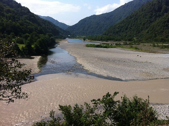
Atmospheric research is the study of the deep ocean of air at the bottom of which we live, the lightest and most mobile shell enclosing our planet (more on this: Diagrams of the Earth's internal structure).
What is the atmosphere and why study Earth's ocean of air?
The atmosphere is the gaseous envelope that surrounds the Earth, and atmospheric research seeks to understand its structure, composition, motion, and the weather and climate that arise within it. As you move away from the planet's surface, the air grows steadily thinner, which makes both human flight and scientific measurement progressively harder. Studying this air ocean explains everyday weather, long-term climate change, and the conditions that pilots, balloonists and spacecraft must contend with.
Atmospheric science as a discipline combines meteorology, atmospheric dynamics and thermodynamics, cloud physics, and the chemistry of trace gases. It draws on direct measurement, remote sensing, and numerical modeling to describe how heat, moisture, and momentum move through the atmosphere — the same processes that ultimately produce wind, rain, and storms described later on this page.
How was the atmosphere explored and conquered?
The exploration and conquest of the atmosphere is rich with the names of heroes who paid with their lives for the boundless daring of flight. The farther one travels from the Earth's surface, the rarer the air becomes.
What is altitude sickness and oxygen deprivation?
At significant altitudes breathing becomes difficult: shortness of breath, general weakness, dizziness, and nosebleeds appear. This is altitude sickness, which some people begin to experience as low as 2,500 metres. It is caused by oxygen deprivation of the body, an effect that worsens steadily with height as atmospheric pressure falls.
How do oxygen instruments make high-altitude flight possible?
Oxygen instruments are used during high-altitude flight to ensure that a person can breathe normally where the surrounding air is too thin to sustain life. These devices deliver supplemental oxygen at concentrations and pressures that compensate for the falling partial pressure of oxygen as altitude increases. Despite the sacrifices that exploration of the atmosphere has demanded, humanity has steadily pushed upward, moving the ceiling of its achievements ever higher.
How are the high layers of the atmosphere studied?
The study of the high layers of the atmosphere has exceptional practical value, because the thin air there allows aircraft to greatly increase their speed — to over 2,000 kilometres per hour. Brilliant chapters in the study of the atmosphere were written by researchers who made unprecedented flights aboard flying craft called stratospheric balloons.
How did flights aboard stratospheric balloons work?
Stratospheric balloons are enormous pear-shaped balloons filled with hydrogen for flight. The researchers sit inside a spherical metal gondola, specially equipped and sealed hermetically against the near-vacuum outside. These pressurized capsules were among the earliest tools for sampling the upper atmosphere directly, the ancestors of today's high-altitude research platforms.
What did the North Pole drifting stations contribute?
Long-term atmospheric research in the North Pole region, yielding very valuable results, was carried out by dedicated polar explorers on the drifting (in Dutch, literally "floating") North Pole stations. The first drifting research station opened on 6 June 1937, led by Papanin (more on this: The activity of glaciers).
Over the years that followed, 41 expeditions of polar researchers were organized on the drifting ice floes of the North Pole. Atmospheric measurements record a fall in air temperature of 5–7° for every kilometre of altitude. Only the study of the higher layers using special sounding balloons and stratospheric balloons, however, established that this cooling continues to roughly 18 kilometres over the equator and to 7–8 kilometres near the poles.
How does temperature change through the layers of the atmosphere?
Temperature does not fall continuously with height but reverses several times across the atmospheric layers. At greater altitudes, from 30 to 60 kilometres, the temperature rises to +65°, then falls again to about −8° at 80 kilometres. At a height of 200 kilometres it reaches several hundred degrees of heat. Artificial Earth satellites and data from space flights contribute valuable information about the upper layers of the atmosphere and interplanetary space.
What are the air zones of the Earth?
The atmosphere is divided into distinct zones defined by how temperature behaves with altitude, the two lowest being the troposphere and the stratosphere.
What is the troposphere?
The lower zone, with rapidly falling temperature, is called the troposphere (from the ancient Greek word "tropos" — a turn). It holds more than three-quarters of the entire mass of the atmosphere. All the meteorological phenomena that create weather on Earth occur within it, which is the origin of the name "turning sphere".
What is the stratosphere?
The layers lying above (up to 80 kilometres) are called the stratosphere (from the Latin word "stratum" — a layer). Here there are no longer any clouds or fogs, which remain far below in the troposphere. Stratospheric balloons rise into the region of the stratosphere, which gives the craft its name: translated from the ancient Greek it means "standing in the stratosphere" (from the word "stratos" — standing).
Studying the stratosphere matters not only for aeronautics: it provides the key to understanding the meteorological phenomena taking place in the troposphere and makes it possible to forecast the weather correctly, which is of exceptional importance for the national economy. Modern atmospheric science extends this interest to stratospheric dynamics and stratospheric circulation, where researchers track the slow overturning of air between the tropics and the poles. Studies analysing reanalysis of air samples and stratospheric air samples have found evidence of stratospheric circulation acceleration in recent decades, a change with consequences for the transport of ozone and trace gases.
How is the thickness of the atmosphere determined?
Attempts to determine the thickness of the atmosphere were made a very long time ago. Arab scholars about a thousand years ago correctly understood the cause of the burning of "falling stars" (meteors) and, for all the imperfection of their measurements, fairly accurately estimated the atmospheric layer at 200 kilometres.
How was the thickness of the atmosphere measured from auroras?
Determining the thickness of the atmosphere from the height of auroras gives values ranging between 80 and 1,200 kilometres.
From this, the average height of the atmosphere can be set at 1,000 kilometres. A thousand kilometres is, of course, no small distance, and however light the air may be, the pressure exerted by such a powerful layer is very considerable. Auroral measurements connect atmospheric study to the physics of the magnetosphere and ionosphere, where charged particles from the Sun excite the rarefied gases of the upper atmosphere to glow.
What is atmospheric pressure?
This pressure is called atmospheric pressure. It forces water to rise in pumps and holds the level of mercury in a barometric tube at a height of 760 millimetres. If the mercury is replaced with water, which is 13 times lighter than mercury, the water in the barometric tube rises to 10.33 metres. A hand pump cannot lift water above this level.
Scientists have calculated that air presses on the human body with a force of 17 tonnes. Such a weight, equal to the carrying capacity of a two-axle freight wagon, seems excessive for the frail human body, yet we do not notice it at all. This is explained first of all by the fact that air presses on us from all sides.
Moreover, the human body also contains air, as well as liquids that on the whole resist compression poorly. For this reason, when a person is in rarefied air, blood begins to flow from the nose, ears, and throat, because the strong internal pressure of the blood ruptures the finest blood vessels — the capillaries.
What is the composition of air?
By composition, air is a mixture of gases, and in addition it contains water vapour.
The table shows the composition of air.
| Gases | Content by volume | |
| Constant | Nitrogen | 78% |
| Oxygen | 21% | |
| Inert gases (helium, neon, argon, krypton, xenon) | 0.94% | |
| Variable | Carbon dioxide (CO2) | 0.02–0.04% |
| Water vapour (H2O) | up to 3% | |
| Occasional | Nitrogen oxides (NO, NO2) | <0.00001% |
| Sulphur oxides (SO2, SO3) | ||
| Hydrogen sulphide (H2S) |
The amount of water vapour depends on the air temperature: the higher the temperature, the more water vapour the air can hold. Cooling, on the contrary, causes the water vapour to condense, forming the tiniest droplets of water. This, for example, is the nature of the steam that can be seen above boiling water in a pot or kettle.
Fog spreading over a river or a marsh, and the clouds in the distant sky, are also visible water vapour. From damp air, invisible vapours settle as drops of dew on grass, on garden benches, stones, and other objects. Water vapour and carbon dioxide freely admit the Sun's rays while at the same time trapping the heat rays reflected by the Earth.
Acting like a valve that lets heat in but not out, they thereby raise the temperature of the layer of atmosphere directly adjacent to the Earth. As a result of uneven heating, the air is warmer in one place and colder in another; the more heated air expands and rises, while the colder, denser air rushes to take its place. This is how the movement of air occurs, the transfer of differently heated air masses, which is the cause of the formation of wind.
How are modern methods used to study the atmosphere?
Modern atmospheric research relies on satellites, sounding balloons, aircraft, ground-based instruments, and large numerical models rather than on balloon flights alone. Together these tools build a continuous, three-dimensional picture of the atmosphere from the surface to the edge of space, feeding both daily weather prediction and long-term climate study.
How do artificial satellites and space flights study the atmosphere?
Artificial Earth satellites observe the atmosphere from above, measuring temperature, moisture, clouds, aerosols, and trace gases across the entire globe. NASA missions such as OCO-2 and OCO-3 monitor carbon dioxide concentrations and surface carbon flux from orbit, while the TEMPO instrument tracks air-quality pollutants over North America hour by hour. Satellite missions require validation and calibration against independent measurements, and NASA's ARSET training program, run through the Atmospheric Science Branch at NASA Ames Research Center, helps users apply these Earth-observation data. Space research itself is coordinated internationally through bodies such as COSPAR and the International Science Council, with results published in journals including Advances in Space Research and Planetary and Space Science.
How do sounding balloons and meteorological instruments work?
Sounding balloons carry lightweight instrument packages — radiosondes — that measure temperature, humidity, pressure, and wind as they ascend through the troposphere and into the stratosphere. Airborne field campaigns extend this with research aircraft carrying lidar systems, remote-sensing instruments, and air-sampling devices for atmospheric profiling and boundary-layer studies. Lidar in particular maps aerosols, clouds, and trace-gas plumes in fine vertical detail, supporting work on cloud–aerosol interactions, precipitation, and wildfire smoke including pyrocumulonimbus (pyroCb) formation.
How is the atmosphere modeled, and what is general circulation?
Atmospheric modeling represents the atmosphere as a grid of equations describing how air moves, warms, and exchanges moisture, allowing scientists to simulate weather and climate on supercomputers. These numerical simulation methods underpin both short-range weather prediction and projections of climate dynamics decades into the future.
What are general circulation models (GCMs)?
General circulation models (GCMs) solve the physical equations of atmospheric dynamics and thermodynamics on a global grid to reproduce large-scale wind, temperature, and pressure patterns. Pioneering work on early GCMs was carried out by scientists such as Akira Kasahara and Warren Washington, whose models grew into the Community Climate Model. Modern operational tools include the Weather Research and Forecasting Model and the Model for Prediction Across Scales, used for weather prediction and forecasting around the world.
What are Earth system models and digital twins?
Earth system models extend general circulation models by coupling the atmosphere to the oceans, land surface, sea ice, and biogeochemical cycles, capturing anthropogenic Earth system alterations across the whole planet. The Community Earth System Model and the Department of Energy's Energy Exascale Earth System Model are leading examples, and emerging "digital twin" approaches aim to build high-resolution virtual replicas of the Earth for scenario testing. Such models address recent-decades climate change, atmospheric circulation trends, and human–environmental sustainability under the banner of the Anthropocene.
How are supercomputers used in atmospheric research?
Supercomputers provide the immense computational power needed to run high-resolution atmospheric and Earth system models, processing billions of grid-point calculations per simulated time step. Platforms such as NASA Earth Exchange and tools like the FARMS Tool and INSPYRE support large-scale data processing, while OpenET applies satellite data to evapotranspiration and agricultural water management. This computational infrastructure also enables digital twins, reanalysis projects, and the validation of satellite missions against modeled fields.
Which scientific centres lead atmospheric research?
Several dedicated centres anchor global atmospheric research, the foremost in the United States being the National Center for Atmospheric Research, supported by a consortium of universities and federal funding.
What is the National Center for Atmospheric Research (NCAR)?
The National Center for Atmospheric Research (NCAR), now styled NSF NCAR, is a federally funded research and development centre based in Boulder, Colorado, that studies weather, climate, and the atmosphere. Founded in 1960 under its first director, Walter Orr Roberts, NCAR was created to give university scientists access to facilities — supercomputers, aircraft, and instruments — too large for any single campus to maintain. Its landmark Mesa Lab, designed by architect I. M. Pei, sits above Boulder and remains the centre's most recognizable home.
How is NCAR organized and how does it collaborate with universities?
NCAR is managed by the University Corporation for Atmospheric Research (UCAR), a non-profit consortium of more than 100 member universities, on behalf of its sponsor, the National Science Foundation. This university-consortium structure makes NCAR a shared national facility: academic researchers, government agencies, and NCAR staff collaborate on projects and share access to its models and instruments. UCAR operations include managing the centre's facilities, staff, and partnerships, and coordinating community-developed tools such as the Community Earth System Model.
What is NCAR's computational infrastructure?
NCAR operates some of the most powerful supercomputers dedicated to the geosciences, running global climate and weather models at high resolution. This computing capacity, paired with large observational and reanalysis data archives, supports both NCAR's own scientists and the broader university community that relies on the centre as a national modeling resource.
What research aircraft and laboratories does NCAR operate?
NCAR maintains a fleet of instrumented research aircraft and a network of laboratories for airborne field campaigns, deploying lidar, radar, and air-sampling systems to study clouds, precipitation, and trace gases in situ. These facilities let scientists from across the consortium mount measurement campaigns — from hurricane reconnaissance to wildfire-smoke sampling — that would be impossible with university resources alone.
What climate research is carried out at NCAR?
Climate research at NCAR spans climate dynamics, the global energy and water budget, and the attribution of recent climate change, with prominent contributions from scientists such as Kevin Trenberth and Warren Washington. NCAR researchers study cloud–radiation interactions, the carbon cycle, and extreme events, and the centre's models are widely used in international climate assessments. Like other federally funded centres, NCAR faces periodic funding uncertainty, and proposals to cut or dismantle its budget have raised concern within the scientific community about the continuity of long-term climate records.
How is atmospheric research funded?
Atmospheric research in the United States is funded largely through the "Big Science" model, in which federal agencies sponsor large shared facilities that no single university could support. This approach grew out of the post-World War II reinvigoration of academic science, when a recognized shortage of trained meteorologists prompted sustained public investment in the field.
What role does the National Science Foundation (NSF) play?
The U.S. National Science Foundation (NSF) is NCAR's primary sponsor and a leading funder of national science initiatives in the atmospheric and geosciences. Through NSF support, NCAR operates as a federally funded research and development centre, with the National Science Foundation setting research priorities and providing the core budget that UCAR administers. This sponsorship model underpins much of the basic atmospheric research carried out at American universities.
What federal programs and partnerships support the field?
Beyond the NSF, atmospheric and Earth-observation research is supported by federal partnerships with NASA, the Department of Energy, and other agencies. NASA missions such as OCO-2, OCO-3, and TEMPO, the Energy Exascale Earth System Model from the Department of Energy, and collaborative training programs like ARSET illustrate how federal funding and partnerships combine satellites, supercomputers, and university expertise. Professional bodies including the American Meteorological Society and the American Geophysical Union help coordinate the community and disseminate results.
How is atmospheric research interdisciplinary?
Atmospheric research increasingly overlaps with cryospheric science, planetary science, radiation physics, and public health, making it a deeply interdisciplinary field. Cryospheric and cold-regions research — covering sea ice, snow and avalanche dynamics, permafrost engineering, and frozen-soil mechanics — appears in journals such as Cold Regions Science and Technology, with contributions from researchers including Betty Sovilla, Nicolas Eckert, Jukka Tuhkuri, Mark Loewen, Krzysztof Szilder, Jilin Qi, and Mingyi Zhang. Planetary science extends the same physics to magnetospheres, ionospheres, cosmochemistry, and the geology of terrestrial and outer planets, while radiation physics — dosimetry, luminescence, and ionizing-radiation detection — connects to the journal Radiation Measurements.
The field also feeds applied work: vector-borne disease modeling, emergency response and disaster coordination, air-quality forecasting, and land-cover and land-use change detection. Researchers such as Daniel Swain study weather extremes and wildfire behaviour, while scientists including Charles Gatebe, Ju-Mee Ryoo, Juan Torres-Pérez, Matthew Johnson, Reem Hannun, Pengfei Yu, Olivier Dessens, and Zhiyuan Cong contribute across remote sensing, trace-gas transport, and stratospheric chemistry. Specialist journals — Atmospheric Research, Global and Planetary Change, Advances in Space Research, Planetary and Space Science, Anthropocene, and Nature Geoscience, many published by Elsevier — serve the subject specialists and international readership of this community.
How did the atmospheric sciences develop historically?
The atmospheric sciences in the United States developed from scattered nineteenth-century weather observation into a coordinated, federally funded discipline after the Second World War. Wartime aviation and the postwar meteorology workforce shortage prompted universities and the federal government to invest heavily in training and research, culminating in the founding of NCAR in 1960. The arrival of electronic computers transformed the field again, turning weather prediction from a largely empirical craft into a quantitative science built on numerical simulation, a transition led in part by the model-building work of Akira Kasahara and Warren Washington.
How are NCAR models adopted in the public and private sectors?
NCAR's community models are widely adopted across both the public and private sectors, far beyond academic research. Government weather services and emergency-management agencies use the Weather Research and Forecasting Model and related tools for operational forecasting and disaster coordination, while private firms in energy, agriculture, aviation, and insurance apply the same models to assess risk and plan operations. Because these models are developed as open community tools, their adoption spreads quickly, and applications now range from agricultural water management through OpenET to vector-borne disease forecasting and air-quality services for cities such as those in California's San Joaquin Valley.
For more practical guides and articles across science and everyday life, browse the Astronomy and Agriculture sections.